Christchurch
Geological Summary
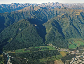
The city of Christchurch is largely built upon a Late Quaternary substrate of gravel, sand, silt and swamp deposits. The Port Hills and Lyttelton areas are dominated by Miocene basalt and trachyte lava and scoria deposits, in places mantled by Quaternary loess and colluvial fan sediment.
Maps and Information
There are no geological mapping projects underway or imminent in the Christchurch area. Previously completed maps are listed below.
Urban Maps
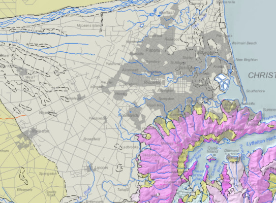
2015: Geology and geomorphology of urban Christchurch and eastern Canterbury
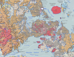
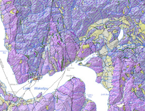
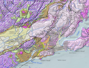
The Christchurch city area is covered by a geomorphological map dataset and 3D geological models published in 2015. The geomorphological map covers Christchurch City and much of eastern Canterbury. Based on the interpretation of high-resolution LiDAR terrain data, the map gives detailed portrayal of surface landforms that in turn indicate the composition of near surface materials.
One 3D geological model covers much of the eastern Canterbury area and includes major stratigraphic units to the greywacke basement. A second geological model is restricted to the main city area and is focussed on the finer stratigraphy of the Holocene alluvial and marine sediments. A third 3D model has been built on a large dataset of cone penetrometer tests acquired following the 2011-2012 Canterbury earthquake events. The modelled volumes infer rock properties such as lithology, density and strength, based on measured downhole information within the top 10-20 m of poorly consolidated sediments.
The geomorphological map(external link) can be downloaded for free from the Online Shop. GIS users can purchase the full digital data(external link) (which includes the 2D and 3D geological and geotechnical model) and come with ready-built map projects for ArcMap, QGIS and LeapFrog Viewer. These geomorphological data also can be accessed via ArcGIS Server(external link) web services. GIS layerfiles that reference and symbolise the web service layers are available for use in ArcGIS(external link) (ArcMap and ArcGIS Pro) and QGIS(external link). Metadata(external link) describing the various geological and geomorphological data are also available.
To view the Urban Christchurch and Eastern canterbury geomorphological map in more detail use this link(external link).
- Begg, J.G.; Jones, K.E.; Barrell, D.J.A. (compilers) 2015. Geology and geomorphology of urban Christchurch and eastern Canterbury(external link). GNS Science geological map 3. GNS Science, Lower Hutt, N.Z. 1 DVD-ROM.
Other information
2008/2018: QMAP 1:250 000 geological map
For wider and more generalised geological context of the Christchurch area, a 1:250 000 geological map was printed with an accompanying an explanatory text. Digital GIS and image versions of the map are available on DVD. The digital version has since been updated in a national GIS dataset at that nominal scale. The underlying GIS datasets have rich feature attributes.
- Forsyth, P.J.; Barrell, D.J.A.; Jongens, R. (compilers) 2008. Geology of the Christchurch area(external link). Institute of Geological & Nuclear Sciences 1:250 000 geological map 16. Lower Hutt, New Zealand. Institute of Geological & Nuclear Sciences Limited. 67 p. + 1 sheet.
- Heron, D.W. (custodian) 2018. Geological Map of New Zealand 1:250 000(external link). GNS Science geological map 1 (2nd edition). Lower Hutt, New Zealand. GNS Science.
1992: 1:100 000 geological map of Banks Peninsula
- Sewell, R.J.; Weaver, S.D.; Reay, M.R. 1992. Geology of Banks Peninsula(external link). Scale: 1:100 000. Lower Hutt: Institute of Geological & Nuclear Sciences. Institute of Geological & Nuclear Sciences geological map 3. 1 folded map.
1992: 1:25 000 geological map of Christchurch Urban area
- Brown, L.J.; Weeber, J.H. 1992. Geology of the Christchurch urban area(external link). Scale 1:25,000. Lower Hutt: Institute of Geological & Nuclear Sciences. Institute of Geological & Nuclear Sciences geological map 1. 1 map + 104 p.
1988: 1:50 000 geological map of Lyttelton
- Sewell, R.J.; Weaver, S.D.; Thiele, B.W. 1988. Geological map of New Zealand 1:50,000 Sheet M36 BD Lyttelton(external link). Lower Hutt: New Zealand Geological Survey. Geological map of New Zealand 1:50,000 M36. 1 folded map + 1 booklet.
1973: 1:63 360 geological map of Kaiapoi
- Brown, L.J. 1973. Geological map of New Zealand 1:63,360 Sheet S76 Kaiapoi(external link). 1st ed. Wellington: Department of Scientific and Industrial Research. Geological map of New Zealand 1:63,360 S76. 1 folded map + 1 booklet.