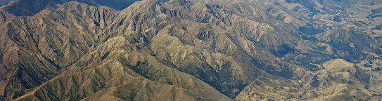
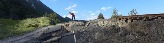
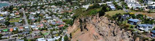
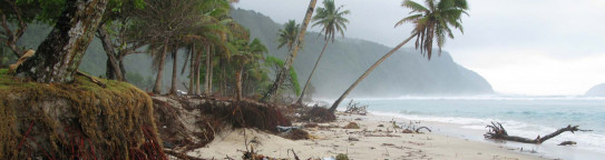
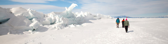
Natural hazards are part of our country’s DNA, and climate change is increasing both the risks and the impacts of hazard events. Managing our increasing exposure to natural hazards is critical to our future well-being and prosperity. Our Earth sciences and social science research helps support natural hazard event response and grow resilience.
He wāhanga noa ngā aituā ao tūroa nō tō tātau whenua, ā, kei te nui haere ngā mōrea me ngā pānga o ngā āhuatanga pūmate i te huringa āhuarangi. He mea nui te whakahaere i tō tātau tuwhera ki ngā pūmate ao tūroa ki tō tātau oranga, whaihua hoki āpōpō. Ka āwhina ā mātau rangahau pūtaiao ā-nuku me te pāpori i te urupare pūmate ao tūroa me te whakatipu i te manawanui.
Our science delivers tangible benefits to help Aotearoa New Zealand move towards a cleaner, safer, more prosperous future.
Ka puta i ā mātau pūtaiao ko ngā painga hei āwhina i a Aotearoa kia neke ki tētahi anamata mā ake, haumaru ake, whaihua ake.
GNS Science is interested in the wellbeing, future needs and resilience of the people of Aotearoa New Zealand.
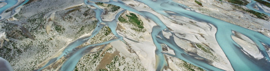
As the Crown Research Institute for Earth and material sciences, our expertise is in the processes that shape the surface and subsurface of the Earth in Aotearoa New Zealand, the Southwest Pacific and Antarctica.
Our work is focused on four research themes associated with the natural settings and geological challenges facing Aotearoa New Zealand and its people. Our themes are underpinned and connected by Vision Mātauranga, Social Sciences and Data Science. Grounding our research in these contexts helps ensure our outputs are useful, usable and used.
Learn more about our work in:
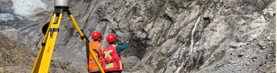
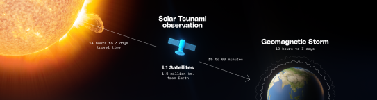
Natural Hazards and Risks
Natural Hazards and Risks
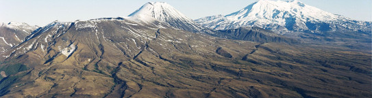
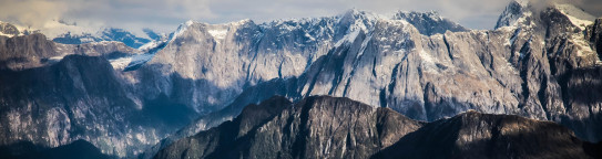
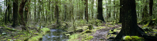
Environment and Climate
Environment and Climate
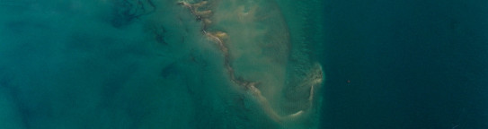
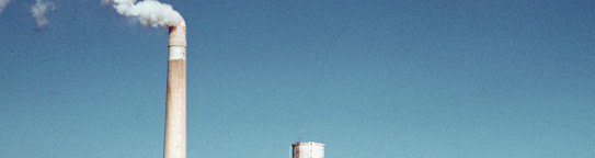
Our research focuses on sustainable management of the environment and effective adaptation to climate change. Our work focusses on natural systems that underpin our environment and climate, such as the carbon cycle, sea level change, and groundwater. Our aim is to reveal fundamental drivers and interactions in our global ocean and climate system.
E arotahi ana ā mātau rangahau mō te whakahaere toitū i te taiao me te urutaunga whaitake ki te huringa āhuarangi. E arotahi ana ā mātau mahi mō ngā pūnaha ao tūroa e paihere ana i tō tātau taiao me te āhuarangi, pērā i te hurihanga waro, huringa taumata moana me te wainuku. Ko tā mātau whai he tūhura i ngā pūtake taketake me ngā tauwhitiwhitinga i roto i tō tātau moana me te pūnaha āhuahira.
Find out more
E arotahi ana ā mātau rangahau mō te whakahaere toitū i te taiao me te urutaunga whaitake ki te huringa āhuarangi. E arotahi ana ā mātau mahi mō ngā pūnaha ao tūroa e paihere ana i tō tātau taiao me te āhuarangi, pērā i te hurihanga waro, huringa taumata moana me te wainuku. Ko tā mātau whai he tūhura i ngā pūtake taketake me ngā tauwhitiwhitinga i roto i tō tātau moana me te pūnaha āhuahira.

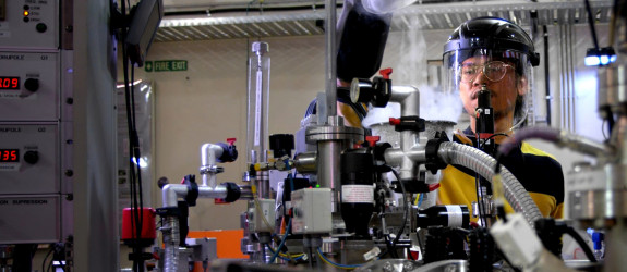
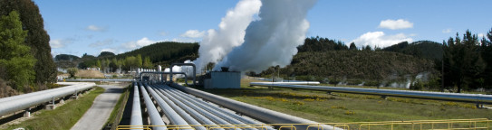
Energy Futures
Energy Futures
We play a major role in enabling Aotearoa New Zealand’s transition to a low-carbon future through the development of alternative energy and heat sources (geothermal, hydrogen, solar), Earth system energy storage, new materials for energy systems and storage and cross sector support needed for enhanced energy security and resilience.
He wāhanga hira tō mātau kia taea ai e Aotearoa te whakawhiti ki tētahi anamata waro iti mā te waihanga i ngā pūngao kē me ngā pūtake wera (ngāwhā, hauwai, kōmaru), putunga pūngao pūnaha ā-nuku, ngā rauemi hou mō ngā pūnaha pūngao me te rokiroki, me ngā tautoko puta noa i ngā rāngai e hiahiatia ana mō te haumarutanga pūngao kua whakareia me te manawaroa.
Find out more
He wāhanga hira tō mātau kia taea ai e Aotearoa te whakawhiti ki tētahi anamata waro iti mā te waihanga i ngā pūngao kē me ngā pūtake wera (ngāwhā, hauwai, kōmaru), putunga pūngao pūnaha ā-nuku, ngā rauemi hou mō ngā pūnaha pūngao me te rokiroki, me ngā tautoko puta noa i ngā rāngai e hiahiatia ana mō te haumarutanga pūngao kua whakareia me te manawaroa.
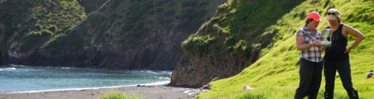
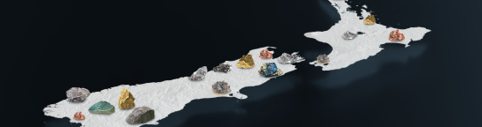
Land and Marine Geoscience
Land and Marine Geoscience
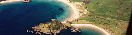
We build fundamental understanding to better define the processes that continue to shape the continent Te Riu-a-Māui | Zealandia and impact our wider society and economy. Our research is framed in environmental, cultural, health and economic outcomes and is underpinned by the precious tāonga in our Nationally Significant Collections and Databases.
Ka tipu i a mātau te mārama taketake kia mārama ake te tautuhi i ngā tukanga e ahuahu haere tonu i Te Riu-a-Māui me te whai pānga ki te iwi whānui me te ōhanga. E here ana ā mātau rangahau ki ngā putanga taiao, ahurea, hauora me te ōhanga, ā, e paiherea ana e ngā taonga puiaki i roto i ā Mātau Kohinga Nui ā-Motu me Ngā Pātengi Raraunga.
Find out more
Ka tipu i a mātau te mārama taketake kia mārama ake te tautuhi i ngā tukanga e ahuahu haere tonu i Te Riu-a-Māui me te whai pānga ki te iwi whānui me te ōhanga. E here ana ā mātau rangahau ki ngā putanga taiao, ahurea, hauora me te ōhanga, ā, e paiherea ana e ngā taonga puiaki i roto i ā Mātau Kohinga Nui ā-Motu me Ngā Pātengi Raraunga.