
Te Whakaheke o Te Wai
This project aims to better support water management based on improved understanding and integration of flow sources, pathways, water travel time, and cultural knowledge and values
Overview
The research is underpinned by the concept of Te Whakaheke o Te Wai (the pathways of the water), tracing groundwater throughout the main catchments and aquifers of Aotearoa New Zealand.
Te Whakaheke o Te Wai holistically describes the flow sources, pathways and lags of water moving through a catchment. For groundwater – our largest freshwater resource – this remains largely unknown. This paradigm-shifting project will derive the whakaheke of groundwater and baseflows in New Zealand’s 200 major aquifer systems and the rivers that drain them.
Outputs from this research are designed to provide decision-makers with much-needed knowledge for improved water management at national, catchment, and local scales. The programme is currently developing the world’s first nationally continuous maps of groundwater age, origin and flow paths. Outputs will be publicly available and benefit people and institutions involved in water management.
This programme aims to
- develop a world-first series of maps showing the source and flow patterns of New Zealand’s 200 known aquifers and large river catchments
- increase our scientific understanding of flow sources, pathways, and lags of groundwater
- give us valuable information about the age, source and destination of groundwater in our aquifers
Te Whakaheke o Te Wai (2021)
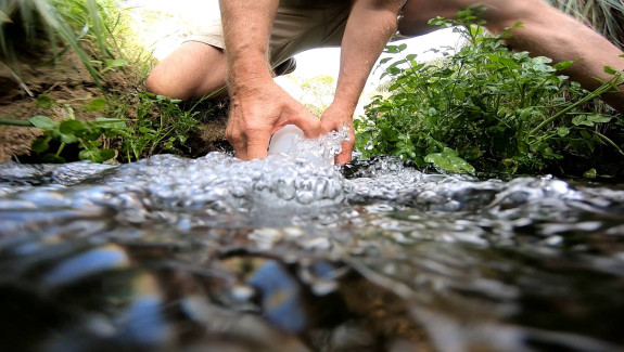
This project focuses on the groundwater systems in Hawke’s Bay’s Heretaunga catchment, and the nature of the water and how it flows through these lands.
To achieve these objectives we are
- conducting a national groundwater and surface water age tracer and stable isotope sampling campaign
- using new modelling approaches to better integrate tracers, mōhiotanga Māori, and other data and simulating a range of decision relevant predictions from the national scale through to local drinking water
The Project
Our research
We are using novel environmental tracers to provide information about the groundwater flow, including source and age of the water. This data will yield New Zealand’s first national maps of groundwater age, origin and flow paths, useable for all institutions involved in water management.
New numerical and meta modelling approaches are being developed to integrate the tracer and other data across scales. Numerical rapid model build tools are being developed to support the scalability of these models across New Zealand, so that predictions can be made at the scale relevant to the decisions being made.
Working with hapū, iwi, and national Māori partners, we are incorporating mātauranga-a-iwi/hapū into our models alongside the tracer and other related data. We will research use of these models across institutional boundaries to promote a collective understanding of the whakaheke of water, its relationship to whakapapa and its role in empowering kaitiakitanga.
The research outputs are designed to inform setting of national policies, managing catchment scale contaminant inflows to groundwater-fed rivers, and protecting local potable water supplies (e.g. Havelock North).
We have created a series of factsheets to provide a summary of the primary outcomes of each of the main workstreams.
Our research involves four complementary areas
Environmental tracer survey: world-leading methods, unprecedented coverage
For over 300 years, rainfall-runoff and groundwater models have been calibrated to measurements of hydraulic head and stream flow. These data provide little insight into groundwater age or transit time as needed for improved water management. Environmental tracers, notably isotopes, give the most direct data informing flow models.
We measure age tracers, which integrate all flow velocities (of water and contaminants) above any measurement point. We use complementary hydrogeological, chemical and isotope data to understand origin of recharge and flow pathways, effects of geology, seasonality and stream order.
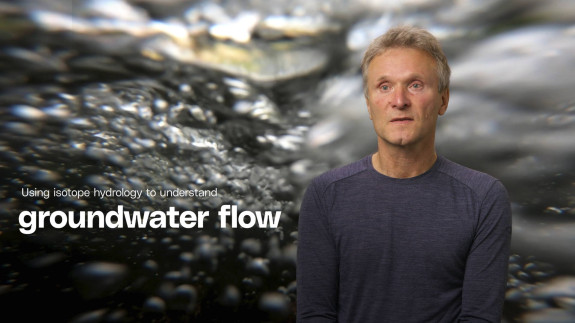
Using isotope hydrology to understand groundwater flow transcript
We are using in particular isotopic tracers, to identify where the water has been recharged into groundwater system, and how long it has been underground. And if you compare the groundwater age at different places in the aquifer then you can understand the dynamics, how the water actually flows through the aquifer.
In past decades, most of the knowledge about aquifer flow has come from surface observations like observing water flows in streams and rivers, but also water levels. And this information does not necessarily tell you how the water flow is through the deeper groundwater system.
So, we now look into the isotopic signature of the water, and we basically let the water tell the story, where it has basically come from, what is the recharge source, and how long it took for the water to flow through the system.
And the groundwater age can then be used to basically calibrate groundwater flow models which are being used for managing groundwater resources.
Merging mātauranga-a-iwi/hapū with western science improves conceptual understanding
Historically, conceptual understanding of groundwater systems has been based on Western science. It is increasingly recognised that indigenous knowledge also provides expert insight into freshwater systems.
In New Zealand, mātauranga-a-iwi/hapū, as it pertains to landscape, springs and rivers, derives from cultural perspectives and close association with the environment. This knowledge is preserved by long oral traditions and thus can provide insights that extend into the past beyond the modern instrumental record. Increasingly, this mātauranga is applied in cultural health monitoring of rivers and supporting improved water policy and planning. The challenge is that mātauranga-a-iwi/hapū pertaining specifically to groundwater presently has low visibility, so its influence remains limited.
Working with hapū, iwi, and national Māori partners, we are incorporating mātauranga-a-iwi/hapū into our models alongside the tracer and other related data.
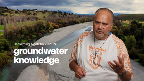
Reclaiming Ngāti Kahungunu groundwater knowledge transcript
Overall water is a taonga, water is a taonga, each part that makes up this integrated system.
For example, as it starts to move its way subsurface into groundwater we have names such as muriwai hou, when you then listen or hear from our olds, as I've heard, the story of the youngest child, Rūaumoko, when the parents were forced apart, Mum was still holding, her child, Rūaumoko, and when she then was separated by the children, she was facedown, and inside her puku, inside her tummy, was Rūaumoko.
Rūaumoko is referred to as being, the deity of earthquakes, of those tectonic plates that move, that create land, and surrounding Rūaumoko is the amniotic fluid.
We make reference to, groundwater, having that same taonga, special uniqueness in terms of looking after a child, in this case, Rūaumoko. So our groundwater in terms of Ngāti Kahungunu philosophy is also contained as being very special, very unique.
We have other names that others will refer to it as Haukunui. These are the rising mists that are the teardrops of Papatūānuku as she is trying to cry towards Ranginui.
Our people had their own economy, whereby the rain from the heavens on top of the mountains recharged the aquifers that were then able to create springs, wetlands, wairepo, wai puna puna wai. And of course, that provided the sustenance for our people in terms of kai, in terms of mātauranga, around how to collect both not only food, but resources that could enable their sustainability in life and living.
So therefore, the wai, the hauora, or the health of water, is really, really sacrosanct. It is important. As we entered into this particular arrangement with Te Whakaheke o Te Wai the movement of water both above and below, that it did for us provide an opportunity to walk alongside of Western science with our mātauranga Māori.
We're now reclaiming our tikanga, our kawa, our rēo, the names which mean so much that's been kept in the knowledge bank of some kuia who's finally got to be interviewed and then, "Wow!"
And so we've got special names that refer to that whole swing of whether there is vibrancy or whether there's a lack of vibrancy right down to it. And it was our kaumātua that said, when you are looking for any measure or indicator, we've got Western science that comes up with a whole raft of different things, cultural health index and so forth.
But what in the Māori world have we got? We've got our own proxy tohu.
And so this is when you start to have the conversations with your hapu. It lifts that lid off the top to then have a peer through there and then you can see, "Wow! Okay."
Models have become a common tool nowadays in terms of water management, basically. So I guess one of the things that have been missing for tangata whenua, mana whenua, is the imbuing of our mātauranga into those particular processes, those tools to best manage water.
So our philosophical base, our tikanga, our kawa, is very important when you start to kind of pull a model together that it does show itself being a part of this now new, this common tool to best manage water.
And what's really come out of this whole exercise is that opportunity amongst other things, to test the models in terms of its current ability to take in up-to-date data, information and knowledge that we can now use to assess a number of different processes and facets, I think.
So we're now running alongside of each other. I think that we are in some ways reclaiming ourselves back into this particular space as we've been left out of this space for quite some time.
So this is an opportunity for Ngāti Kahungunu to step in alongside of this process. We're resetting. We're wanting to reframe our focus and direction going forward. This information of Te Whakaheke o Te Wai is a serious contribution to enable that.
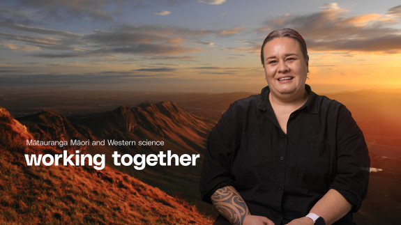
Mātauranga Māori and Western science working together transcript
From a Māori perspective, there are whakataukī that talk about we must look to the past to better understand the future.
So, in order for me to understand what's going on now and how we can better look at managing water in the future, we needed to look at the past.
What happened in the past? What was the landscape like in the past? What was the water like in the past? How did we interact with it in the past? So that we could understand actually where we are now, what has happened from the past until now to get us into this situation?
Being able to understand things like deforestation, and the importance of recording that type of information.
Understanding how my ancestors used the land in terms of mahinga kai, or being able to access resources from wetlands or rivers, whether that be food or harakeke or raupō. Understanding those sorts of things and how we feed that into the model, I think was a really great way of working.
It took a while for us to kind of figure out how you bring in certain types of knowledge that aren't necessarily seen as facts, but they are a truth.
I saw this project as an exciting opportunity to really understand how Western science and mātauranga Māori could work together.
It was a way that we could really come together and teach each other about how to work better within this project, how to look at things, how to understand things a little bit differently, you know, not from a purely scientific perspective or a purely Māori perspective, but actually try and bring those two knowledge systems in together so that we can more holistically understand what was going on within that project. I think the rest of the country will benefit from the learnings from this project immensely.
It's shown how mātauranga Māori and Western science can work together. It shows how meaningful relationships can be built as part of projects like this. And I think it also shows that when there is shared understanding, shared goals, shared ideals about a certain kaupapa or topic, that actually we can come together really well and figure things out together.
Advanced workflows for rapid, accurate modelling at relevant scales
Only by bringing data and expert knowledge together in a numerical model is it possible to make predictions for locations without data, or to explore ‘what if’ scenarios (e.g. increased abstraction, land use change). Industry-standard groundwater software is now routinely used for these purposes, in Aotearoa New Zealand and globally.
The challenge is that current methods for model calibration and uncertainty analysis are not suitable for depicting Te Whakaheke o Te Wai because:
- they do not readily integrate tracer and other data alongside expert knowledge and mātauranga-a-iwi/hapū
- they do not effectively represent highly connected flow pathways
- national, regional and local scales cannot be examined within a single model due to prohibitively slow run times.
Giving the community a numerical voice through groundwater modelling transcript
The Bridge Pa community has a marae right next to a stream called the Paritua Stream, and that stream has increasingly been experiencing dry or low stream flows, and then dry stream bed conditions.
Dry stream bed has occurred over historical periods but the frequency with which they're occurring has become greater.
In 2021 there was a period of about eight months where the stream was predominantly dry which was the longest that it had been.
And that's a stream of cultural significance and it was quite distressing for the community. So, we've focused in on that stream catchment and looked at all of the changes that have occurred over time, both natural changes, and also man-made changes that have occurred since European settlement, that have affected the stream flow, and tried to untangle all of these different natural and man-made forces to work out what are the big levers in terms of turning that stream dry more frequently.
My science part in the project is to build a groundwater model that's in part giving a numerical voice to the concerns of that community as well as using all of the information available both from the indigenous knowledge and also from knowledge or data that the council may have collected, and also more novel data - so the groundwater isotope data that Uwe has been collecting, which tells us the age of groundwater in an area, and also where it's flowed from and the rate at which it's flowing through that aquifer system.
And also more recently there's SkyTEM data, so airborne geophysical data. That SkyTEM data is giving us a lot more information about the structure of the aquifer system below the land surface.
We pull in all of that information into our numerical groundwater model, so that we can process that information in the way that will help inform questions about how to restore the flow in that stream.
Every model that you build should really be different, and purpose built for the question that's being asked. And so, it's really important that you connect with the people asking those questions.
The things that we've done differently, because of the questions like,"Why does the stream not flow like it used to?", "And actually what did it used to be like?" We've had to look at data or inferences from data and other archival resources from way back to pre-European periods.
And we've also had a lot more conversations with the iwi in that area to hear any other information that they can bring. So, you kind of cast your net wider in terms of where your information is coming from and that can be quite a rich source of knowledge.
It's not measured at a single point, in a single point in space and time, but it's knowledge that covers a large area and over a large timeframe, and that can be really rich information.
Better use of data, knowledge and models in the decisions that matter
Historically, many scientific investigations were conducted to advance the state of knowledge in general, without a specific application in mind. It is increasingly recognised that, to improve our water management, these investigations must be tailored from the outset to address specific water management issues we face. The challenge is that different water management organisations have different information needs depending on their various mandates and scales of operation.
Working with mana whenua transcript
Mana whenua are really critical to the success of this project. We couldn't do it without them. Also, the mātauranga that they bring is critical.
They have a particular way of looking at the groundwater systems, that actually give us a strong idea of their shape, their extent, and their volume.
They have different whakataukī and oral histories that relate very specifically to groundwater systems.
So, even though most of us don't think about them on the day-to-day, mana whenua - Ngāti Kahungunu - have these models themselves, these images of what groundwater systems look like, based upon their knowledge of where the springs have emerged from the ground and how the rivers are flowing, the volumes in the rivers and how they all connect and link together.
So, there's a really deep mātauranga there from Ngāti Kahungunu.
We are privileged to sit alongside with them, and to draw upon that.
Mātauranga is like an extra evidence base that gives us more information, but also helps us to make better models that are more accurate and more precise.
We've worked together really well. Where they value the scientific contributions is in giving them, as Cath puts it, a numerical voice for community concerns.
That's super important to them as we seek to better manage this precious resource that we have, of fresh water.
We're running out of fresh water. The quality is being compromised.
We've got to do a better job as a people.
And I think mana whenua see the value of the work that we're doing on Te Whakaheke o Te Wai, because we are addressing those issues head-on, of scarcity and of quality of fresh water, but also just trying to do a better job at visualising that whole system so we can better manage it.
-
Recent highlights
Modelling workshop: Focus on the problem. Don’t let the model become the problem
The Te Whakaheke o Te Wai team co-led a workshop attended by a broad audience comprised of modellers, and those who inform or use models to make decisions. Its focus was on “decomposing the problem” prior to modelling in order for modelling to provide a more effective and direct route between site issues and exploration of site management options.
New technologies were presented that can enable numerical expression of hydrogeological site knowledge better than in the past, and that can process model outputs in ways that are relevant to site management. In an audience participation session participants were asked to respond to decision-support challenges for an imaginary decision-support modelling problem.
This workshop was experimental in nature because of its participatory approach. Though its focus was on modelling, it endeavoured to meet the industry where the industry is at, and to addresses decision-support modelling issues that are rarely discussed at industry forums. Also see https://gmdsi.org/blog/focus-on-the-problem/(external link).PEST utilities translated into python libraries
The internationally adopted parameter estimation and uncertainty analysis software PEST has been developed over a long period by John Doherty (Watermark numerical computing). To support use of these tools in the python interface, wethe Te Whakaheke o Te Wai team translated these PEST utilities into python libraries.
Decision-support groundwater modelling with python online course
A five-part series of webinars were delivered to an Australian/NZ audience. This online course on applied decision-support groundwater modelling with python was delivered in collaboration with the Groundwater Modelling Decision Support Initiative(external link)
Heretaunga Hui
A hui was held in the Heretaunga Plains with iwi and research partners, stakeholders, and local communities in May 2023.Te Whakaheke o Te Wai research findings were presented to the local communities, with discussion of how these can be implemented to help overcoming their groundwater issues including stream depletion and contamination of drinking water resources.
The group convened on at Te Taiwhenua o Heretaunga - the hui was opened with a karakia from Marei Aptu. The group then visited various sites of hydrological interest, including areas at Omahu, Awatoto, and Esk Valley that had been devastated by Cyclone Gabrielle, where they learnt about the impacts of such extreme weather events. Next, they visited Ōmahu marae, where they were welcomed with pōwhiri. Uwe Morgenstern provided a summary of the Heretaunga Plains aquifers, with a focus on the aquifers as a drinking water source. Questions raised by the local community included the status of nitrate contamination of the Heretaunga aquifers, and potential of the aquifer to help removing water loads at flood events.
Maimai Field Day
The research at the Maimai catchment (West Coast of Aotearoa New Zealand) over recent decades has been instrumental for understanding stream flow generation. Together with the Global Institute for Water Security, University of Saskatchewan, the Te Whakaheke o Te Wai team organised an international field day in this catchment.
The Maimai Field Day was held in February 2023, co-hosted by Jeffrey McDonnell, Global Institute for Water Security, University of Saskatchewan, and Uwe Morgenstern, Te Whakaheke o Te Wai Co-leader. The field day included participants from Maanaki Whenua Landcare Research, NIWA, GNS Science, Scion and DOC, plus hydrologists from universities in NZ, Canada, USA and Germany. The group toured the extensive hillslope trench system in the M208 catchment and discussed topics related to the sequencing of different landscape units through storm events, scaling relations for water and water quality, catchment complexity and groundwater age.
The goal of the event was to stimulate interest in research at Maimai—a set of small headwater catchments near Reefton. Over the past 40 years, the many investigators from NZ and internationally have added to our fundamental understanding of forest flows, hillslope geomorphology and streamflow generation processes to build upon for local knowledge and to underpin local policy decisions. Maimai is arguably the best characterised headwater research catchment in the world. Recent events following Cyclone Gabrielle show the importance of understanding how headwater catchments release their water.
-
Project updates
TWOTW April 2024 Newsletter (PDF, 4.8 MB)
TWOTW December 2023 Newsletter (PDF, 2.1 MB)
TWOTW June 2023 Newsletter (PDF, 7.2 MB)
TWOTW November 2022 Newsletter (PDF, 4.1 MB)
TWOTW July 2022 Newsletter (PDF, 2.5 MB)
TWOTW April 2022 Newsletter (PDF, 1.9 MB)
TWOTW October 2021 Newsletter (PDF, 2.2 MB)
-
Publications
Journal publications
Aranui A., Moore C., Mercier O., Taves M., Hemmings B., Doherty J., Gyopari M., (2025): Developing a shared catchment biography to guide restoration efforts with an Indigenous community. In prep.
Balocchi, F.; Rivera, D.; Arumi, J.L.; Morgenstern, U.; White, D.A.; Silberstein, R.P.; Ramírez de Arellano, P. An Analysis of the Effects of LargeWildfires on the Hydrology of Three Small Catchments in Central Chile Using Tritium-Based Measurements and Hydrological Metrics. Hydrology 2022, 9, 45. https://doi.org/10.3390/hydrology9030045(external link)
Bruce D. Dudley, Andy McKenzie, Jacob S. Diamond, Alice F. Hill; (2025) “Complementary Precipitation Isotope Models Reveal Young and New Water Fractions in New Zealand Rivers” Hydrological Processes, 2025; 39:e70265; in Hydrological Processes published by John Wiley & Sons Ltd.
Cartwright, I., Morgenstern, U., Hofmann, H., Gilfedder, B. Comparisons and uncertainties of recharge estimates in a temperate alpine catchment. Journal of Hydrology 590 (2020) 1255558.
Cartwright I, Morgenstern U, Howcroft W., et al. The variation and controls of mean transit times in Australian headwater catchments. Hydrological Processes. 2020;1–15. https://doi.org/10.1002/hyp.13862(external link)
Cartwright I, Morgenstern U, Hofmann H. Concentration versus streamflow trends of major ions and tritium in headwater streams as indicators of changing water stores. Hydrological Processes. 2020;34:485–505. DOI: 10.1002/hyp.13600
Coble MA, Rogers KM, Curtis J, van der Raaij R, Byrne DJ, Suckow A, Morgenstern U. 2024. New method for measuring dissolved Ne, Ar, and N2 in water using a plasma emission detector: application for quantifying denitrification in groundwater. ACS ES&T Water. 4(9):3851–3862. https://doi.org/10.1021/acsestwater.4c00170(external link)
J Doherty, C Moore. 2020. Decision support modeling: Data assimilation, uncertainty quantification, and strategic abstraction.
Groundwater 58 (3), 327-337Dudley, McKenzie, Diamond and Hill 2024a. Young water fractions in New Zealand rivers: a comparison using machine learning and geostatistical interpolation models of precipitation isotopes. In Review.
Dudley, B. D., Hill, A.F., McKenzie, A. 2024b. A seasonal precipitation isoscape for New Zealand. Journal of Hydrology: Regional Studies 52, 101711.
Kenny, Sarris, Scott1, Moore, 2024. ‘A numerical investigation of the effects of model parameterization in the delineation of source protection zones under uncertainty’. Water Research. In review.
Gourdol, L., Stewart, M. K., Morgenstern, U., and Pfister, L.: Short high-accuracy tritium data time series for assessing groundwater mean transit times in the vadose and saturated zones of the Luxembourg Sandstone aquifer, Hydrol. Earth Syst. Sci., 28, 3519–3547, https://doi.org/10.5194/hess-28-3519-2024(external link), 2024.
Haile A. Shishaye, Douglas R. Tait, Damien T. Maher, Kevin M. Befus, Dirk Erler, Luke Jeffrey, Michael J. Reading, Uwe Morgenstern, Sarit Kaserzon, Jochen Mueller, Wanda De Verelle-Hill, The legacy and drivers of groundwater nutrients and pesticides in an agriculturally impacted Quaternary aquifer system, Science of The Total Environment, Volume 753, 2021, 142010, ISSN 0048-9697, https://doi.org/10.1016/j.scitotenv.2020.142010(external link)
Hemmings, B, Moore, C, Rawlinson, ZJ. 2024a. Te Whakaheke o te Wai Programme. Heretaunga Plains regional groundwater model update: Age and flow predictions and uncertainty. GNS report In Review
Hemmings, B, Knowling, MJ, Moore, CR. 2020. Early uncertainty quantification for an improved decision support modeling workflow: A streamflow reliability and water quality example. Frontiers in Earth Science 8, 502
Jeffrey J. McDonnell, Keith Beven, Uwe Morgenstern & Laurent Pfister (29 Nov 2024): The first catchment water balance: new insights into Pierre Perrault, his perceptual model and his peculiar catchment, Hydrological Sciences Journal, DOI: 10.1080/02626667.2024.2427890
Kitlasten, W., Moore, C.R., Hemmings, B., 2022. Model structure and ensemble size: Implications for predictions of groundwater age. Frontiers of Earth Science, Section: Hydrosphere, Volume 10 - 2022, https://doi.org/10.3389/feart.2022.972305(external link) .
Kitlasten, W., Moore, C.R., Doherty, J. 2024. Advanced history matching and uncertainty quantification to effectively assimilate information in groundwater age tracer data. In prep.
Matthew J. Knowling1, Jeremy T. White1, Catherine R. Moore1, Pawel Rakowski2, and Kevin Hayley (2020). On the assimilation of environmental tracer observations for model-based decision support. Hydrol. Earth Syst. Sci., 24, 1677–1689, 2020, https://doi.org/10.5194/hess-24-1677-2020(external link)
Knowling, MJ, White, JT, McDonald, GW, Kim, JH, Moore, CR, Hemmings, B. 2020. Disentangling environmental and economic contributions to hydro-economic model output uncertainty: an example in the context of land-use change impact assessment.
Environmental Modelling & Software 127, 104653Jeffrey J. McDonnell, Keith Beven, Uwe Morgenstern and Laurent Pfister, The first catchment water balance: A critical review, Hydrological Sciences Journal (Special Issue on History of Hydrology), accepted 2024).
McDonnell, JJ, C. Gabrielli, A. Ameli, J. Ekanayake, F. Fenicia, J. Freer, C. Graham, McGlynn, B., Morgenstern, U., Pietroniro, A. Sayama, Seibert J., Stewart, MK. Vache, M. Weiler, R. Woods, The Maimai M8 experimental catchment database: Forty years of process-based research on steep, wet hillslopes. Hydrological Processes. 2021; 35:e14112. https://doi.org/10.1002/hyp.14112
Moore, C., Scott, D., Burberry, L., Close, M., 2022. Using sequential conditioning to explore uncertainties in geostatistical characterization and in groundwater transport predictions. Frontiers in Earth Science. Section: Hydrosphere, Volume 10 - 2022. https://doi.org/10.3389/feart.2022.979823(external link) . T.
Exploring the adequacy of steady-state-only calibration. CR Moore, J Doherty - Frontiers in Earth Science, 2021.
Oluwunmi, P, Hemmings, B, Moore, Yang J,C. Rajanayaka, C. Shiona, H, Cameron, S. 2024. Groundwater contributions in low to high surface water flows in New Zealand rivers. Science of the Total Environment. In prep.
Robson-Williams M., Harcourt N.R. Mercier O.R., 2022. Achieving societal collaboration and impact in Aotearoa-New Zealand through transdisciplinarity. GAIA Ecological Perspectives for Science Publications and Society
Sarris, D. Scott, A. Kenny, and C. Moore, 2022 Journal of Hydrology New Zealand: “Transition probability analysis of lithology descriptions for probabilistic delineation of well capture zones”
Robson-Williams M., Harcourt N.R. Mercier O.R., 2022. Achieving societal collaboration and impact in Aotearoa-New Zealand through transdisciplinarity. GAIA Ecological Perspectives for Science Publications and Society.
Stewart, M. K., Morgenstern, U., and Cartwright, I.: Comment on “A comparison of catchment travel times and storage deduced from deuterium and tritium tracers using StorAge Selection functions” by Rodriguez et al. (2021), Hydrol. Earth Syst. Sci., 25, 6333–6338, https://doi.org/10.5194/hess-25-6333-2021(external link) , 2021.
Shovon Barua, Ian Cartwright, P. Evan Dresel, Uwe Morgenstern, Jeffrey J. McDonnell, Edoardo Daly, Sources and mean transit times of intermittent streamflow in semi-arid headwater catchments, Journal of Hydrology, Volume 604, 2022, 127208, ISSN 0022-1694, https://doi.org/10.1016/j.jhydrol.2021.127208(external link)
Tschritter, C., Daughney, C. J., Karalliyadda, S., Hemmings, B., Morgenstern, U., Moore, C., 2022 (in review). Estimation of groundwater age distributions from hydrochemistry: Comparison of two metamodelling algorithms in the Heretaunga Plains aquifer system, New Zealand, Hydrological Earth Systems Science Discussions. [preprint], https://doi.org/10.5194/hess-2022-258(external link) .
Zhou, Z., Cartwright, I., and Morgenstern, U.: Sources and mean transit times of stream water in an intermittent river system: the upper Wimmera River, southeast Australia, Hydrol. Earth Syst. Sci., 26, 4497– 4513, https://doi.org/10.5194/hess-26-4497-2022(external link) , 2022.
Zibo Zhou, Ian Cartwright, Uwe Morgenstern, L. Keith Fifield, Integrating major ion geochemistry, stable isotopes (18O, 2H) and radioactive isotopes (222Rn, 14C, 36Cl, 3H) to understand the interaction between catchment waters and an intermittent river, Science of The Total Environment, Volume 908, 2024, 167998, doi.org/10.1016/j.scitotenv.2023.167998.
White, JT, Knowling, MJ, Fienen, MN, Feinstein, DT, McDonald, GW, Moore, CR. 2020. A non-intrusive approach for efficient stochastic emulation and optimization of model-based nitrate-loading management decision support. Environmental Modelling & Software 126, 104657
White, JT, Fienen, MN, Moore, CR, Guthke A. 2023. Editorial. Rapid, Reproducible, and Robust Environmental Modeling for Decision Support: Worked Examples and Open-Source Software Tools. Frontiers in Earth Science.
White, JT, Hemmings, B, Fienen, MN, Knowling, MJ. 2021 Towards improved environmental modeling outcomes: enabling low-cost access to high-dimensional, geostatistical-based decision-support analyses. Environmental Modelling & Software, 105022.
Yang J., Moore, C., Rajanayaka, C., Shiona, H., Hemmings, B., Oluwunmi, P., Cameron, S., Woodward, S. (2025). National Nutrient Contribution Dynamics in New Zealand Rivers. Hydrological Processes.
Gourdol, L., Stewart, M. K., Morgenstern, U., and Pfister, L.: Short high-accuracy tritium data time series for assessing groundwater mean transit times in the vadose and saturated zones of the Luxembourg Sandstone aquifer, Hydrol. Earth Syst. Sci. Discuss. [preprint], https://doi.org/10.5194/hess-2023-152(external link), in review, 2023.
Morgenstern U. 2023. 2023 groundwater residence time assessment of Heretaunga Plains municipal water supply wells in the context of contamination risk via young water flow paths and impact by Cyclone Gabrielle. Lower Hutt (NZ): GNS Science. 33 p. (GNS Science report; 2023/44). https://doi.org/10.21420/2CHQ-N017(external link)
Theo S Sarris, Allanah Kenny, David M Scott, Catherine Moore (2023). Transition probability analysis of lithology descriptions for probabilistic delineation of well capture zones. Journal of Hydrology (New Zealand)Tschritter, C., Daughney, C. J., Karalliyadda, S., Hemmings, B., Morgenstern, U., and Moore, C.: Estimation of groundwater age distributions from hydrochemistry: comparison of two metamodelling algorithms in the Heretaunga Plains aquifer system, New Zealand, Hydrol. Earth Syst. Sci., 27, 4295–4316, https://doi.org/10.5194/hess-27-4295-2023(external link), 2023
J White, M Fienen, C Moore, A Guthke - Frontiers in Earth Science, 2023. Rapid, reproducible, and robust environmental modeling for decision support: worked examples and open-source software toolsZibo Zhou, Ian Cartwright, Uwe Morgenstern, L. Keith Fifield, Integrating major ion geochemistry, stable isotopes (18O, 2H) and radioactive isotopes (222Rn, 14C, 36Cl, 3H) to understand the interaction between catchment waters and an intermittent river, Science of The Total Environment, Volume 908, 2024, 167998, doi.org/10.1016/j.scitotenv.2023.167998(external link)
Balocchi, F.; Rivera, D.; Arumi, J.L.; Morgenstern, U.; White, D.A.; Silberstein, R.P.; Ramírez de Arellano, P. An Analysis of the Effects of LargeWildfires on the Hydrology of Three Small Catchments in Central Chile Using Tritium-Based Measurements and Hydrological Metrics. Hydrology 2022, 9, 45. https://doi.org/10.3390/hydrology9030045(external link)Kitlasten W, Moore CR., Hemmings B (2022). Model structure and ensemble size: Implications for predictions of groundwater age Frontiers in Earth Science (V10) https://www.frontiersin.org/articles/10.3389/feart.2022.972305(external link) DOI=10.3389/feart.2022.972305 ISSN=2296-6463
Shovon Barua, Ian Cartwright, P. Evan Dresel, Uwe Morgenstern, Jeffrey J. McDonnell, Edoardo Daly, Sources and mean transit times of intermittent streamflow in semi-arid headwater catchments, Journal of Hydrology, Volume 604, 2022, 127208, ISSN 0022-1694, https://doi.org/10.1016/j.jhydrol.2021.127208(external link)
Catherine Moore, David Scott, Lee Burbery, Murray Close. (2022). Using sequential conditioning to explore uncertainties in geostatistical characterization and in groundwater transport predictions. Frontiers in Earth Science (v10).Catherine R Moore, John Doherty (2021) Exploring the adequacy of steady-state-only calibration. Frontiers in Earth Science.
McDonnell, JJ, C. Gabrielli, A. Ameli, J. Ekanayake, F. Fenicia, J. Freer, C. Graham, McGlynn, B., Morgenstern, U., Pietroniro, A. Sayama, Seibert J., Stewart, MK. Vache, M. Weiler, R. Woods, The Maimai M8 experimental catchment database: Forty years of process-based research on steep, wet hillslopes. Hydrological Processes. 2021; 35:e14112. https://doi.org/10.1002/hyp.14112(external link)
White, J.T., Hemmings, B., Fienen, M.N., Knowling, M.J., 2021. Towards improved environmental modeling outcomes: Enabling low-cost access to high-dimensional, geostatistical-based decision-support analyses. Environmental Modelling and Software. Volume 139, May 2021, 105022 https://www.sciencedirect.com/science/article/pii/S1364815221000657?(external link)Cartwright, I., Morgenstern, U., Hofmann, H., Gilfedder, B. Comparisons and uncertainties of recharge estimates in a temperate alpine catchment. Journal of Hydrology 590 (2020) 1255558.
Cartwright I, Morgenstern U, Howcroft W., et al. The variation and controls of mean transit times in Australian headwater catchments. Hydrological Processes. 2020;1–15. https://doi.org/10.1002/hyp.13862(external link)
Hemmings, B, Knowling, M.J., and Moore C.R., 2020. Early uncertainty quantification for an improved decision support modelling workflow: A streamflow reliability and water quality example. Frontiers in Earth Science. doi: 10.3389/feart.2020.565613.
Knowling, M.J.; White, J.T.; Moore, C.R.; Rakowski, P.; Hayley, K. 2020 On the assimilation of environmental tracer observations for model-based decision support. Hydrology and Earth System Sciences, 24(4): 1677-1689; doi: 10.5194/hess-24-1677-2020(external link)
ReportsClose, ME, Humphries, B, Tschritter, C. Sarris, T. Moore C, 2023. Model scenarios for a microbial risk assessment tool. ESR report for MfE. Envirolink Large Advice Grant HZLC162.
Close, M, Sarris, T, Kenny, A. Humphries, B, Devane, M, Tschritter, C, Hemmings, B, Moore, C, Scott, L. 2023. Microbial Risk Assessment tool for discharges near drinking water wells: Documentation Report. ESR report for MfE. Envirolink Large Advice Grant C03X2001.
Doherty J, Moore C. 2023. Problem Decomposition. https://gmdsi.org/wp-content/uploads/2023/06/problem_decomposition_monograph.pdf
Doherty J, Moore C. 2021. Decision support modelling viewed through the lens of model complexity. https://gmdsi.org.
Hemmings, B, Moore, C, Rawlinson, ZJ, Taves, M. 2024. Hawke’s Bay 3D Aquifer Mapping Project: Numerical Groundwater Modelling experiments using SkyTEM data in the Heretaunga Plains. GNS report.
Hemmings, B, Moore, C, Rawlinson, ZJ. 2024a. Te Whakaheke o te Wai Programme. Heretaunga Plains regional groundwater model update: Age and flow predictions and uncertainty. In Review.
Morgenstern U, Davidson P. 2022. Groundwater tracers for improved understanding of water and nitrate flow through Te Hoiere / Pelorus catchment to inform decision making in restoration programme. Lower Hutt (NZ): GNS Science. 21 p. (GNS Science report; 2022/50). doi:10.21420/937F-H779.
Moreau M, Morgenstern U, van der Raaij RW, Horrox J. 2021.
West Coast groundwater dynamics and hydrochemical evolution as inferred from regional water age and chemistry tracer data. Lower Hutt (NZ): GNS Science. 69 p. (GNS Science report; 2021/16). doi:10.21420/60DD-SQ44.
Aranui, A. 2020. Te Whakaheke o te Wai: Mātauranga a Iwi/Hapū Research Report. Victoria University of Wellington.Dudley, B., Yang, J., Shankar, U., 2020. Estimated young water fractions at NIWA river water quality network sites. Prepared for GNS Science September 2020. NIWA CLIENT REPORT No: 2020287CH.
Morgenstern U., Davidson P., Townsend D.B., White P.A., van der Raaij R.W., Stewart M.K., Moreau M., and Daughney C. 2019. From rain through river catchment to aquifer: the flow of water through the Wairau hydrologic system. Lower Hutt (New Zealand ): GNS Science. 83 p. (GNS Science report; 2019/63). doi:10.21420/7125-ST46
Conference Presentations
Morgenstern, U., Tritium as tracer for the hydrological cycle, South Pacific Environmental Radioactivity Association, Christchurch 28 Nov to 1 Dec 2022.
Daughney C.J., and Morgenstern U., 2020. Use of symbolic regression to estimate groundwater age distributions from hydrochemistry, Heretaunga Plains. In: New Zealand Hydrological Society Conference, from 1 – 4 December 2020, Invercargill Waihōpai, New Zealand : oral abstracts. [Wellington, N.Z.]: New Zealand Hydrological Society.
Dudley, B.D., Shankar, U., Yang, J., and Montgomery, K. 2019. Development of a surface water isotope layer for New Zealand. In: New Zealand Hydrological Society Conference 3-6 December 2019, Rotorua, New Zealand :oral abstracts. [Wellington, N.Z.]: New Zealand Hydrological Society.
Johnson, P.J.; Morgenstern, U.; Moore, C.R.; Cameron, S.G. 2019 Te Whakaheke o te Wai : improving understanding of groundwater flow pathways in New Zealand. p. 90 In: New Zealand Hydrological Society Conference 3-6 December 2019, Rotorua, New Zealand : oral abstracts. [Wellington, N.Z.]: New Zealand Hydrological Society.
Moore, C., 2019 Keynote Speaker, New Zealand HS. Model design for decision support: uncertainty quantification, data assimilation and model complexity entanglement. In: New Zealand Hydrological Society Conference 3-6 December 2019, Rotorua, New Zealand : oral abstracts. [Wellington, N.Z.]: New Zealand Hydrological Society.
Moore, C. and Doherty J. 2020. How upscaling hydraulic properties undermines the reliability of our decision-support predictions. In: New Zealand Hydrological Society Conference, from 1 – 4 December 2020, Invercargill Waihōpai, New Zealand : oral abstracts. [Wellington, N.Z.]: New Zealand Hydrological Society.
Sarris T., Scott, D.M., Close, M.E., and Moore C., 2020. Transition Probability Analysis of Lithology data: Implications for numerical delineation of well capture zones. In: New Zealand Hydrological Society Conference, from 1 – 4 December 2020, Invercargill Waihōpai, New Zealand : oral abstracts. [Wellington, N.Z.]: New Zealand Hydrological Society.
Morgenstern, U., Davidson, P., Townsend, D., Stewart, M.K., 2019. Groundwater Storage that feeds the Wairau River and Streams in the Wairau Plain. In: New Zealand Hydrological Society Conference 3-6 December 2019, Rotorua, New Zealand : oral abstracts. [Wellington, N.Z.]: New Zealand Hydrological Society.
Toews, M.W.; Hemmings, B.J.C. 2019 A surface water network method for generalising streams and rapid groundwater model development. p. 166-167 In: New Zealand Hydrological Society Conference 3-6 December 2019, Rotorua, New Zealand : oral abstracts. [Wellington, N.Z.]: New Zealand Hydrological Society.
Yang, J., Jakeman A., and Rajanayaka, C., 2019. Emulation methods for sensitivity and uncertainty analyses in hydrologic modelling. MODSIM Conference. 2019, Canberra, Australia. -
Outreach and community
Aranui, A., 2019. 'Mapping Whenua: Te Whakaheke o te Wai: Mātauranga a iwi me ngā hapū' at Victoria University of Wellington for Te Kawa a Māui course MAR203 Mapping Whenua.
Morgenstern U., 2019. Wairau Aquifer Envirolink project, presented to the Environment Committee at Marlborough Regional Council.
Presentation and discussion at Fish hook summit https://www.kahungunu.iwi.nz/fish-hook-programme(external link)The Te Whakaheke o Te Wai team provided science advice for the interactive displays about aquifers at the Waiaroha Water Discovery Centre in Hastings.
-
Student publications
Completed
Arnold, Oscar., 2023. Wāhi Ngaro: an offering to cross-cultural management of groundwater. Bachelor of Arts (Honours) Thesis, Te Herenga Waka – Victoria University of Wellington. 58 p.
Thomas, Alyssa., 2023. Ngā Rangatira Mō Apōpō. Rangatahi aspirations for Pukekauri dam in Patuharakeke rohe: an educational wānanga for youth engagement and visioning. Master of Indigenous Studies, Te Herenga Waka - Victoria University of Wellington. 111 p.
Willow Milligan, 2024. Pupū Ake te Whenua: Monitoring the cultural health of the Wharepapa Arthur Marble Aquifer. Master of Arts thesis, Te Herenga Waka - Victoria University of Wellington
Thomas, A., Maxwell, K., Dobson-Waitere, A., Aranui, A., Phipps-Black, R., Thomson, T., & Mercier, O. R., 2024. Helping the ‘Helping hands’: supporting Māori postgraduates to advance community aspirations for environmental research. Higher Education Research & Development, 1–16. https://doi.org/10.1080/07294360.2024.2393118
Ongoing
Forstner, Tara. PhD research is focused on investigating methods for assessing the baseline (pre-European) conditions of a groundwater-surface water system incorporating Mātauranga Māori and Western scientific practices.
-
Programme team
Catherine Moore
Uwe Morgenstern
Gemma Clark
Karen Houghton
Mike Taves
Conny Tschritter
Magali Moreau
Dougal Townsend
Biljana Lukovic
Vanessa Trompetter
Peter Gardner
Reagan Lithgow
Reuben Rodricks
Jay Curtis
Jeff Brass
Damon Clarke
Stewart Cameron
Alwyn Venter
Soren Haubrock
Brioch Hemmings
Lee Chambers
Sapi Karalliyadda
Susana Guzman Carballo
Paul Oluwunmi
Wes Kitlasten
Jeff MacDonald
Ian Cartwright
John Doherty (Watermark Numerical Computing)
Jeremy White (Intera)
Matthew Knowling (Adelaide University)
Jing Yang (NIWA)
Bruce Dudley (NIWA)
Chris Daughney (NIWA)
David Scott (ESR)
Murray Close (ESR)
Theo Sarris (ESR)
Alannah Kenny (ESR)
Ocean Mercier (VUW)
Amber Aranui (VUW)
Ngaio Tiuka, (Ngāti Kahungunu Iwi)
Shade Smith (Ngāti Kahungunu Iwi)
Marei Apatu (Te Taiwhenua o Heretaunga)
Jeff McDonnell (University of Saskatchewan)

Uwe Morgenstern Principal and Lead Scientist, Isotope and Tritium Lab
View BioPresent research/professional speciality: Since 1998, Dr Morgenstern has led the Isotope Hydrology team and managed the Water Dating Laboratory at GNS Science. His scientific expertise centres on the use of isotopic methods, such as tritium and 32Si, for determination of the age of water, ice, and sediments. A recent international assessment conducted by the IAEA has shown that, under Dr. Morgensterns management, the GNS Science Water Dating Lab has become the worlds most accurate tritium analytical facility (by a large margin). The information derived from the age measurements is crucial for reconstruction of past global climate and for management of groundwater and surface water resources. Research leadership: New Zealand Ice Core Programme GNS Science Hydrogeology Core Programme
Contact MeResearch programme details
Collaborators: National Institute of Water and Atmospheric Research (NIWA), Institute of Environmental and Scientific Research (ESR), Te Tai Whenua O Heretaunga, Victoria University of Wellington (VUW,), Watermark Numerical Computing
Additional collaborators: Hawkes Bay Regional Council (HBRC), Environment Canterbury (ECan), Monash University, University of Saskatchewan, Luxembourg Institute of Science and Technology, Hastings District Council (HDC), Hawke's Bay District Health Board (HBDHB), Ministry for the Environment (MfE), Ngāti Kahungunu Iwi Incorporated
Duration
2018–2024
Funding platform
2018 Endeavour Fund – Research Programmes
Status
Current
Programme leaders
Catherine Moore, GNS Science
Uwe Morgenstern, GNS Science
Funder
Funder: Ministry of Business, Innovation & Employment (MBIE)
Co-funders: GNS Science, NIWA, ESR, HBRC, ECan, Monash University; University of Saskatchewan; Luxembourg Institute of Science and Technology; HDC; HBDHB; MfE; Ngāti Kahungunu,