
Hidden landslides and silent tsunami
GNS Science is working with NIWA, the University of Auckland, iwi partners and researchers in Australia to better understand the causes, frequency and impacts of underwater landslides.
Overview
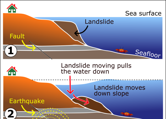
Underwater landslides are large movements of the seafloor which transfer large volumes of sediment into the deep ocean. They can threaten offshore infrastructure and generate near-shore tsunami without obvious warning signs such as strong ground shaking, and so have been nick-named “silent tsunami”. And they’re difficult to predict.
We’ve all seen TV footage of landslides on land, but they happen under water in oceans, seas, lakes and fjords. Underwater landslides can be much larger than onshore landslides because the material involved is waterlogged. They create highly mobile masses that can travel great distances.
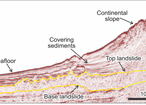
As you’d expect, underwater landslides are inherently difficult to identify and study, as they are hidden beneath the waves. We use two techniques to study them:
- seafloor scanning techniques , or multi-beam bathymetry data
- seismic reflection that uses sound waves to image the layers of rock in the Earth below us
We want to learn how often underwater landslides happen, why they occur, how big they can be and what their geohazard potential is. Aotearoa New Zealand’s largest known underwater landslides are in the Tasman Sea and that’s where this project is taking us.
The project aims to
- understand the causes, frequency and hazard potential of underwater landslides in the Tasman Sea
- better understand the mechanism through which underwater landslides generate tsunami
- test new methods to quantify risk relating to underwater landslides that can be applied in other areas of New Zealand
- work with iwi partners Ngāti Tama and Ngāti Mutunga in northern Taranaki to explore synergies between contemporary science findings and applied knowledge (mātauranga) of coastal rohe to best prepare communities that are vulnerable to tsunami hazards
To achieve these objectives, GNS Science has
- undertaken extensive mapping of the offshore geology around New Zealand to identify underwater landslides, along with detailed mapping and analysis of individual landslides
- partnered with NIWA and the University of Auckland to collect new seafloor mapping data from the Tasman Sea, where we have identified New Zealand’s largest known underwater landslides.
- begun a new trans-Tasman collaboration with the University of Newcastle, Australia, to study the landslide and their hazard potential using numerical computer models
The project
Discovering 5 million years of hidden landslides
Mapping the geology beneath Zealandia, including the underwater portions of the continent, led to the discovery of the biggest underwater landslides ever found in New Zealand waters. Over the past five million years, the eastern Tasman Sea has been hit by a series of 6 landslides, some covering a land area larger than Wales (>22,000 km2) and the volume equivalent to 40X Mt Ruapehu (4,000 km3).
GNS Science researchers set out to investigate what caused the landslides, how much time goes by between events, if they could generate a tsunami, and the likelihood of more landslides. We’re partnering with a team of New Zealand and Australian researchers to tackle these big science questions.
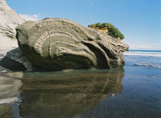
Jam Roll Bay | Virtual Field Trip
“Fossilised” underwater landslides explained (using cake)
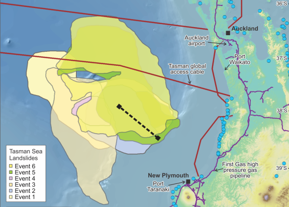
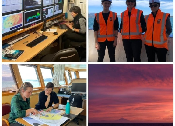
So far, we’ve done more detailed mapping of the most recent landslide. GNS, NIWA and the University of Auckland carried out a research voyage on the NIWA vessel R/V Tangaroa in October 2021. We collected the first detailed seafloor mapping at the site of the landslides, and there are plans to return in 2022 to collect further geophysical information and core samples from the seafloor.
Modelling tsunamigenic potential
Numerical modelling – simulations carried out using powerful computers - has become an important tool for tackling geological problems, especially those that are hard to observe directly. Our Australian collaborators at the University of Newcastle will use the landslide maps and core samples collected by GNS, NIWA and the University of Auckland to build and guide simplified models of the landslides, seafloor, water column and coastline. Then, they’ll simulate the motion of the landslides along with resulting tsunami, and the impacts of tsunami waves at the New Zealand and Australia coastlines.
Working with Ngāti Tama and Ngāti Mutunga
This research is designed to enhance connections between Ngāti Tama and Ngāti Mutunga, whose rohe border the Tasman Sea, and GNS Science through the study of the underwater landslides and consideration of human experiences of living in the coastal environment.
The scientific methods are intended to help understand causes of tsunami hazard, enabling Ngāti Tama and Ngāti Mutunga to develop management approaches informed by both science and their unique mātauranga.
Research project details
Collaborators: NIWA, University of Auckland, Ngatia Tama, Ngāti Mutunga, University of Newcastle, Australia
Duration
2021–2023
Funding platform
Ministry of Business, Innovation and Employment’s Strategic Science Investment and Endeavour Funds
Status
In Progress
Programme leader
Suzanne Bull, GNS Science