Agent models of tsunami evacuation behaviour

the sea tsunami

This project will be using modelling to simulate the movement of people during a tsunami evacuation event. These models will be used to make suggestions for improved evacuation strategies, the effectiveness of which will be tested on a community level.

Overview

This is an Endeavour Smart Ideas project led by GNS Science in partnership with Civil Defence and coastal communities who stand to be impacted by tsunami.

The project aims to

  • simulate the decisions and movements of individual people during a tsunami evacuation
  • identify communities that have specific problems, such as “bottlenecks” and being far from high ground
  • propose solutions, such as widening tracks signing alternative routes or building tsunami evacuation towers

To achieve these objectives, we will

  • use modelling to identify barriers to quick and safe evacuations
  • incorporate how people might behave if they encounter obstacles while evacuating
  • use virtual reality to assess effectiveness of evacuation plans

The project

Evacuations – modelling movement

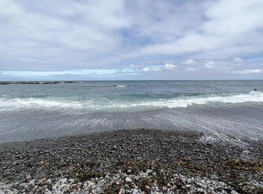
New Zealand is among the nations at greatest risk from natural disasters. More than 430,000 New Zealanders live in tsunami evacuation zones, and many more work or play there. Comparisons of the impacts of recent, large tsunamis overseas have demonstrated that well-executed tsunami evacuations can prevent many casualties.

Our project focusses on our collective ability to swiftly and safely follow the ‘Long or strong – get gone’ advice. We will simulate the decisions and movements of individual people during a tsunami evacuation.

New Zealand's Tsunami Hazard – Understanding the tsunami threat and what to do about it in New Zealand. transcript
Most tsunami are generated by geological processes, and most of those are earthquakes
with the fault line moving and moving a large ammount of water above it,
but can also be a submarine landslide,
or volcanic eruption, or even a landslide going into the ocean,
and on very rare occasions, even an asteroid hitting the ocean.
Faults on the other side of the pacific
eg. in Chile, Peru or even North America, Alaska, Japan etc.
right around the Ring of Fire can also send tsunami our way.
In those cases, we're not gonna feel the earthquake
but we have sensors, and we're part of the Pacific Tsunami Warning System so we will get warning,
probably 10 or more hours warning ahead of time,
that there's been an earthquake and probably that a tsunami has been generated
and our official Emergency management systems will warn you that that's tsunami is coming,
and what you should do.
We think about tsunami sources in terms of local, regional and distant sources.
Local sources are those ones where the tsunami has got less than an hour to get here.
In those cases, the earthquake will be your only warning.
Because if you're really close to the fault, the tsunami could arrive within minutes,
it's important not wait for anything.
Leave immediately, head to higher ground or inland
and stay away for many hours. Stay away until you get the official all clear.
Waves can keep coming for hours, or even tens of hours
from a distance source, and you won't know when they're over.
All of New Zealand's coastline is at risk from tsunami,
but some areas are at risk from bigger or more frequent events than others,
especially the East Coast of the North Island between Wellington and East Cape.
It faces one of these big subduction zone faults.
Tsunami from these largest faults are similar to what we saw in Japan in 2011
and the Indian Ocean in 2004.
In these largest subduction zone earthquake and tsunami,
how far would we need to go inland to get to safety?
I'm gonna show you.
you need to go up hill, or inland.
There is a road behind me that I can walk up
and show you about how high you need to get in those worst cases.
So up here I'm about 30 or a bit more than 30 meters above sea level.
It gives you some idea of how high you need to get if you're right at the coast.
The Wellington South Coast communities have decided to paint a blue line across their roads
at about the level the largest tsunamis can get to.
It's worth noting that these are just a Wellington initiative at the moment,
so you not gonna see these around the rest of the country.
elsewhere you need to be looking for evacuation maps.
This information board at the park in Island Bay shows what those evacuation maps look like.
You can see a series of red, orange and yellow zones
that can be used especially in official warnings to tell us what areas need evacuating.
It may be just the red foreshore, or the orange, and yellow zones that need to be evacuated during official warning.
That might be a warning coming from Peru or Samoa.
Somewhere far enough away that we can give an official warning.
The key message is, if there is time for an official warning
they'll tell you which zone to evacuate.
But if you feel a large earthquake
longer than a minute or too strong to stand up easily,
you need to evacuate all zones immediately.
You don't know how big it's gonna be,
and those earthquake felt sources are potentially close by,
so you need to evacuate without waiting for anything.
You will not get an official warning after a large earthquake.
head uphill or inland.
Every meter you go, the safer you get.

New Zealand's Tsunami Hazard

Understanding the tsunami threat and what to do about it in New Zealand.

The variables at play

A number of variables determine the outcome on an evacuation. These include:

  • Vehicle type: Are people on foot or are they evacuating using cars or bicycles?
  • Obstacles: If the tsunami has been caused by a local earthquake, are obstacles such as landslides and liquefaction blocking people’s paths as they are trying to reach safety?
  • Terrain: How close is a given community from higher ground?

Identifying evacuation issues

Modelling the predicted movement of people during an evacuation will identify likely issues, such as insufficient suitable escape routes, so that additional infrastructure can be installed. Solutions may include widening tracks, signing alternative routes or building tsunami evacuation towers for communities who are far from higher ground.

The effectiveness of these solutions can be tested using simulations. We will produce high quality animations that will enable people to experience what a large-scale evacuation would be like. This will involve developing Virtual Reality scenarios in which people can ‘virtually’ participate in evacuations. Such scenarios will assess the usefulness proposed solutions and aid in making better decisions.

Our work will involve citizen science with local communities in tsunami evacuation areas. This will help to identify problems and solutions that are relevant for the diversity of people within a local environment. It is also an important step in educating communities on their specific risks.

Research programme details

Collaborators: University of Canterbury, Massey University, East Coast LAB, Royal Melbourne Institute of Technology

Duration

2021 – 2024  

Funding platform

Endeavour, Smart Ideas

Status

Current/future

Programme leader

William Power, GNS Science

Funder

Ministry of Business, Innovation and Employment (MBIE)

Find more content related to:

GNS Science topics

By continuing with this download you agree to abide by the rules laid out in the Terms and conditions/Terms of use listed on this page.

If there are no specific Terms and conditions/Terms of use listed then please refer to our Copyright and Disclaimer page and Privacy Policy page

Download