Kāpiti Coast

Geological Summary
The geology of the urban areas of Paraparaumu, Waikanae and Paekakariki is dominated by stabilised Quaternary dune deposits overlying older Quaternary alluvial, colluvial and marine sediments. These rest on Mesozoic greywacke basement exposed in the hills to the east.
Maps and Information
GNS Science has a project underway mapping geomorphology for slope stability assessment in the Kapiti Coast area but no geological mapping projects are underway or imminent. Previously completed maps include:
2000/2018: QMAP 1:250 000 geological map
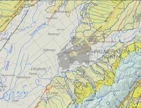
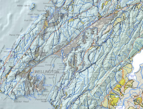
For wider and more generalised geological context of the Kapiti Coast area, a 1:250 000 geological map was printed with an accompanying explanatory text. Digital GIS and image versions of the map are available on DVD. The digital version has since been updated in a national GIS dataset at that nominal scale. The underlying GIS datasets have rich feature attributes.
- Begg, J.G.; Johnston, M.R. (compilers) 2000. Geology of the Wellington area(external link). Institute of Geological & Nuclear Sciences 1:250 000 geological map 10. Lower Hutt, New Zealand. Institute of Geological & Nuclear Sciences Limited. 64 p. + 1 sheet
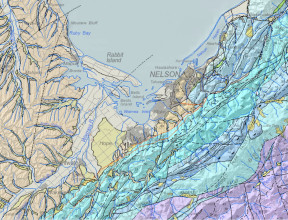
- Heron, D.W. (custodian) 2018. Geological Map of New Zealand 1:250 000(external link). GNS Science geological map 1 (2nd edition). Lower Hutt, New Zealand. GNS Science.
A geological map image can be downloaded(external link) or interrogated through the geological map application(external link). For GIS users, the QMAP geological feature layers can be downloaded from GNS Science’s Web Map/Feature Service(external link).