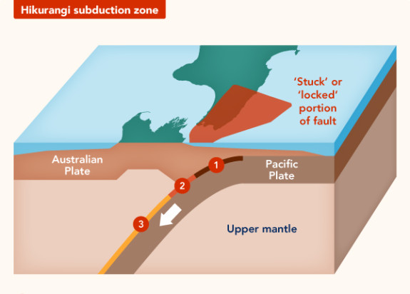
Hikurangi Subduction Zone
The Hikurangi subduction zone is potentially the largest source of earthquake and tsunami hazard in New Zealand.
GNS Science is researching how often this zone can produce earthquake events, and how large these events can be.
Understanding the Hikurangi subduction zone
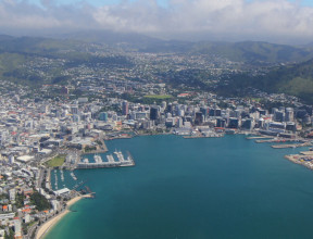
The Hikurangi plate boundary, located off the East Coast of the North Island, is where the Pacific tectonic plate subducts (or dives underneath) the Australian tectonic plate. This is called a subduction zone. A large team of national and international scientists have been studying the Hikurangi plate boundary to find out what risk it poses to New Zealand.
Subduction zones are responsible for some of the largest and most powerful earthquakes and tsunamis in the world.
The Hikurangi subduction zone is potentially the largest source of earthquake and tsunami hazard in New Zealand. At GNS, we are leading a majority of the research on the Hikurangi subduction zone, with major collaboration and contributions from international partners.
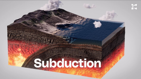
Subduction in New Zealand – New Zealand is at the boundary between two tectonic plates, the Australian Plate, and the Pacific Plate. In the North Island, the Pacific Plate is being pushed under the Australian Plate in a process called subduction. transcript
In the North Island, the Pacific Plate is being pushed under the Australian Plate. This setting, with one plate going down beneath another, is called subduction and that can cause large earthquakes, such as those that have occurred in Japan or in Indonesia. It can also create smaller, but still major, earthquakes close to the coast, such as that in Napier in 1931.
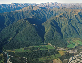
The best place to study slow slip events
Slow Slip earthquakes are often referred to as “slow earthquakes”, as they happen slowly over a period of weeks to months, rather than suddenly in one large earthquake. The world’s shallowest slow slip events occur just offshore Gisborne, and offer a globally unique opportunity to understand why slow slip events happen.
A new study has given scientists a better understanding of the way plate tectonic stresses build up and are dissipated on the Hikurangi subduction zone. We are, in effect, “taking the pulse” of Hikurangi to see if we spot the signals that herald an earthquake.
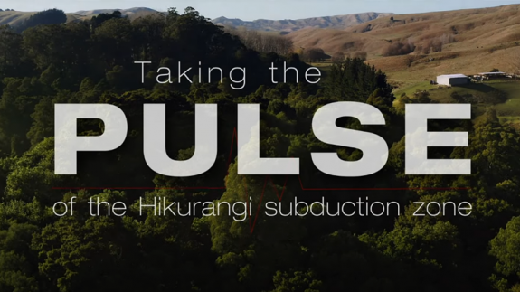
Earthquake Monitoring – Taking the PULSE of the Hikurangi subduction zone transcript
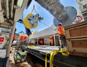
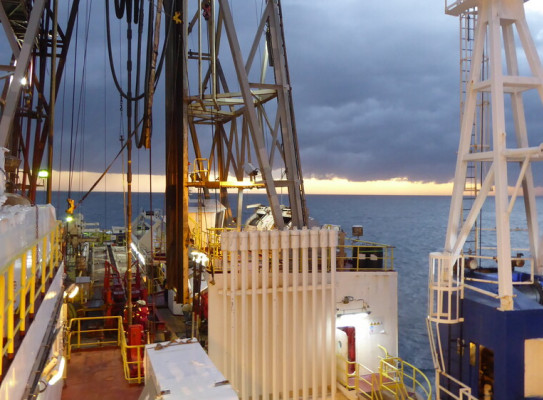
Over a couple of weeks, a team of around 10 scientists have deployed more than 50 instruments to record signals related to slow slip earthquakes.
The PULSE project is an important step towards better understanding earthquake hazard in New Zealand, and the subduction processes that are happening along the Hikurangi subduction zone along the East Coast.
The Porangahau region is particularly interesting because these slow slip events happen approximately every five years or so in this region.
The last event was triggered in 2016 and November after the Kaikoura earthquake.
And so we've been expecting that there would have been a slow slip sometime in 2021, about five years after 2016. The slow step events themselves happen so slowly that they don't produce vibrations and ground shaking, and that means that we can't record them or know that they're happening with normal seismic instrumentation.
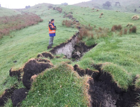
The only way that we've been able to observe them and map out where and when they happen is by deploying GPS equipment. So these are sensors that sit at the ground surface and record their position, and that can tell us how points on the earth surface are moving really slowly through time.
So while these sorts of events don't produce any noticeable ground shaking in themselves, they can produce and trigger small earthquakes.
So the other type of instruments that we can install are these seismometers, these earthquake recorders. We bury the sensors in the ground, and we leave them there for a few months, and they basically record any kinds of vibrations that travel through the crust.
When we record these small earthquake signals, we're able to do a much better job of telling where these earthquakes are happening. And that can tell us something about how these slow slip events are changing the state of stress in the crust and how they're triggering the seismicity.
These slow slip events do happen on other subduction zones around the world, but New Zealand and the Hikurangi in particular has really been a magnet for world leading science in terms of slow slip event understanding in recent years.
And this is because the Hikurangi is in a really unique setting to be so close and so shallow beneath our feet underneath the North Island.
And the observations that we make are much clearer then if we were trying to observe things much deeper down in the earth.
The type of fault motion that we see in these slow slip events is exactly the same as what we see in these large damaging tsunamigenic subduction zone earthquakes.
And so we want to try and understand that if the driving forces behind these two different slip modes, the slow slip and the damaging slip, - if the driving forces are the same, then can we use the much more frequent slow slip earthquakes to better understand how the fault is driven to failure.
And this deployment wouldn't have been possible without the generous help of many of the landowners along New Zealand's east coast. Thank you for letting us put one of these instruments on your land.