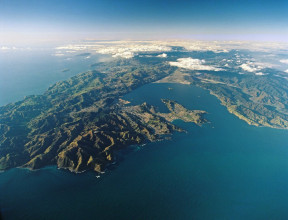
Our Changing Landscape
Our landscape and seascape are in a state of constant transformation from geological, climatic and human activities.
Our research focuses on understanding surface processes through integrated geological, geochemical and geophysical investigations to inform predictive modelling of sedimentation and erosion.
Our science
People and society are central to the approach we take in our research to better understand Earth systems, surface processes and our impact on these processes. GNS Science is interested in all processes that shape the surface and subsurface of the Earth in the Aotearoa New Zealand sector of the Southwest Pacific. Our research in this area is channeled toward supporting the wellbeing, future needs and resilience of the people of Aotearoa New Zealand.
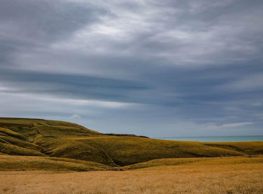
There is one constant about the landscape of Aotearoa New Zealand – change. Our continent is positioned astride an active plate boundary, where dynamic seismic, volcanic, physical, hydrological, chemical and thermal process constantly shape the surface of our continent.
Key questions driving our research
- What role do Earth surface and sea floor processes play in defining the changing dynamic of Aotearoa New Zealand's landmass?
- How can we better understand how slopes evolve, deform and fail through time?
- How can we use new technology, methods and datasets to rapidly assess the risks from landscape change to inform mitigation actions?
- Can we project the impact of changing environmental systems on the future of the coastal zones and coastal systems?
- How will changing climate and land use affect our groundwater systems and impact on freshwater security?
Processes that change our landscape
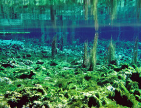
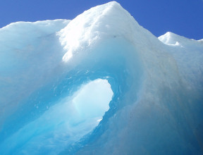
The Earth's crust and surface is continuously shaped and re-shaped by simultaneous and interacting geological, weather and man-made processes. Some of these processes can be 'slow', like the glaciers carving U-shaped valleys between the mountain folds of our Southern Alps. Other processes can be 'fast', such a significant landslide permanently altering the path of a thousand-year-old river flow. Similarly, these processes can be altered by human impact or intervention, like the anthropogenic acceleration of climate warming causing rapid glacier retreat or the clearing of a landslide to restore a river's original path.
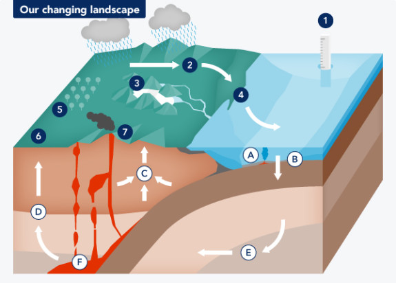
In addition to processes that physically shape our landscape, these processes can also alter the chemical and biological compositions of our Earth's surface. For example, a change in the heat or chemical outputs of our geothermal and hydrothermal systems may impact the biodiversity they sustain. In turn, this can impact the natural resources, such as energy, nutrition, minerals and groundwater, that our communities rely on.
By further understanding these underlying processes, how they interact and how human impact and intervention may further affect our landscape, we can better support the planning and building of resilient communities.
Vertical land movement impact on sea-level rise – The importance of land movement to understanding and predicting future sea levels transcript
Kia ora, koutou. Ko Richard Levy toko ingoa. Ke Te Pou Ao me Te Herenga Waka e mahi ana.
Hello, all. I'm Richard Levy. I work at GNS Science and the University of Wellington - Te Herenga Waka.
I co-lead the New Zealand Sea Rise programme, Te tai pari o Aotearoawith my colleague here.
Kia ora, I'm Tim Naish. I'm also at Te Herenga Waka, Victoria University of Wellington.
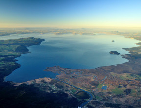
Today we're going to talk a little bit about the importance of vertical land movements when it comes to understanding and predicting future sea level.
In places like New Zealand that sit across convergent plate boundaries where there's uplift and where there's earthquakes and where there are vertical land movements, this has to be taken into account when predicting future sea level.
So vertical land movements can be quite significant and they can be as large as the global mean sea level signal itself.
So right now, global mean sea level is about 3.5 millimetres per year of sea level rise. That's the average rate around the world.
And in some places around the New Zealand coastline, the land is subsiding twice that much or it is rising twice that rate.
And so when the land is subsiding at the same rate sea level is rising, you essentially double the amount of sea level rise, and where the land is uplifting at the same rate sea level is rising, you cancel out the global sea level rise. So vertical land movements or VLMs as we call them, matter when predicting sea level rise.
We're using a couple of different instruments to make these estimates. Global positioning satellites that are sitting in some of the hills behind us attached to the rocks, accurately measuring change in the position of the rock through time is one method we're using, but we're also using radar systems that are based on satellites that are orbiting the Earth above us right now.
These satellites repeat their orbits and fire a radar beam down to the surface of the Earth, hits the earth, reflects back and can actually measure the elevation of the land at sub-millimetre scale. And as those orbits repeat and additional measurements are made you can actually detect change in the surface elevation of the Earth at very high resolution.
So we're able to use those satellite interferometry those satellite radar data, and the GPS data to combine to get accurate measurements of changes in the surface elevation. And we're doing this every two kilometres around the 15,000 kilometres of New Zealand's coastline, making these measurements so that we can incorporate them into our sea level projections.
When the land is going up, we can show that the amount of sea level rise will be less than you would predict if you weren't considering those vertical land movement estimates. Where the land is sinking, it's going to amplify the amount of sea level rise in the future.
Because New Zealand is sitting on a plate boundary, you've got the Australian plate and the Pacific plate basically crashing into each other and that creates uplift and mountains. So a lot of New Zealand in the long term historically has gone up.
Something interesting is happening off the eastern margin of the North Island of New Zealand, and that is where the Pacific plate is going down, being pushed down under the Australian plate and it locks, it grips, and it pulls the land down. So in the lower North Island and on the eastern side of the lower North Island, the land is actually subsiding, going downat quite high rates of up to eight millimetres per year. Right here on the south coast of Wellington at Lyall Bay, the subsidence is three to four millimetres per year, which is effectively doubling the amount of sea level rise we can expect right now and in the coming decades and centuries.
And so, on short timescales of decades to centuries the land in this region - the lower North Island and the eastern lower North Island, is being pulled down, but it does pop back up again on the long timescale.
So an example of that is if you look out here to Turakirae Head, you can see these lovely flat surfaces, these terraces which are old shorelines, hundreds of thousands of years old, and they're now uplifted because of that long term uplift. But right now, and what matters on human timescales and what matters for projecting the impacts of sea level rise in this part of New Zealand, it's the short term subsidence that really matters, and has to be factored into our sea level projections.
This part of New Zealand is exposed to some fairly big swell waves that get generated down around Antarctica. So this part of New Zealand already gets big storm events that at a high tide causes coastal flooding, and these buildings around us are often in the news and getting damaged by those storm events.
Now the problem with the subsidence is that it's really amplifying the amount of sea level rise we will get over the coming decades.
So, by 2050, globally we would expect an average sea level rise of about 30 centimetres. You can double that for this spot. So that'll be 50 to 60 centimetres in the coming decades, and that cannot be avoided. That is already baked in, from the global warming so far.
So what that means is that the hundred year coastal flooding event we currently get now that does a lot of damage to the roads and the houses around this part of Wellington, will become an annual event with just 30 centimetres of global sea level rise, but 60 centimetres right here because of the land going down.
We're sitting here on the south coast of Wellington on a pretty nice day. There's very little wind, weather's fine, there's a little bit of a swell and we can sort of see the level of the ocean. You sort of might wonder, why do we really need to worry about a slight change in the level of the ocean? The seagulls sitting on the beach might have to migrate up the beach a little bit to sit where they are. Who cares right?
But you imagine this place on a day where the swell is large and there's a big storm coming in and we already know that, when that happens, the road behind us is inundated by waves that crash across the road. Add 20 centimetres to the average sea level and put that same storm on top of it, and those waves are going to inundate even further.
So the bottom line is that relatively small increases in average sea level matter when you put those big storms on top of it.