'Seeing' beneath the surface: aerial survey reveals Wairarapa aquifer opportunities
An interactive 3D map of the Ruamāhanga Valley subsurface is supporting the water resilience of the region, identifying areas that could hold a hidden groundwater resource.
Earth Sciences New Zealand has collaborated with Greater Wellington to collect data through aerial electromagnetic surveying, with the data now available through the new online tool.
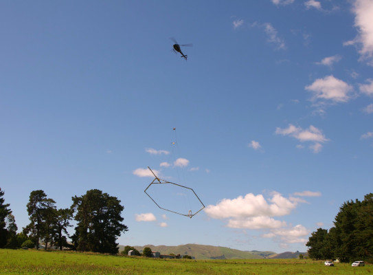
The state-of-the-art SkyTEM surveys were carried out in 2023, by a helicopter towing a large hexagonal loop 40 m above the ground. Transmitters in the loop send electromagnetic signals underground, and sensors measure the strength of the returning signals. The technology can ‘see’ what’s under the ground by determining the resistivity from the way the signals change. The electromagnetic response is sensitive to rock type, porosity, permeability, clay content, moisture content, and properties of water such as salinity, all of which help in the mapping and characterisation of aquifers.
Earth Sciences New Zealand and Greater Wellington groundwater specialists have analysed and processed the data to develop the online mapping tool(external link), through which users can virtually explore potential aquifers to depths of 300 metres underground.
Earth Sciences New Zealand Senior Geophysicist Richard Kellett, says that the technology provides unprecedented detail of the subsurface, covering large areas quickly and cost-effectively.
Previously we’ve had to rely on drilling boreholes, but that only provides information for that specific location. SkyTEM is like having hundreds of thousands of wells at a fraction of the cost.
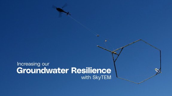
Increasing our groundwater resilience with SkyTEM
The Ruamāhanga Valley mapping project is funded by Greater Wellington, Kānoa Regional Development and Investment Unit, Carterton District Council, Masterton District Council and South Wairarapa District Council.
Greater Wellington’s Director for Knowledge & Insights, Dave Hipkins, says the tool provides knowledge for a more resilient future for Wairarapa’s groundwater.
“This is not a map to new water sources, but it does identify areas that we can investigate further for groundwater. We suggest that landowners draw on expertise of technical experts to interpret the outputs from the models to inform further investigations, modelling, technical and planning assessments required for consent applications to ensure our precious natural resources continue to be fairly allocated.”

-
Earth Sciences New Zealand’s aerial aquifer mapping across the country
Earth Sciences New Zealand has worked with partners such as regional councils to use aerial electromagnetic surveying to support groundwater resilience in their regions. We have collected data over more than 29,000 km of flight lines in Hawke’s Bay, Northland, Gisborne/Tairāwhiti, Southland and the Ruamāhanga project.
Our work in Northland, Gisborne, Otago and Southland is delivered through Aqua Intel Aotearoa(external link), a partnership between Kānoa – Regional Economic Development and Investment Unit and Earth Sciences New Zealand.
Aqua Intel Aotearoa works with scientists, the Government, councils, iwi and local stakeholders to improve our understanding of groundwater and surface water in the regions.
Our cutting-edge groundwater numerical modelling team use the SkyTEM data to refine and reduce uncertainty in the numerical models used to make groundwater management decisions. This improved confidence in modelling helps ensure sustainable management of this critical resource.