Science New Zealand Awards 2022
The Science New Zealand Awards is an annual celebration of the achievements of the scientific community and the positive impact they’ve made across Aotearoa, and the world.
Our winners this year have deepened our understanding of active geological forces in Aotearoa. Emily Warren-Smith won the Early Career Researcher Award for her landmark work studying the Hikurangi margin.
The NZSeaRise vertical land movement team produced the highest resolution map ever created of sea level rise along our coastline.
We were also able to celebrate Dr Rob Funnell’s four decades of science excellence, and his dedication to his colleagues, recognising him with the GNS Science Lifetime Achievement award.
Read on to learn more about their great work.
Early career researcher award
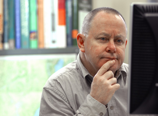
Dr. Emily Warren-Smith
Dr. Emily Warren-Smith was nominated by GNS Science | Te Pū Ao for her creative and insightful integration of geophysical and geological data to reveal entirely new insights into earthquake, slow-slip and plate boundary processes. Dr. Warren-Smith is an exceptional geoscientist who has demonstrated an ability to undertake large-scale, novel, multidisciplinary investigations into fundamental Earth processes. Her work has greatly improved our understanding of earthquake and slow slip event processes, as well as the longer-term tectonic forces that drive plate boundary zone evolution.
A valuable member of the international scientific community, Dr. Warren-Smith has convened sessions at the EGU and the Geoscience Society of New Zealand. She is actively developing new, young talent by mentoring students and actively engaging with the public about earthquakes through Twitter. Dr. Warren-Smith’s work continues to be the subject of frequent media coverage in New Zealand and abroad.

Early career researcher award – Early career researcher award
-
Learn more :
In 2019 Nature Geoscience published Dr. Warren-Smith’s novel study that discovered fluid cycling (fault-valve behaviour) may influence the timing of tectonic plate subduction slow-slip events (Warren-Smith et al., 2019). It was that research that saw Dr. Warren-Smith awarded the 2019 New Zealand Geophysics Prize for the year’s most meritorious publication in geophysics.
Dr Warren-Smith’s analysis of earthquake focal mechanisms used robust statistical methodology to quantify temporal variations in the stress field in the top of the subducted slab that correlated with different stages of a slow-slip event cycle. This landmark study reveals a clear relationship between changes in pore fluid pressure and the onset of slow slip, demonstrating that the timing of slow slip events (and potentially earthquakes) is controlled by fluid cycling processes. The study has to date been cited 73 times in Google Scholar.
A Fast-Start Marsden grant, of which she is lead investigator, has also allowed Dr. Warren-Smith to deploy a seismic network adjacent to the Alpine Fault to detect minor seismic activity (microseismicity) unlikely to be noticed by people. It is this microseismicity that may be linked to the starting and stopping points of previous great earthquakes along the fault. This research is intended to help develop a new understanding of the causes of microseismicity— as well as how these small earthquakes may be used as a tool to constrain large scale tectonic processes and seismic hazard (Warren-Smith et. al, submitted, JGR).
The international scientific community’s respect for Dr. Warren-Smith is clear from the number of invitations she has received to share her insights and knowledge at conferences, including the Japanese Geophysics Union, the American Geophysical Union, Seismological Society of America, and the United Kingdom-based Earth2Earth seminar series; she has also convened sessions at the Geoscience Society of New Zealand and European Geophysics Union.
More than simply growing her own understanding of geophysics Dr. Warren-Smith is actively developing new young talent by mentoring an MSc and two PhD students. She is also focused on helping the next generation of scientists and members of the public by directly engaging with them through Twitter to help explain issues related to earthquakes.
Emily is clearly laying the foundations for an impressive career that will have a major impact locally, nationally, and abroad. She is a vanguard in both the methods used to interpret earthquake observations, and in our understanding of fault zone evolution and rupture processes.
Dr Warren-Smith’s immense contributions to the New Zealand and global scientific community would be notable for a career of any length but are exceptional for someone so early in their scientific career.
Team achievement
New Zealand SeaRise Vertical Land Movement Team (Sigrun Hreinsdottir, Ian Hamling, Kate Clark, Nicola Litchfield, Richard Levy)
Research conducted by the NZ SeaRise Vertical Land Movement Team has provided a novel and enriched view of how much time property owners, councils, and our government may have before rising seas begin to claim back parts of Aotearoa New Zealand. Their work has given the clearest picture yet of where, as a result of plate tectonics and local faults, land in the motu is rising and subsiding. The insights generated by the team have painted a timeline of sea encroachment that is, for some communities, decades sooner than previously thought.
The NZ SeaRise Team captured the attention of a nation and wide-spread media coverage that continues to this day. More importantly, the research and the insights generated from its data have sparked an urgent drive to help make careful and informed investment decisions that allow the nation to strengthen necessary infrastructure, plan coordinated retreats, or avoid investing to minimise the costs associated with climate change.
Team achievement – Team achievement
-
Learn more :
The NZ SeaRise | Te Tai Pari O Aotearoa programme released in May 2022 the first location-specific sea level rise projections for New Zealand. The projections incorporated novel, higher resolution vertical land movement (VLM) data—proving a game-changer in the nation’s understanding of the timing and potential impact of rising sea levels. GNS Science’s Vertical Land Movement team produced estimates that sit at the heart of these new projections.
Traditional approaches to measuring vertical land movement were impossible with over 15,000 kilometres of coastline in Aotearoa New Zealand; to overcome this, the team combined observations from Interferometric Synthetic Aperture Radar (InSAR) and Global Positioning Satellite stations to increase the breadth and density (resolution) of vertical land movement estimates.
The team used Synthetic Aperture Radar images collected between 2003 – 2011 for their estimates to minimise the influence of large earthquakes post-2011 that may have altered regular patterns of uplift and subsidence in New Zealand. More than 2500 individual interferograms were generated over 8 years to estimate a vertical displacement rate. These were then compared with GPS data to ensure a consistent frame of reference.
The product of the team’s effort is the highest resolution and most systematic map of countrywide vertical land movement that has ever created. The nation now has a tool that provides sea-level rise projections for every two-kilometre stretch of its coastline— over 7000 individual sites in total— with large variability around the country resulting from volcanic, tectonic, and anthropogenic sources.
Understanding the impact of vertical land movement on sea level rise significantly changes the time available to plan for its impacts. The amount of sea level rise we may have previously anticipated in 5-6 decades now seems likely to occur within a few decades.
The amount of sea-level rise that local infrastructure can handle in Wellington is relatively small – just 30 centimetres. That amount of sea level rise is already unavoidable, no matter how much we curb emissions. Inundation events are likely to become much more frequent with once-in-a-century flooding becoming an annual event. Thanks to the team’s efforts planners can now fast-forward adaptation plans for the benefit of Aotearoa, its people, communities and economy.
The SeaRise projections are publicly available on an online interactive map – and their release received significant media attention in May 2022. The new projections are being incorporated into the next Ministry for the Environment guidance for local government practitioners on coastal hazards and climate change.
Lifetime achievement award
Dr. Rob Funnell
Rob wasn’t nominated solely for the enormous financial contributions his work contributed to for Aotearoa New Zealand; he was nominated for the manaakitanga he displayed throughout his decorated 37-year career.
Rob was known for collaborating and supporting his colleagues at GNS Science— even staying late into the night to help returning workers from the field to unpack their vehicles and stow their gear—providing not just a helping hand but a warm cuppa and supportive voice.
When the times changed, so did Rob: he pivoted from research identifying hydrocarbon reserves to more recent efforts to find ways we may be able to sequester carbon. It’s for those reasons that he is here, tonight, nominated for the Science New Zealand Lifetime Achievement Award.

Lifetime achievement award – Lifetime achievement award
-
Learn more :
The split of DSIR into separate Crown Research Institutes, in 1993, brought Rob to GNS Science, in Lower Hutt. It is at GNS that Rob authored 21 journal papers, 2 books, 45 science reports, and 106 consultancy reports on a wide range of topics, including:
- geophysical well logging,
- basin history and hydrocarbon generation modelling,
- petroleum systems and charge modelling,
- basin and play prospectivity assessment,
- oil and gas reserve estimation,
- and carbon capture and storage (CCS).
At GNS Science Rob led the development of ground-breaking software that pioneered three-dimensional basin modelling in New Zealand. The software enabled focused exploration of New Zealand’s basins.
The discovery of the Tui oil field, offshore Taranaki, was the result of one of Rob’s earliest basin modelling projects. Ultimately, the oil field’s discovery generated more than a billion dollars of taxes and royalties for Aotearoa New Zealand.
Rob’s scientific and technical accomplishments are a hallmark of his 37-year career, but it is his enduring commitment to Aotearoa New Zealand and a selfless, supportive, and effective leadership style that may be his greatest contributions to the wider scientific community.
Rob’s manaakitanga for his staff was present in everything he did. Colleagues recall he would always stay after hours to greet returning field parties, even helping to unload their vehicles. New arrivals to GNS would be housed, fed, and helped with the practicalities of settling into their roles. He was never too busy to answer questions, explain some baffling geophysical phenomenon, or simply to lend an empathetic ear to one’s problems.
Rob has become an internationally recognised basin modelling expert and authority on Carbon Capture and Sequestration (CCS), working on many projects in Southeast Asia, South Korea, Australia, and the United States. Appointed to the Western Australia Government’s technical review panel for the world’s largest CCS project, at Northwest Australia’s Gorgon Field, he has also led GNS Science’s participation in the Australian Cooperative Research Centre on CO2 capture and storage (CO2CRC).
Rob Funnell’s highly distinguished 37-year career leaves a substantial legacy of technical achievement and myriad researchers in Aotearoa and abroad who have benefitted from his dedication to science. While he may not be behind the tools full time anymore it is clear he continues to play an ongoing and pivotal role in mitigating climate change and enriching New Zealand— and the world’s— science community.
Rob’s full-time career ended in 2021 when he retired from a role as the Basin Analysis team leader at GNS—a role he took over in 2018.