New tool can forecast eruptions when volcano data goes offline
Earth Sciences New Zealand scientists have developed a promising volcano eruption forecasting method that can provide critical information even when other tools fail.
Scientists observe volcanic activity in several ways and use this information to assess a volcano’s level of activity. Visual observations, gas emissions and seismic recordings collected on site or remotely all contribute to the science data mix. But technical issues sometimes prevail and volcanic environments can be tough on the sensitive equipment, taking it offline.
The new tool means scientists can continue to calculate the probability of an impending eruption, as early as weeks out from an explosive event, markedly reducing the chances of being data blind leading up to and following an eruption event.
Lead author and Earth Sciences NZ geophysicist Yannik Behr said monitoring equipment located on volcano surfaces can be vulnerable to damage from hazards such as ash, ballistics, landslides, and lahars.

Access to data, particularly during volcanic unrest, is critical for making assessments and informing advice provided to emergency managers and other decisionmakers.
“While the more data available from multiple sources increases the model’s accuracy, this new model has still proven to be useful when one or more data streams are excluded. This makes it a valuable tool for increasing our resilience to sensor outages so that we can deliver the most up-to-date advice for potentially life-saving decisions.”
Volcano forecasts complement 24/7 volcano monitoring by informing expert assessment of volcanic activity. For example, a higher probability on a forecast tool might support a volcano activity level (VAL) going from VAL1 to VAL2, which indicates a higher level of unrest.
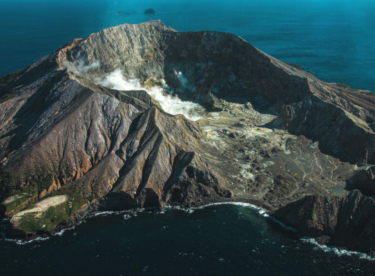
The forecast model was developed for Whakaari/White Island, which has not had on-island monitoring equipment since 2022. Read a statement here(external link) on the current restricted access and monitoring of Whakaari/White Island.
Dr Behr said the model’s current forecasts only use gas emissions data but is trained on a diverse set of volcanic observational data.
“When applied to historical activity, the model accurately forecasts the increased likelihood of an eruption days to weeks prior to the three explosive eruptions recorded between 2013 and 2019 when using all available data. Even without on-island sensors it would still have produced useful forecasts for two out of the three eruptions,” Dr Behr said.
“This is a promising result and will greatly complement the established monitoring methods we use to look for signs of a future eruption. This could prove particularly valuable given Whakaari/White Island’s current state of unrest.” See the latest Volcanic Activity Bulletins(external link) here.
“What’s more, the method can be easily adapted to other volcanoes and increase the resilience of their existing forecasting methods that often rely on a single data stream.”
The research, undertaken as part of the Earth Sciences New Zealand-led Beneath the Waves programme, has been published in Geophysical Research Letters(external link).
The model detects patterns in multiple volcanic observations including carbon dioxide, sulphur dioxide and hydrogen sulphide gas emission rates as well as seismic tremor recordings and earthquake rates. When operational, the forecasts will be updated automatically as new monitoring data becomes available.
About the Beneath the Waves programme
The Beneath the Waves programme is the first to comprehensively assess the hazards of Whakaari/White Island and Tuhua/Mayor island from seabed to summit. The new data is being used to build robust simulations and models that can help monitor, assess, and forecast possible hazard scenarios for the Bay of Plenty from future volcanic events.
Beneath the Waves is an Earth Sciences NZ-led MBIE-funded programme delivered with collaborators from University of Canterbury, Massey University, Victoria University of Wellington, and Bay of Plenty Civil Defence and Emergency Management.
Visit beneaththewaves.org.nz(external link) for more information.