Sliding Lands Hōretireti Whenua
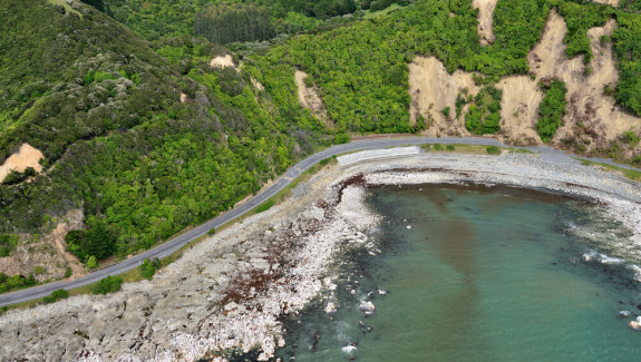
As a hilly country with high rainfall and frequent earthquakes, landslides are an ever-present hazard in many parts of the country, with climate change likely to increase the risk of landslide events.
To increase Aotearoa’s resilience against rapid and dangerous landslides triggered by extreme weather or earthquakes, we need to understand when and where such landslides may occur, what their impacts could be for a range of disaster scenarios, and how to effectively communicate the risk and impact to affected communities.

About the project
The Hōretireti Whenua Sliding Lands programme will create national-scale landslide models that can forecast where rapid and dangerous landslides are likely to be triggered by earthquakes and rainfall events.
The models will use susceptibility factors such as rainfall, ground shaking, vegetation type, and slope gradient to determine the likelihood and locations of fast-moving landslides across the country for earthquake and rainfall triggers. These susceptibility models will be combined with landslide runout models and vulnerability models to predict the hazard and risk from landslides. From this information our models will determine what the impacts may be, particularly to people, property, industry, and the environment.
The programme will also investigate people’s perception of landslide phenomena, hazards, and the models we develop to understand the risk and impacts of landslides, as well as their perceptions of vulnerability to landslides. Findings will be used to improve the communication and visualisation of model outputs around risk, as well as inform the development of the models themselves.
The effectiveness of the landslide models will be tested and refined using two case studies based in Tairāwhiti and Auckland.
Project phases
- Develop nation-wide probabilistic models for earthquake-induced and rainfall-induced landslides of varying landslide types and sizes.
- Research perceptions of landslide phenomena and associated vulnerability.
- Apply our novel impact-based landslide forecast models to case studies to test their effectiveness to real-world scenarios.
- Refine model outputs and communication frameworks that maximise the usability of model results for end users.
The models
The models will comprise:
- susceptibility
- runout
- vulnerability and risk.
The programme will create probabilistic models of landslide susceptibility using physics-based knowledge and machine learning techniques to develop rapid landslide nowcasts and forecasts. The programme will also develop a suite of landslide runout models for different landslide types, that will estimate how far debris travels downslope to determine what might be impacted.
The outputs of these models will be used to develop nowcasts and an impact-based warning system for landslides during earthquakes and when heavy rainfall is forecasted. The system will generate automatic impact-based warnings to support response and emergency management efforts by NEMA, local CDEMs and MetService.
The research will also investigate the behaviour and perceptions of individuals, communities, iwi, and organisations in response to landslides. The results from this research will be woven into the risk models by rethinking how we deal with vulnerability and use that understanding to inform effective hazard- and risk-based communication strategies, ultimately developing new vulnerability models for people, infrastructure, and buildings.
Data and tools
The models will be built on years of scientific research, a vast catalogue of landslide data - including an inventory of more than 140,000 Cyclone Gabrielle-induced landslides, availability of high-resolution rain radar, LiDAR and other remotely sensed datasets, advances in modelling techniques including using artificial intelligence and machine learning techniques, and information on people’s perception of landslide hazards, their associated vulnerability, and the model outputs.
The programme will use RiskScapeTM(external link), an open access, multi-hazard risk modelling tool, to create national-scale landslide forecast models by integrating hazard and vulnerability model components with the MERIT Tool to quantify the socio-economic impact of landslide hazards.
Case studies
The two case studies are designed to develop and test the models to ensure they are fit for purpose. They will also allow the programme to extensively progress and disseminate the new knowledge gained from this research via databases, models, geospatial datasets, forecasts and nowcasts.
Tairāwhiti
A case study in Tairāwhiti will focus on iwi and will recognise the distinctive research, science, and innovation contributions of Ngāti Porou. It will be led by and support Mātauranga Māori and Kaupapa Māori research by:
- detailing learnings from recent landslide events,
- co-designing a landslide response framework for hapū, iwi and the community, and
- enhancing natural hazard preparedness and response in Kura Kaupapa Māori/schools.
Auckland
A case study in Auckland will assesses the social and economic vulnerability and risk to people, businesses, and the local community from landslides, incorporating climate change scenarios. It will explore the impact of landslides using key socio-economic metrics that examine:
- the value of the data and model for key decision-makers, and
- whether improvements in model resolution and quality from the susceptibility, runout, and vulnerability and risk models result in better decision-making.
Funding and collaborators
This research programme is funded $10.5 million from the MBIE 2023 Endeavour Fund.
The programme is led by GNS Science, with research partners Massey University, Manaaki Whenua Landcare Research, Te Runanganui o Ngāti Porou, Market Economics, University of Auckland, Resilient Organisations and University of Canterbury.
GNS Science is working with iwi partners, international collaborators from the UK (Durham University) and Switzerland (ETH Zurich) and stakeholders from central and local government.
-
Programme team
Saskia de Vilder (GNS)
Emma Hudson-Doyle (Massey University)
Chris Massey (GNS)
Julia Becker (Massey University)
Lauren Vinnell (Massey University)
Catalina Miranda (Massey University)
Charlotte Brown (Resilient Organisations)
Hugh Smith (Manaaki Whenua)
Tom Robinson (University of Canterbury)
Nick Rosser (Durham University)
Andrea Wolter (GNS)
Kerry Leith (GNS)
Robert Buxton (GNS)
Janine Bidmead (GNS)
Jordan Aaron (ETH Zurich)
Nick Horspool (GNS)
Liam Wotherspoon (University of Auckland)
Sheng-Lin Lin (GNS)
Sally Potter (Canary Innovation)
Sara Harrison (GNS)
Mary Anne Clive (GNS)
David Johnston (Massey University)
Kelvin Tapuke (Massey University)
Tania Gerrard (GNS)
Brenda Rosser (GNS)
Garry MacDonald (Merit)
Ngarangi Walker (Te Runanganui o Ngāti Porou)
Tash Wanoa (Te Runanganui o Ngāti Porou)
Oscar Montes (Scion supporting Te Runanganui o Ngāti Porou)