NZ Water ModelTātaihia te Parataiao o Te Wahapū
The New Zealand Water Model provides a nationally consistent framework to help inform decisions on the use and quality of freshwater.
Overview
Water users from regional councils through to farmers and industry must set limits on the use and quality of freshwater, and allocate water takes based on those limits. The New Zealand Water Model provides a nationally consistent framework to help inform those decisions.
NZ Water Model – Hydrology (NZWaM – Hydro) is a partnership between NIWA (lead), GNS Science and Manaaki Whenua - Landcare Research, and Environment Southland, Horizons Regional Council, and Gisborne Regional Council.
Water management is a significant challenge due to interactions between land, vegetation, climate, surface water and groundwater. Better national-scale hydrological knowledge with data on surface water, soil, geology and groundwater combined with advanced modelling techniques can help make more informed management decisions.
Meeting the challenge
Setting limits on water allocation and land use to protect water resources can be particularly difficult in areas with sparse measurements, especially under unprecedented future conditions such as climate change. Collection of appropriate data combined with data assimilation through computer models can help inform decision-makers and provide an understanding of the uncertainties associated with the various predictions of interest related to management activities.
Models must be designed to answer appropriate questions related to the effects of different land-use and climate scenarios. These models must be complex enough to represent the integration of natural and human processes at the appropriate scale, but simple enough to accommodate efficient data assimilation through history matching (e.g. “model calibration”). The data used for history matching need to be capable of adequately informing predictions of interest in the near and far future.
The groundwater components of NZWaM developed by GNS aim to
- enable forecasts (and associated uncertainty) of how climate, land use, water use, and other environmental changes will affect fluxes between surface water and groundwater from national to sub-catchment scales
- enable forecasts (and associated uncertainty) of how climate, land use, water use, and other environmental changes will affect fluxes between surface water and groundwater from national to sub-catchment scales
- better quantify estimates and uncertainty of groundwater contributions to base flow (i.e. low flow periods), enabling communities to make more sustainable water management decisions.
To achieve these objectives, the programme will
- build a geospatial and geo-temporal database to organise and harmonise data, and provide transferable, scalable and cost-effective applications
- build a geospatial and geo-temporal database to organise and harmonise data, and provide transferable, scalable and cost-effective applications
- collect tracer data (e.g. stable isotopes and tritium) to help identify the source and travel time of water through the hydrologic system
- combine surface-water predictions from NIWA with groundwater models to simulate the equivalent flow and transport processes
- use the ability of the simulations to reproduce the observed tracer data, combined with parameter value uncertainty, to make forecasts and quantify their uncertainty
- build a geospatial and geo-temporal database to organise and harmonise data, and provide transferable, scalable and cost-effective applications
The Project
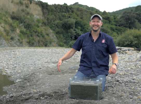
GNS Science’s role in NZWaM - Hydro
Our work focuses on developing groundwater models from national to sub-catchment scales, along with components of the Hydro-Geofabric related to groundwater flow. Our groundwater models are built and parameterised in a way that allows robust quantification of the uncertainty.
This uncertainty arises from interactions between climate, vegetation, land use, and geology. In simple terms, we gather, harmonise and enhance existing multi-source spatial datasets to form a framework of nationally consistent inputs tailored for hydrological modelling designed to address pressing water resource concerns in a rapidly changing world.
GNS Science is responsible for developing:
- national datasets of aquifer hydraulic properties
- compatible groundwater-flow and age models in test catchments
- calibration of these models with groundwater age-tracer data
- an uncertainty framework that will be applied to address issues related to groundwater-surface water interactions
Working with Te Rarawa
This project was a partnership designed to enhance connections between Te Rarawa iwi and GNS Science through the sedimentation study.
It used scientific methods to help understand the causes of environmental changes in the mauri, enabling Te Rarawa to develop management approaches informed by both science and their mātauranga.
In March 2021, seven Te Rarawa participants travelled to GNS Science to participate in hands-on sampling and analysis of material from the cores. This contributed significantly to the two-way sharing of knowledge and skills that underpinned and guided this project.
The project team and other partners delivered marae-based environmental education kaupapa to the next generation of kaitiaki across Te Hiku. These included Geo Noho and Noho Taiao. In these multi-day projects, amongst other hands-on activities, school children went into the field to collect and analyse their own sediment cores.
Where to from here?
GNS Science has invested heavily to expand our coastal research activities and capability. Activities and results from this project are included in our multi-year Integrated Coastal Dynamics research project, which is part of our Global Change Through Time programme.
Growing our capacity and work in the Hokianga and Te Hiku areas is a cornerstone of this investment and new direction.
The results will also be used to underpin a Te Rarawa / GNS Science co-design of a MBIE Endeavour Research Programme bid with Mātauranga Māori as its cornerstone.
The two organisations will also pursue further Te Ao Māori-centric education projects for Te Hiku taitamariki.
Research programme details
Collaborators: NIWA, Manaaki Whenua – Landcare Research
Duration
Ongoing
Funding platform
Strategic Science Investment Fund
Status
Ongoing
Leader
Wes Kitlasten, GNS Science
Funder
Ministry of Business, Innovation and Employment (MBIE)