
NZ SeaRise
NZ SeaRise Te Tai Pari o Aotearoa brings together local and international experts to improve sea-level rise projections in New Zealand.
Overview
Managing and adapting to coastal change caused by sea level rise is complex. It depends on accurate projections of future sea level and the response of the local environment to these sea level shifts. The NZ SeaRise Te Tai Pari o Aotearoa project is helping us make better decisions about how to anticipate and manage the consequences of rising seas around Aotearoa New Zealand.
Observations show that average global surface temperature has increased by more than a degree over the past 100 years, at the same time sea-levels have risen by 20cm. Just how much temperature will increase over the coming years depends on our greenhouse gas emissions, which are highly dependent on decisions we make about the way we live. We do know that, even if we manage to achieve net zero emissions by 2050, there is enough extra heat in the Earth system that sea level will continue to rise for decades and possibly centuries to come. However, we don’t know exactly how much or how rapidly seas will rise around New Zealand and how these changes will impact our coastal areas.
This project aims to reduce this uncertainty by improving estimates of Antarctic Ice Sheet melt and by examining the effect of up and down land movement around our 15,000 km long coastline.
This project aims to
- produce estimates (projections) of the magnitude and rate of sea-level rise at locations around our 15,000 km coastline
- include estimates of vertical land movement (VLM) in these sea-level projections
- examine the effect of projected sea-level rise on groundwater levels in South Dunedin
- examine the effect of projected sea-level rise on coastal rivers and estuaries in Hawkes Bay
- fill knowledge gaps that currently limit our ability to anticipate and manage the hazards, risks, and impacts of future sea-level rise
To achieve these objectives, we will
- produce estimates of annual up and down movements (vertical land movement - VLM) at 2km spacing around New Zealand’s coastline using data from our national continuous GPS network and radar data from satellites (InSAR)
- incorporate the latest outputs from climate and ice sheet models included in the recent IPCC Assessment Report 6 with our estimates of VLM using state-of-the-art statistical techniques to produce location-specific sea-level projections
- model the response of groundwater height to sea-level rise in South Dunedin
- model sea-level rise induced changes in salinity at the mouth of rivers in Hawkes Bay and consider the impact on inanga/whitebait spawning sites
- incorporate new sea level projections into a web-based map portal, Takiwa(external link).
The Project
-
Causes of sea level change
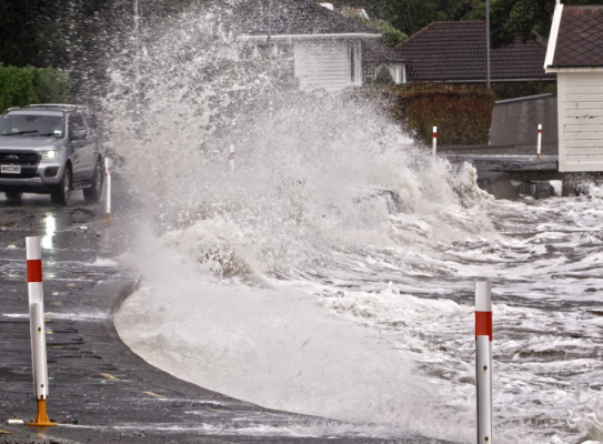
Our planet is warming as greenhouse gas concentrations in Earth’s atmosphere continue to increase. The warmer temperatures are causing sea levels to rise as warming oceans expand and water from melting glaciers, ice caps and ice sheets flows into the sea. These rising seas will impact the things we value including private and public infrastructure and our coastal environment, much of which defines us as a nation. At risk will be dunes, coastal wetlands, estuaries, beaches, shellfish, fish nursery habitats like seagrass, groundwater and artesian water quality, coastal habitats that provide storm surge protection and act as rich carbon sinks.
However, projecting just how much and how fast sea level will rise is difficult and this makes it challenging for us to plan into the future. This difficulty is mostly because we don’t know enough about Antarctica’s ice sheets nor how global emissions will track this century. Understanding Antarctica’s likely contribution to future global sea-level rise, and projecting sea-level change around Aotearoa, is a major focus of our work.
-
Sea-level rise since 1900
Global mean sea level has risen approximately 18cm since 1900. For New Zealand, the observed local sea-level rise averaged across our four main ports (Auckland/Tāmaki Makaurau, Wellington/Te Whanganui-a-Tara, Lyttleton/Ōhinehou, and Dunedin/Ōtepoti) is 21 ± 0.6 cm from 1900-2018. Whereas 20cm may not seem like a lot, this historical rise in sea level has increased the frequency of coastal flooding events around the world and future sea-level rise will amplify this impact.
Approximately two-thirds of the historical rise in sea level is due to an increase in ocean water mass as fresh water from melting ice sheets and glaciers enters the sea. The remaining third is due to expansion of the ocean as it warms. While the average rate of sea-level rise through this time interval is 1.56 ± 0.33mm yr-1, measurements from satellites indicate sea-level rise has accelerated over the past 25 years and that the current rate of rise is approximately 3 ± 0.4mm yr-1.
Sea-level rise is not uniform
Unlike a uniform increase in water height that occurs as water is added to a bathtub, sea-level rise varies across geographic location and over time – sea-level rise at any specific location can depart markedly from the global average. So, while global mean sea level (GMSL) projections help us understand the total magnitude of change, they do not offer estimates that are always relevant at a local scale.
Local Sea Level (LSL) is the sea level experienced at a specific point on a coastline and has obvious relevance when it comes to planning and adapting to inevitable change. LSL is influenced by a range of complex climate change-related processes including:
- ice sheet melt
- oceanographic processes, including changing currents and thermal expansion
- glacier and ice cap melt
- changes in land water storage (including both natural and human-controlled mechanisms)
Non-climatic geodynamic processes also influence LSL and include instantaneous changes in Earth’s gravity field and rotation, and VLM due to tectonics, sediment compaction, and glacial isostatic adjustment or GIA, which is an ongoing response to previous episodes of ice sheet growth and retreat.
VLM is particularly important in New Zealand as we sit across the active boundary between the Pacific and Australian plates. NZ SeaRise is integrating the latest understanding regarding these processes at global, regional, and local levels to generate LSL projections around our entire coastline.
The ups and downs along our coastline
The vertical position of our coastlines is also changing due to the movement of tectonic plates. New Zealanders understand the impact of plate movement better than most people in the world. We live on a plate boundary and our coastline is always changing.
Scientists can measure the amount of VLM using global positioning satellite technology and radar systems mounted on Earth-observing satellites. These instruments show us that parts of our coast are rising at a rate of 1cm every year and others are sinking by as much as 1cm per year. Areas of land that are rising reduce the effect of global sea-level rise and can even cause a local fall in sea level – at least in the short term.
Local sea-level projections
We have generated Local Sea Level (LSL) projections for Aotearoa which include all sources that contribute to sea-level change (outlined above) spaced every 2km around our coastline. These projections are for a range of emissions scenarios (Shared Socio-economic Pathways – SSPs) and associated changes in global surface temperature. They use climate and ice sheet model outputs and data included in the IPCC Assessment Report 6.
Impact studies to help complete the picture
We are investigating how rising seas will affect groundwater levels in South Dunedin.
We are also working with iwi in Hawkes Bay to examine how sea-level rise might alter the distance that salty water can flow up coastal river systems and potentially affect important ecosystems.
Research programme details
Collaborators: Victoria University of Wellington (VUW), NIWA
Duration
2018–2022
Funding platform
Endeavour Fund
Status
Current
Programme leaders
Dr Richard Levy (GNS/VUW) and Professor Tim Naish (VUW)
Funder
Funder: $7.1M over five years from Ministry of Business, Innovation and Employment (MBIE)