
Envirolink toolsDeveloping a collaborative satellite data workspace for regional councils
This project developed a suite of standard processing methods for satellite data of land-use change, wetland dynamics, flood and drought impacts, coastal change and forestry change.
Overview
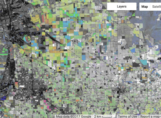
Google Earth Engine (GEE) is a game-changer for New Zealand regional council and other environmental scientists when it comes to using satellite data to identify and map land, soil, vegetation and inland water consistently across all regions. This cloud-computing service for satellite data processing enables data and methods to be easily shared between all regional councils.
Regional councils no longer have to download and process data vast amounts of data. Instead, they can use tutorials and lessons learnt in a collaborative platform called ‘EnviroSatTools’ to tailor and adjust data to their own needs. Central government scientists can also access the data for their own research.
The project aimed to
- work with regional councils and satellite remote sensing experts to test the opportunities and challenges for regional councils to share each other’s scripts and data in a collaborative platform built on GEE
To achieve these objectives, we
- developed a suite of methods and algorithms in GEE that assesses a range of factors applicable at both national and regional scale
- delivered one-on-one training at regional councils and six-monthly national training workshops
- created guidelines outlining the explanation and possible uses of the methods and algorithms
The project
The project included one-on-one training and six-monthly national workshops for regional councils. The goal was to build capability with the Google Earth Engine (GEE) tools for each regional council’s specific criteria and applications.
Training was provided by domain experts across New Zealand – GNS Science, University of Auckland, Indufor, Manaaki Whenua Landcare Research and Xerra.
EnviroSatTools
Working collaboratively
The collaborative workspace has three main components:
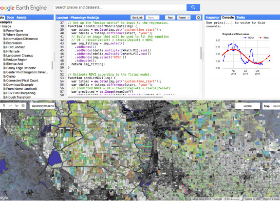
- GEE; a game-changer that significantly speeds up and standardises the processing, analysis and visualisation of satellite data. An archive of multi-petabytes of satellite data can be processed in the cloud, without the need to download or process on inhouse computers
- a web-forum to share findings and ask technical questions
- a home for methods, algorithms and documentation, based on the Git Software, including a Wiki space for documentation
Pilot studies
The project developed five application modules:
- change detection
- wetlands
- forestry change
- flood mapping
These modules were prioritised by regional councils. Each module contains one or more applications, coded in GEE. Each application can be used directly or adapted, e.g. different region of interest.
Google Earth Engine
Google Earth Engine (GEE) is a processing platform that facilitates easier and more shareable satellite remote sensing data analyses. GEE takes away the high computational burden of having to download and process vast amounts of satellite data. It also hosts and processes datasets, reducing data compilation efforts and increasing analytical efficiency.
In Google’s own words:
“Google Earth Engine is a cloud-based platform for planetary-scale geospatial analysis that brings Google's massive computational capabilities to bear on a variety of high-impact societal issues including deforestation, drought, disaster, disease, food security, water management, climate monitoring and environmental protection. It is unique in the field as an integrated platform designed to empower not only traditional remote sensing scientists, but also a much wider audience that lacks the technical capacity needed to utilize traditional supercomputers or large-scale commodity cloud computing resources.”
Research programme details
Project partners: University of Auckland, Indufor, Xerra, Manaaki Whenua Landcare Research
Duration
2019–2021
Funding platform
Status
Project lead
Rogier Westerhoff, GNS Science
Funder
New Zealand Ministry of Business, Innovation & Employment (MBIE)