How do we know where the heat is?
Aotearoa New Zealand is fortunate to have abundant geothermal resources. While geothermal systems are geologically complex and site-specific, there are several broadly recognised sources of geothermal heat in Aotearoa New Zealand.
In general, subsurface temperatures are influenced by local geology (rock composition), thermal gradient (heat from the Earth interior), tectonic structure (faulting and rock movement) and volcanism (active or remnant). The accessibility of that heat is also dependent on subsurface water content and flow rate. Although temperatures without water can be used (closed loop) the efficiencies of accessing flowing subsurface water has a large influence on the amount of energy that is retrievable economically.
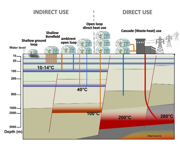
The figure below is a schematic of several different subsurface settings which may represent geoheat resources. “Indirect use” generally refers to settings where heat pumps may be needed to reach desired temperatures, while “direct use” show setting where geoheat is likely able to be used directly.
Local geology, groundwater, heat flow, and faulting can be estimated from geophysical measurements, geological mapping, and borehole logs. These are the key characteristics provided in the mapping and calculator tool we developed for this project.