Sedimentary basins
Sedimentary basins are natural depressions in the Earth’s surface where thick layers of sediment slowly accumulate.
The continent of Zealandia
Research focuses on using samples and information from New Zealand’s sedimentary basins to understand the way that the continent of Zealandia has changed and evolved through time. Sediments in the Deepwater Taranaki Basin record the uplift and erosion of the Southern Alps, for example.
Sedimentary basins along the East Coast of New Zealand tell the story of the early development of the Hikurangi Subduction Margin, where the Pacific Plate is being slowly pushed down below the Australian Plate.
Work being undertaken as part of the current Understanding Zealandia/ Te-Riu-a-maui programme uses the rock records from New Zealand’s sedimentary basins to better understand natural hazards, past ocean and climate changes and the heritage and history of New Zealand.
-
What are sediments ?
Sediments are mostly made of small particles of rock that have been broken down by weathering and transported by wind, glaciers, rivers or gravity before settling out or being ‘deposited’. For Earth Scientists, sedimentary basins provide a unique record of tectonic forces, ocean, atmosphere, life and climate changes going back millions of years. They also house valuable energy and mineral resources such as lithium and cobalt, which are critical for the transition to clean energy.
-
What are sedimentary basins?
Sedimentary basins form where parts of the Earth’s crust naturally subside (sink) over time to create a natural depression. Sedimentary basins are different sizes — some are relatively small, while others can be hundreds or thousands of kilometres wide and several kilometres deep.
As the Earth’s surface subsides, layers of sediment slowly accumulate. As more and more layers of sediments build up, sediments at the bottom of the pile are pushed down, becoming deeply buried and crushed by the layers above. This burial and pressure cause physical and chemical reactions that turn them into rocks over many millions of years.
Over even more time, the layers of rock that have formed in sedimentary basins can be subjected to changing tectonic forces as a result of the constant, slow shifting of the tectonic plates that make up the Earth’s crust. These forces can bend, break and up-lift the sedimentary rocks, forming faults and folds and even pushing them up to form mountain ranges. This explains why limestone – a sedimentary rock formed in warm, shallow seas – is found at the highest point on Earth at Mt Everest’s summit.
-
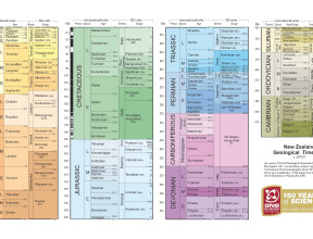
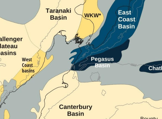
New Zealand’s sedimentary basins
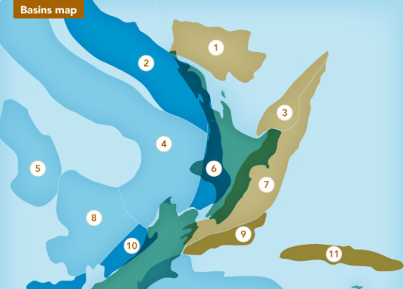
Aotearoa New Zealand has more than 20 sedimentary basins located both on land and offshore. Many of them are relatively young in geological terms - they began to form nearly 100 million years ago as the ancient supercontinent of Gondwana began to break up and form smaller landmasses.
Sedimentary basins have been important to New Zealand for economical and energy security reasons. All of New Zealand’s fossil fuels are found in sedimentary basins. Several of the smaller basins are mined for coal, while the Taranaki Basin contains significant reserves of oil and natural gas. As New Zealand and the world look to transition away from using fossil fuels for energy, sedimentary basins remain important for our energy future. They contain various minerals and elements that are needed to manufacture clean energy technology, such as electric vehicle batteries and solar energy systems.
Sedimentary basins in New Zealand are also helping scientists to understand and prepare for climate change. The Whanganui Basin holds a remarkable record of shallow-sea sediments from the last 2.5 million years when sea levels fluctuated frequently due to alternating warm and cold periods (glacial and interglacials). The rocks that are now uplifted can be studied in the river and coastal cliffs of the Manawatu-Whanganui region. The sea level ‘signals’ that scientists have interpreted from the rocks enable us to understand how much sea level rise we could expect as the Earth continues to warm.