Newly identified fault system off Gisborne sheds more light on Hikurangi subduction zone
A newly identified complex fault system north of Gisborne may shed new light on the risks of earthquakes and tsunami in the region, according to new research led by GNS Science.
The findings, reported in the Bulletin of the Seismological Society of America, suggest that distinctive marine terraces were caused by earthquakes on multiple offshore upper plate faults.
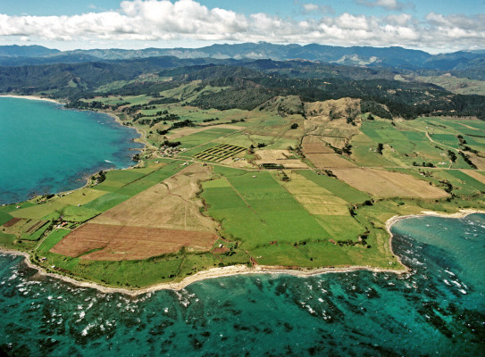
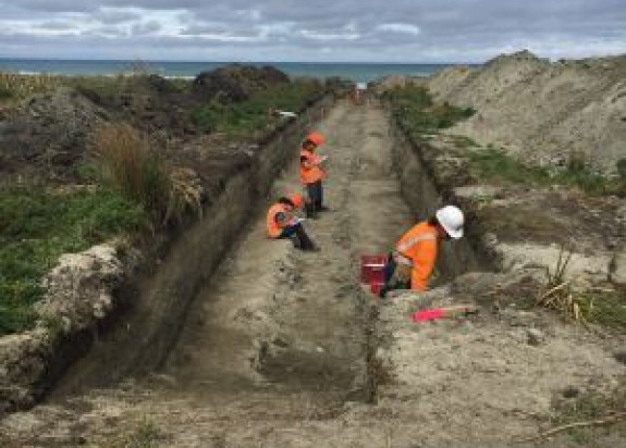
A team led by Dr Nicola Litchfield of GNS Science used radiocarbon and other methods to date the ages of marine terraces at two North Island sites, Puatai Beach and Pakarae River mouth.
Previously scientists thought the youngest terraces were created at the same time by a rupture in the Hikurangi subduction zone or a single-fault earthquake in the upper plate.
But radiocarbon dating of beach shells and layers of volcanic ash showed the uplift happened at different times.
“New research techniques allow us to build a high-resolution picture of where and how these uplifts occurred,” Dr Litchfield says.

We’re now confident that each terrace represents an individual quake – and the patterns of uplift allowed us to map new offshore faults in the region.
Dr Litchfield says the magnitude 7.8 Kaikoura earthquake in 2016 prompted seismologists to look closely at the mechanisms behind complex multiple-fault earthquakes.
She says this research will add to the growing understanding of the hazards posed to the East Coast by the Hikurangi subduction zone.
“Since the newly-identified faults are close to the coastline, this may mean short warning times for a tsunami.
“We need to learn more about these newly mapped offshore faults, how they might rupture together, and what they mean for the overall seismic hazard.
“This study is part of a huge work programme led by GNS Science’s Dr Laura Wallace, funded by a grant from the MBIE Endeavour Fund – which aims to unlock the secrets of the Hikurangi subduction zone.
“Communities along the East Coast can do their part by following advice from the National Emergency Management Agency, particularly the getready.govt.nz website.
Prepare your grab-and-go kits, practice your tsunami hikoi – and in the event of a long or strong earthquake, get gone to higher ground or inland without waiting for an official warning.