New generation science transforming earthquake monitoring and tsunami forecasting
Earthquakes and tsunami are a feature of life in our corner of the South Pacific, given Aotearoa New Zealand’s location on the collision zone of the Pacific and Australian tectonic plates.
With every event, scientists gather more data and learn more. This, combined with advances in technology, gives GNS Science more tools and techniques to provide better information to emergency response agencies and, ultimately, to keep us all safer.
After a large earthquake, time is of the essence. GNS Science' Rapid Characterisation of Earthquakes and Tsunami (RCET) Programme is developing methods to rapidly characterise large earthquakes, map their shaking, and forecast potential tsunami. This allows us to understand the likely impacts and damage more quickly.
Having accurate data in near real time will help emergency responders make better decisions about where to direct their response and what resources are needed, give more accurate information about when and where a tsunami might arrive, and how long the threat will last.
These events aren’t frequent, but their impact on life, the way we live, and on our economy can be catastrophic – so the more exact the information we have and the quicker it flows, the better.
Time-critical and bespoke large earthquake information
Size matters when it comes to assessing the impact of earthquakes.
We can think of small to medium earthquakes as happening at a ‘point on a map’ – the epicentre. As seismic waves travel through the earth and radiate out from the epicentre they typically lose energy. We can model this process, map the severity of shaking, and identify where damaging shaking may have occurred.
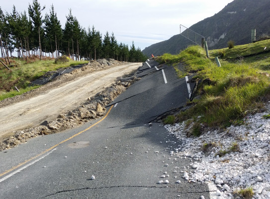
This doesn’t work so well for large earthquakes where the rupture starts at the epicentre, then extends along a fault (or multiple faults), sometimes for hundreds of kilometres. In this case, the rupture may ‘build up’ as it goes and release a large amount of energy far from where it began. Strong shaking could occur anywhere along the rupture and is unlikely to be evenly dispersed around the epicentre. Treating the earthquake as a ‘point on a map’ could result in misdirected response activity in the critical hours following an event.
The RCET Programme is developing a range of tools and techniques that use a combination of new data processing and modelling methods applicable to large earthquakes. Some of these tools are already running in near real-time to estimate the rupture, its size, direction of travel, and shaking. If a large earthquake occurs an expert team will interpret the results and work together to deliver enhanced rapid science directly to emergency management and to the public, on the GeoNet website(external link). The Shaking Layers tool will also be made openly available on the GeoNet website.
One key new feature being developed collaboratively by the GNS Science teams is Shaking Layers – maps of shaking intensity anywhere in New Zealand that also incorporate the latest earthquake science.
Together, the new tools and information have the potential to quickly contribute to a picture of the scale of damage, potential landslides, loss of life, and financial impact. With rapid, high-accuracy, and geographically explicit estimates of an earthquake’s shaking and impacts, scientists will be able to provide better advice to emergency response agencies to ensure the right resources are quickly sent to where they are most urgently required.
Improving the accuracy and speed of tsunami warnings in the Southwest Pacific
New Zealand’s geographical and geological place in the Pacific puts us at risk from many different tsunami sources following large earthquakes, some of which may arrive at our nearest coasts in less than an hour, giving little time for warnings and action.
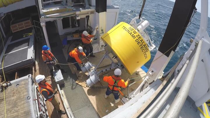
GNS’ GeoNet programme operates hundreds of motion sensors around the country that detect earthquake waves and give us a first ‘heads up’ long before the first tsunami waves arrive. A coastal network and an array of deep-ocean gauges monitor waves around New Zealand and the Southwest Pacific, warning experts of unusual ocean behaviour.
And now, RCET is introducing new processing techniques that will use this data to rapidly estimate the true size of an earthquake rupture offshore, and forecast its tsunami, making important information on the potential tsunami threat available faster to emergency response agencies. Having these forecasts earlier will mean that more targeted information can be provided about specific coastal locations, wave heights and timeframes.
The faster and more accurate advice will mean people in at-risk areas can be given much more timely information about when they need to evacuate and for how long, and will also give emergency responders far richer information to use in time-critical evacuation management.
Focus on Northland
Geographically, Northland is the best place in New Zealand to help us monitor “stealth tsunami” that can impact our coastlines within an hour, yet not produce strong ground shaking – and making New Zealand's “long or strong get gone” message less effective as a natural warning.
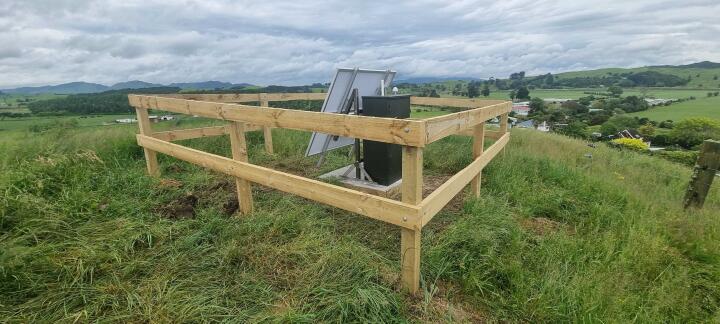
It is home to the newest seismometer array (a cluster of monitoring devices) hosted in partnership with Te Tai Tokerau. These strategically placed monitoring devices detect the first seismic waves reaching our shores, providing a first heads up indicating if, and when, a tsunami might be on its way. The array is managed by the GeoNet team, and the data is openly available on the GeoNet website.
This array helps GNS to track the evolution of really large earthquakes to the north of New Zealand, and estimate their true size, providing useful inputs to tsunami forecasts. The array also improves our ability to detect and catalogue small earthquakes in Northland. Small earthquakes tell us about future large earthquakes, and help scientists better understand the hazards posed by earthquakes in that region.
Improved information benefiting all New Zealanders and our Pacific neighbours
In the very near future, New Zealand’s hazard responders will receive faster, more accurate information about large earthquakes and tsunami, enabling better decisions and better outcomes for New Zealanders and our Southwest Pacific neighbours – thanks to GNS' new tools and techniques being delivered via the GNS RCET Programme.