New data on the large Whareongaonga landslide
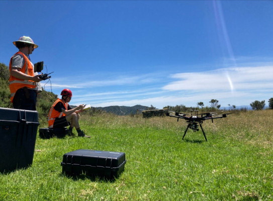
In late December 2021, some of the GNS Science Engineering Geology team used our new LiDAR (Light Detection and Ranging) drone to capture high resolution, topographic data of the landslides at Whareongaonga, south of Gisborne.
The landslide and others adjacent – caused by heavy rainfall - had undermined the already damaged Wairoa to Gisborne rail line and buried several wahi tapu sites, including a historic Ngāi Tāmanuhiri pā site, Māra kai (food gardens) and taunga ika (fishing grounds).
The new drone uses LiDAR, which is a remote sensing method that uses light in the form of a pulsed laser to measure distances to the Earth surface. It enables us to build a high resolution (1 m) 3D model of the ground surface.