Landslide map upgrade offers better data for safer land-use
To engineer safer neighbourhoods and enduring infrastructure on hilly landscapes prone to landslides, New Zealand needs robust landslide data to inform decisions on where and how we live.
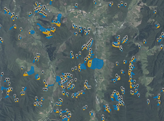
Earth Sciences New Zealand is doing its part by undertaking a major upgrade to the New Zealand Landslide Database (NZLD). It will increase the number of landslides held in the current inventory from 23,000 to more than 500,000. The upgrade also includes landslide features with more consistent attributes – such as the triggering event, size and damage – to provide users with more information than ever to inform land use decisions.
The newly upgraded NZLD is viewable on a webmap that can be accessed by anyone looking for previously mapped landslides, primarily those triggered by significant rainfall and earthquake events.
People wanting more technical information can register for free to access more comprehensive features such as landslide source areas, debris trails, table views and multiple ways to explore and query the database.
Why New Zealand needs landslide data
Knowing where and when landslides have occurred in the past offers some insight into where they may occur in the future.
The NZLD is a world-class landslide resource that is accessible and usable by both curious individuals and more technical users for multiple needs – such as planning new developments, protecting assets, undertaking risk analyses and assessments and emergency management planning.
With climate change increasing the frequency of rain-induced landslides coupled with the ever present threat of earthquake-induced landslides, a comprehensive and quality-assured landslide database provides the crucial underpinning data needed to develop the landslide hazard and risk models that will make New Zealand safer.
These models can flag areas at risk of landslides for further investigation through to providing the basis for forecasts that estimate how existing or future developments will likely be impacted by rainfall or earthquake-induced landslides.
Incorporating robust science advice into decision-making will make New Zealand a more resilient nation and provide people, government and industry with greater knowledge to help them adapt to climate change and invest in economic growth, rather than paying to rebuild assets again and again.
At an individual level, this information can help improve awareness about landslide hazards, increase understanding of how landslide events may impact people, homes, and communities, and provide data to support informed decision making to build resilience.
What is happening
Earth Sciences NZ has previously mapped thousands of landslides, primarily triggered by high rainfall and significant earthquake events – such as Cyclone Gabrielle and the 2016 Kaikōura earthquake. These datasets are being compiled and added into the newly upgraded NZLD, which was initially released in 2017 by (then) GNS Science.
The increased landslide inventory will be released in stages. The initial launch will contain more than 100,000 landslides with hundreds of thousands more landslides added to the webmap over the next year.
The datasets have been quality-checked and meet the FAIR data principles.(external link)
While some of the datasets are currently available through regional and local council, the fully redeveloped webmap makes this information available in a single publicly accessible location accessed on a visually interactive platform.
The data can be accessed for non-commercial use in two ways.
- Public non-registered users can view landslide points only.
- Public registered users can view all landslide feature classes (including polygons and tables). Registration is free.
Where available, the attributes will include useful information such as landslide type, trigger, event, size and a quality ranking.
Unmapped areas can still be at risk
It’s important to note that the database doesn’t include every landslide that’s ever occurred in New Zealand. Areas without mapped landslides may still be at risk of landslides and require further investigation.
Future plans for premium users
Earth Sciences NZ has a long history of delivering outstanding public good science for New Zealand and the advancement of science globally, delivered by world-class experts. The comprehensive and trusted data collected over many years holds significant value in supporting development and innovation that can help grow the economy.
In exciting news, Earth Sciences NZ is exploring options to package this data and related products for commercial use and reinvest the proceeds back into delivering great science for New Zealand.
More to come later.
-
NZLD leads
Regine Morgenstern – technical lead
Brenda Rosser – science lead
Chris Massey – landslide hazard lead -
Funding
The New Zealand Landslide Database update, data curation and redevelopment of the webmap has been funded by GeoNet. The datasets viewable in the webmap were generated from multiple sources, which were funded by various projects, all of which are acknowledged in the references associated with a given dataset.