Hunga (Tonga) voyage: Surveying begins
Research and surveying of the Hunga volcano (Tonga) is well underway onboard the R/V Tangaroa and once again, VUW Associate Professor Simon Lamb gives us a detailed summary of life on the ship and the science being performed.
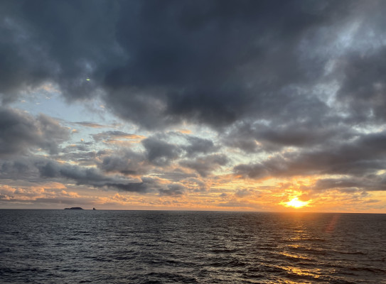
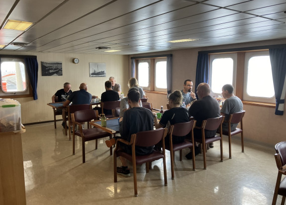
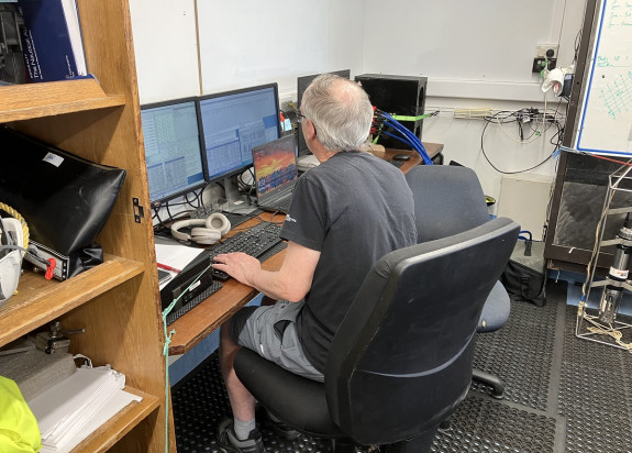
Since my last report, we have had fine weather with light winds, and on some mornings the sea surface is so smooth that it has a glassy sheen. The humidity is over 80%, with an air temperature in the high 20s, and the ocean is as warm as a tepid bath. Everybody has settled into their night and day shift routines, hunched in front of computer screens in the various instrument rooms or ship’s library. It is only at mealtimes that one gets a feel for how many scientists are onboard. There is also the daily ‘toolbox’ meeting on the bridge, when the Captain or the ship’s Officer of the Watch briefs us on safety and we can discuss the upcoming scientific experiments. We have all come out negative on the day-7 COVID test, making the ship a COVID-free bubble. The food continues to be delicious, with a wide variety of menus including dangerously rich cakes and puddings.
Data acquisition is relentless, and we have been ‘mowing the lawn’ – or clocking up ‘runs’ on the scoreboard, as Cornel, our voyage leader, likes to say – sailing back and forth in a series of parallel lines over Hunga volcano, taking geophysical measurements. The ship creeps along at about 5 knots, while the multibeam instrument continually generates sound waves and then listens for their return. This way, we have sailed about 1000 km, all the time making a detailed map of the sea floor, so that we now know the shape of the Hunga submarine volcano to the nearest few metres. We also have a new map of the magnetic and gravity anomalies over the volcano. Fabio Caratori Tontini (University of Genova) is using this information to model the magnetism and density of the rocks in the volcano, potentially revealing both the magma chamber from which the vast ash cloud erupted in 2022 and the location of hydrothermal vents.
At the surface, all that can be seen of the volcano are the remnant stubs of the two islands – Hunga Tonga and Hunga Ha’apai – on the crater rim. These islands were profoundly reshaped by the 2022 eruption, and what is left of Hunga Tonga appears today as a shark’s fin sticking out of the water, a few tens of metres across, whereas Hunga Ha’apai looks like a stranded whale several hundred metres long. Our nearest approach to these islands was about 300 metres, giving us spectacular views of the layers of volcanic rocks above sea level – the first time we got this close, the foredeck was crowded with crew and scientists taking photographs and speculating on the type of lava and ash erupted from the volcano. The birds probably know better, because they have made the islands their home – frigate birds, white-tailed tropicbirds, boobies, grey faced petrels, and many other species.
Friday 24th May was a special day, as the geophysical mapping of the volcano was completed in the morning, and the seismic equipment could now be deployed. This involved letting out a 600 m long line of seismic ‘microphones’ in a long streamer from the back of the ship. In addition, an airgun was put over the side which created an underwater ‘boom’ every few seconds, sending up a stream of bubbles. It could be clearly heard through the ship’s hull. Importantly, the sound waves also penetrate the sea floor up to a kilometre or so, bouncing back to the surface whenever they encounter geological reflectors. The time taken for these ‘echoes’ to be picked up by the receivers in the streamer is used to construct a picture of the layering in the bedrock, so that we can begin to look right inside the volcano. Over the following days the seismic gear was towed along a network of lines across the volcano. However, disaster struck on the second day when the compressor for the airgun malfunctioned, making loud erratic noises. Fortunately, the necessary spare part was on board, and after a few hours of repair work by the ship’s crew, the compressor and airgun were back to their normal regular selves.
There was a feeling of excitement when the data for the first seismic lines appeared on the computer screens in the control room. Dan Barker (GNS) and Stuart Henrys (GNS) were hard at work processing the data, converting the faint echoes of the airgun explosions into a geological section through the buried layers of rock, building up an image of the foundations of the Hunga volcano. We can see thick layers of ash on the flanks of the volcano, suggesting a long history of big volcanic eruptions. Layers are also visible at the bottom of the deep crater, possibly consisting of ash that fell back down after the 2022 eruption.
Next week, the scientists will start trying to get their hands on the rocks on the seabed by scooping them up with an iron dredge on the end of a long cable. They will also begin investigating the hydrothermal vents where hot water is gushing out of the crater of the volcano.