GNS Science Te Pū Ao Joins the AWS Open Data Sponsorship Program to Better Prepare for Natural Disasters
For the first time, GeoNet’s entire archive is available to download.
GNS Science Te Pū Ao is the first organisation in Aotearoa New Zealand to release their research datasets on the Registry of Open Data on Amazon Web Services.
Since 2010, natural disasters have impacted thousands of citizens and cost New Zealand close to $27 billion(external link) in insured losses. Freely and easily accessible data on earthquakes, tsunamis, and other natural hazards can help accelerate global research. It also enables governments and communities to better understand and prepare for natural hazards, reduce risks to prevent disasters when events occur, and even forecast future events.
GNS Science Te Pū Ao (GNS Science) and its GeoNet(external link) programme, New Zealand’s leading geoscience and data provider, is the country’s first organisation to use the Amazon Web Services (AWS) Open Data Sponsorship Program(external link) to achieve this. This means that for the first time, GeoNet’s entire archive is available to download. This program covers the cost of storage for publicly available cloud datasets to make them accessible for analysis on AWS and encourages the development of communities that can benefit from shared data.
The GeoNet programme is a geohazards monitoring service that produces data that captures earthquakes, volcanic activity, large landslides, and tsunamis. GeoNet is run by GNS Science with primary funding from Toka Tū Ake EQC(external link) (formerly the Earthquake Commission). GeoNet also collects data between geohazard events such as ambient noise tomography, which records seismic noise.
Making data freely available to researchers has been an underpinning philosophy of the GeoNet programme since its inception in 2001. Now, its datasets are faster to download, especially for large dataset requests, and more accessible to researchers, learning institutions, and the general public globally via the Registry of Open Data on AWS(external link), which exists to help people discover and share data.
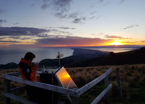
Recording data on the ground to safeguard people
By using the AWS Open Data Sponsorship Program, GeoNet is able to eliminate unexpected costs associated with users downloading large datasets, while providing end-users with free and open access to its entire archive. This data can be used to leverage machine learning services to improve natural disaster monitoring that benefit the broader global community.
For example, GeoNet data is used as an input to hazard models that inform New Zealand engineering guidance, which means structural engineers can better place critical infrastructure like power plants based on the probability of an earthquake, landslide, or tsunami. The insurance industry uses hazard and risk models, with input from GeoNet data, to better calculate risks of disaster-prone areas so that actuaries can better estimate the financial impact of uncertainty for insurance policies and help clients minimise risk.
Machine Learning is opening up new research avenues all over the world. Enabling access to our large and fundamental geohazard datasets and helping users bring their compute to the cloud is a key step forward because of quicker and easier access to information.
"Being part of the AWS Open Data Sponsorship Program is a great opportunity for us to step boldly forward, supporting research that could have wide ranging dividends, like training algorithms to detect currently unknown trends that could potentially predict future events,” said Dr Jonathan Hanson, GeoNet Data Manager, GNS Science.
Dr Calum Chamberlain, a geophysics lecturer from Te Herenga Waka—Victoria University of Wellington(external link) said, “GeoNet's high-quality seismic data is at the heart of research projects around the world. By making their data open-access on one of the most broadly adopted cloud computing platforms, AWS, GeoNet will open the door to researchers to apply cutting-edge methods to long-duration seismic datasets to understand earthquake processes for the benefit of New Zealand. Personally, having cloud access to GeoNet's seismic data has helped me work on problems of long-term earthquake interaction and aftershock forecasting.”

Huge demand for data and knowledge
Since its inception, GeoNet has accumulated over 100TB of data collected by its seismic sensors, coastal sea level gauges, geodetic instruments, acoustic sensors, tsunami sensors, cameras, and environmental sensors to help us understand our planet. This is the equivalent to 4.5 years of HD video, and the data is growing by 13TB, or as much as 6,500 hours of HD video, annually. More than 100TB of GeoNet’s data has been accessed by end-users around the world in the last 12 months, illustrating the huge demand for knowledge. Information about the GeoNet public dataset can be accessed by researchers, students, and education institutions to discover and share datasets to enable global collaboration and accelerate research.
Prior to joining the AWS Open Data Sponsorship Program, GeoNet manually handled requests for large amounts of data from researchers, filtering and exporting datasets to an external access point which researchers collected. This process was slow and labour-intensive, previously taking a number of weeks, compared to instant access that users now enjoy. It was not previously possible for users to download the entire GeoNet seismic archive. Moving to the AWS Open Data Sponsorship Program allowed GeoNet to offer instant access to large datasets and the entire archive at no cost.
Toka Tū Ake EQC Manager Research Dr Natalie Balfour echoes the importance of having open access to hazards data and information and getting the data to the people who can use it.
“New Zealand’s data is of great value for the science community, universities, engineers, and so many others worldwide. We’re thrilled that AWS supports our commitment to sharing data and sponsoring GeoNet in this venture. To have this data freely available on AWS will drive research globally, especially in areas like machine learning, and help us to better prepare for natural disasters,” said Dr Balfour.
Tim Dacombe-Bird, Country Manager for Public Sector, AWS New Zealand, said “Datasets are exponentially increasing and require technology systems that can easily scale to provide fast, valuable, and actionable insights into the data. It’s great to see organisations like GNS leveraging the cloud and making their valuable data freely available to researchers and the public on the AWS Open Data Sponsorship Program, which could minimise the impact of natural disasters in future, and help Aotearoa and the rest of the world be a safer place. The cloud offers many more possibilities to address real-world challenges, and as our engagement with the New Zealand research community grows, we hope that other organisations will see value in joining the AWS Open Data Sponsorship Program.”
The GeoNet program is a collaboration between GNS Science Te Pū Ao, Toka Tū Ake EQC, Toitū Te Whenua Land Information New Zealand (LINZ), Hīkina Whakatutuki Ministry of Building, Innovation and Employment (MBIE) and Te Rākau Whakamarumaru National Emergency Management Agency (NEMA).