
Vanuatu volcano monitoring systemEstablishing a modern volcanic monitoring system in Vanuatu
A six-year, MFAT-funded programme led by GNS Science to ensure Vanuatu is better able to mitigate the adverse economic effects of a range of geological hazards, with a focus on volcanic eruptions.
Overview
Vanuatu’s location on the Pacific Ring of Fire and wide distribution of small islands makes it particularly vulnerable to a range of geological hazards, including volcanic eruptions, earthquakes, and tsunami. Vanuatu's economy, which is largely based on agriculture and tourism, can be severely affected by these hazards.
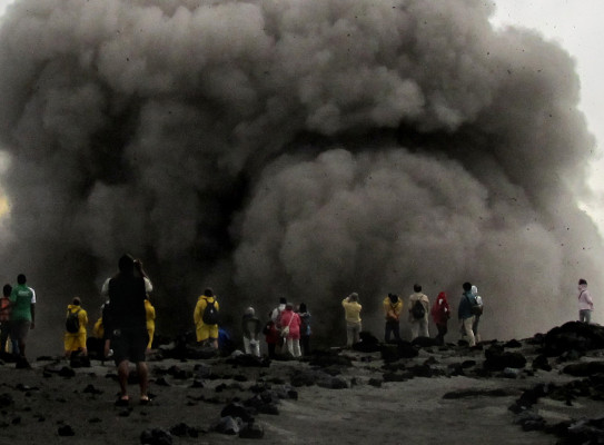
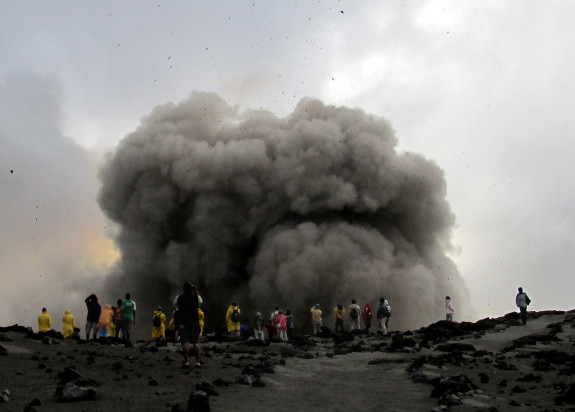
Ten volcanoes have erupted in Vanuatu in historic times including Gaua in 2009-10. In 2010, ash from Yasur (Tanna) volcano disrupted airline flights from New Caledonia to Vanuatu. In February 2015, an eruption occurred from a new vent on Ambrym, but fortunately had limited impact on residents. In September 2017, Ambae entered a period of strong eruptive activity which lasted a year. The impacts on the island’s residents were severe, with the whole island (population approximately 11,000) being evacuated.
The project aimed to
- support the Vanuatu government to respond more effectively to local geological hazards and reduce some of their adverse effects
- help Vanuatu to take a leading role in regional monitoring of geological hazards and provision of information
To achieve these objectives, we
- worked with Vanuatu Meteorology and Geohazards Division (VMGD) to provide timely information on geological hazards to the Vanuatu government and local responding agencies, held courses and exercises to inform stakeholders of local hazards and test capabilities of responding agencies, and enable better evaluation of volcanic activity
The project
The 2009-10 eruptions of Gaua highlighted how decisions were being made with only limited monitoring information about the volcano and its likely impacts. A 10-year Strategic Development Plan 2010-2019 outlined how Vanuatu needed to develop the necessary capabilities to produce a natural hazards monitoring and outreach programme capable of providing prompt, reliable and effective advice on volcanic eruptions, earthquakes, and tsunami. That plan formed the basis of this project, which was implemented with the Vanuatu Meteorology and Geohazards Department (VMGD) as the key partner agency.
GNS Science assisted VMGD to provide timely information on geological hazards to their government and local responding agencies, to be recognised as an authoritative source of education and outreach material, to hold courses and exercises to inform stakeholders of hazards and test capabilities of responding agencies, and to set an example for small developing countries.
Outcome
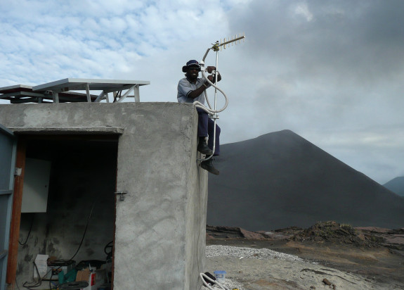
One significant outcome of the project was supporting VMGD to develop an extensive earthquake monitoring network (including sites focussed on volcano monitoring) and associated analysis systems. They also operate several automatic cameras that take regular photographs of volcanoes. These capabilities, coupled with skills developed in making visual observations of volcanoes and volcanic activity, form the framework on which all subsequent volcano assessment and provision of advice are based.
During the 2017-18 Ambae eruption, VMGD performed exceptionally well in extremely difficult circumstances. The benefits of this project, in terms of basic volcano monitoring, hazard mapping and community and stakeholder outreach, were repeatedly demonstrated. The Vanuatu government relied extensively on advice from VMGD and the National Disaster Management Office (NDMO) when making decisions and could trust that the advice was accurate and timely.
Research programme details
Collaborators: Vanuatu Meteorology and Geohazards Department (VMGD)
Duration
2012–2019
Funding platform
The New Zealand Aid Programme
Status
Past
Leader
Dr. Steven Sherburn
Funder
Ministry of Foreign Affairs and Trade (MFAT)