It's Our Fault

223214 Kyle Bland GNS Science

By working together with science, communities, local and central governments, we help prepare the Wellington community for getting through major earthquakes.

Overview

Since 2006, over 50 scientists from GNS Science, research institutes and universities across New Zealand have contributed to the success of It’s Our Fault.

The project aims to

  • study the forces that shape the Wellington region
  • work with communities, iwi, councils and government to help our region get through a major disaster

To achieve these objectives, we

  • provide advice for planning and policy
  • model regional risks and hazards
  • draw on national and global earthquake research to inform regional planning and understanding of our hazards

The project

It’s Wellington’s fault

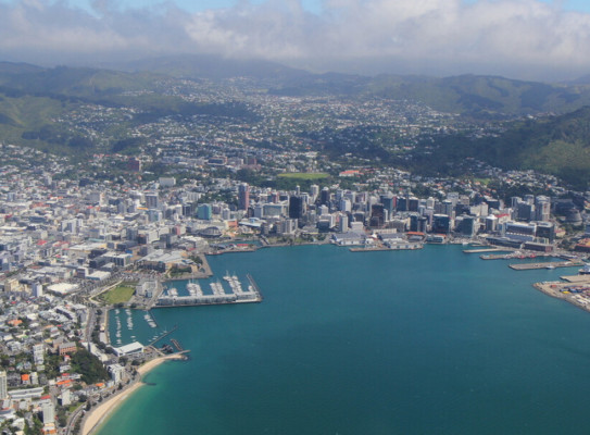
Wellington lies on the boundary between the Australian Plate and the Pacific Plate. Underneath Wellington, these plates are currently locked together, and abrupt movement along their boundary could produce a powerful earthquake and tsunami. The high population of the area makes it one of New Zealand’s highest-risk geological hazards

The Wellington region’s unique and beautiful geography was created by major fault lines running through the landscape, including the Wellington Fault, the most active fault in the region. The It’s Our Fault programme studies the awesome forces that shape our region and looks at how we prepare for and recover from earthquakes. Our programme is rooted in research excellence, working with communities, and learning from recent earthquakes.

Planning, modelling and understanding our hazards

Back in 2006, It’s Our Fault supported Wellington to become a more resilient city through a comprehensive study of the likelihood of large Wellington earthquakes and their effects and impacts on humans and the built environment. Today, the programme is supporting the region's growing resilience with targeted science and policy research projects in line with community and local government needs.

The programme is currently focusing on five key areas:

1: Planning and Policy

We apply It’s Our Fault and GNS Science’s research to planning and policy frameworks across the Wellington Region through workshops and the targeted sharing of outputs. The project also undertakes research in response to planning and policy issues identified by researchers and practitioners.

2: Ground Deformation

This project will exploit high-resolution (3 x 14 m) InSARdata covering the Wellington region following the 2016 Kaikōura earthquake to identify anomalous areas of ground movement, quantify the rate and temporal evolution, and classify the likely processes causing the movement. 

3: Tsunami Hazard and Vulnerability

We identify and quantify the challenges associated with evacuation in the event of local-source tsunami, i.e. those generated on nearby faults with short travel times to the Greater Wellington region. The investigations included the identification of local fault sources posing tsunami hazards, estimates of tsunami travel times from the identified local fault sources, and evacuation time modelling.

4: Hikurangi Subduction Zone Hazard

We look for evidence of past Hikurangi subduction earthquakes in the Wellington Region through dating and surveying uplifted marine terraces and subsiding lagoons.  We are also creating physics-based models of deformation in plausible subduction interface earthquakes. These models will allow estimation of seafloor deformation (necessary for tsunami models) and ground shaking for a range of possible future earthquakes.

5: Active Fault Paleoseismology

Several new likely active faults have recently been identified near towns in the Wairarapa Valley. These were identified from their expression in the landscape using Light Detecting and Ranging (LiDAR) data. Little is known about these faults and because of this, and their locations, they warrant further study to: (1) confirm whether they are active faults; and (2) if they are faults, what paleoseismic investigations could be undertaken to determine their recurrence interval and slip rate.

Researching Raised Beaches for 'It's Our Fault' – A project to study past earthquakes along an uplifted coastline in Palliser Bay near to Wellington, New Zealand's capital city. transcript

So i'm Nicola Litchfield. I'm a paleo seismologist at GNS. And so we're here with the team of us studying past earthquakes, so we're down near the beach in Palace Bay which is quite a wild rocky coastline.

So this is an area that has a series of uplifted beach ridges that we think probably uplifted an individual earthquake similar to what happened in the Kaikoura earthquake in 2016.

So the different terrace levels beach ridge levels are picked out by the vegetation there's darker vegetation and the
hollows where it's a bit wetter. The ridges themselves are the beaches but then every so often there's an earthquake
that lifts them up out of the sea and once that happens a new one forms further out, so we have this old one preserved.

So we've had a digger here today to dig a series of pits on each of these beach ridges and the purpose of that is to find shells for dating in here for dating the past earthquakes.

People might remember after the kaikoura earthquake in 2016 that the coast was uplifted and there was lots of stranded Paua and crayfish and shellfish that had died in the earthquake and this is the same thing we're seeing here.

That's great here's an example we found some of these shells in one of these pits and it's going to be really useful
to date the timing of when this ridge was uplifted and the timing of a past earthquake.

The purpose of this work is to figure out the size timing and frequency of past earthquakes by comparing what we find here with other sites and this cook straight area that will tell us what faults have caused these earthquakes and
we're pretty sure that these faults are going to be submarine faults so they will cause tsunami.

This is part of the "it's our fault" program which is a program designed to increase wellington's resilience to natural hazards particularly earthquakes.

So this is a component that's focusing on figuring out the earthquakes on past faults but in particular the hikurangi
subduction zone.

So the hikurangi subduction zone is where the pacific plate is diving down beneath the australian plate along this edge of the north island.

Okay so we've just dug this pit. It's freshly dug we haven't started studying it yet but what I think I'm standing in
here is beach deposits. These sandy gravels here, and then it's overlaid by some younger more silty deposits which have come off the hill slopes later.

So although these earthquakes have happened a long time in the past they will happen again in the future so it's really important to understand how big, how often, where they're coming from – so that we can be better prepared for future earthquakes and tsunami.

Researching Raised Beaches for 'It's Our Fault'

A project to study past earthquakes along an uplifted coastline in Palliser Bay near to Wellington, New Zealand's capital city.

The faults of others

We are part of the Plate Boundary Network. The network aims to strengthen the relationships between natural hazard programmes actively involved in sharing information on natural hazard and impact science and carrying out public education and engagement in Aotearoa New Zealand.

Litchfield Nicola 2519

Nicola Litchfield Earthquake Geologist/Tectonic Geomorphologist

Nicola is a senior earthquake geologist in the paleoseismology team, based at Avalon, Lower Hutt. She studies past earthquakes and their impacts on the landscape, which in turn informs seismic hazard and risk. Research interests include understanding the formation of marine terraces and their use to record earthquakes along the Hikurangi Subduction Zone, understanding the interactions between upper plate faults and the Hikurangi subduction interface, and kinematics and behaviour of active faults in a variety of geological settings. Nicola is the science leader of the It’s Our Fault programme and is a key member of the NZ Community Fault Model and National Seismic Hazard Model projects.

View Bio Contact Me
Research project details

Collaborators: Urban Edge Planning, Out There Learning

Duration

2006 – present

Funding platform

N/A

Status

Current

Programme leader

Nicola Litchfield, GNS Science

Funder

EQC, Wellington City Council, Wellington Region Emergency Management Office

Find more content related to:

GNS Science topics

By continuing with this download you agree to abide by the rules laid out in the Terms and conditions/Terms of use listed on this page.

If there are no specific Terms and conditions/Terms of use listed then please refer to our Copyright and Disclaimer page and Privacy Policy page

Download