
Future-proofing Groundwater SystemsBuffering climate change effects on water availability and quality
Earth Sciences New Zealand is building our understanding of the inner workings of Aotearoa’s groundwater systems, mapping their vulnerability to future climate and land-use pressures, and developing adaptive planning approaches for resilient groundwater management.
The availability and quality of freshwater in Aotearoa New Zealand is declining, and climate change will bring significant additional pressures to our freshwater resources.
Overview
Groundwater sustains lives and livelihoods. It replenishes the flows of Aotearoa’s rivers and streams, makes up much of our drinking water supply, and accounts for over 80% of water used for irrigation in our horticulture and agriculture industries. Yet we currently have few tools to effectively manage it.
Aotearoa’s groundwater is declining in quantity and quality at the same time as demand for this vital resource increases — a problem that is projected to worsen due to climate change. To protect our groundwater resources and adapt to changes in climate and land use, we urgently need to better understand groundwater systems and develop new strategies to manage and protect them.
The Future-proofing Groundwater Systems research programme brings together groundwater modellers, isotope hydrologists, complex-system and policy scientists, researchers, and mātauranga Māori experts. This multidisciplinary team will develop an agile groundwater management framework based on an enhanced understanding of:
- Aquifer structure and storage parameters
- Groundwater source, age, recharge, and flow rates
- Nitrate assimilation capacity at catchment levels
Research aims
- Identify where groundwater systems can buffer drought impacts.
- Identify where groundwater is most able to buffer nitrate load.
- Simulate the effectiveness of management interventions at decision-relevant scales.
- Deliver simulator-based data-processing supporting adaptation decisions that characterise trade-offs and synergies, to define optimal management pathways.
- Implement dynamic adaption pathways for freshwater resources with multiple highly contested goals and complex physical environments.
-
Analysing the fingerprint of isotopes formed by cosmic rays to understand aquifer storage capacity and drought resilience
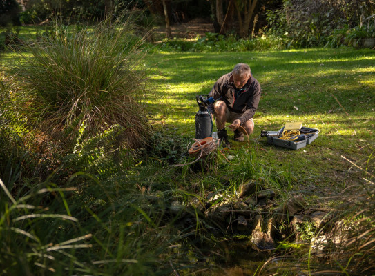
Researchers will use an innovative tracer technique to identify where the groundwater has come from and how long it has been underground. One of the tracers used is Tritium, a radioactive isotope of hydrogen produced in the atmosphere by nuclear reactions between cosmic rays and atmospheric gases. After Tritium combines with oxygen forming water molecules, it becomes part of the water cycle. As part of the rainwater, it enters groundwater systems and there it can be used as a 'radioactive clock'. When the rainwater infiltrates into the ground and becomes separated from the atmosphere, the clock starts to tick, with the Tritium concentration decreasing. This decrease can be measured and the age of the groundwater calculated.
The groundwater age data is used to provide information about the dynamics of groundwater flow, storage volumes of the aquifer, along with data from airborne electromagnetic surveying.
-
Identifying aquifer resilience to nitrate contamination
In a world-first, the team will measure groundwater denitrification at the catchment scale, using Earth Science New Zealand’s new state-of-the-art noble gas facility. Nitrate (NO3) is a chemical compound that occurs naturally, but the use of fertilisers and waste from animals adds to the amount of nitrate in the environment. When there is too much nitrate it can leach from the soil and contaminate our groundwater and surface water.
Microbial denitrification is a naturally occurring process, which under the right conditions can reduce nitrate (NO3) contamination in groundwater into inert harmless N2 gas. This ‘excess-nitrogen’ accumulates in the groundwater along its flow path. The amount of excess-nitrogen can be measured at springs or a wells where the groundwater discharges. Noble gas analysis allows the team to calculate the amount of ‘intrinsic’ nitrogen in the groundwater (atmospheric N2 that has been dissolved in rainwater and infiltrated the groundwater system) to then quantify how much denitrification has occurred in the groundwater system.
Through this improved understanding of where denitrification is taking place, and the conditions under which denitrification occurs, the programme will identify strategies to enhance mitigation of excess nitrate loads.
-
Simulating freshwater response to climate and land-use change
A national groundwater model will be extended to extract information from available and new data, including groundwater isotope and geophysical data, to understand how groundwater vulnerability to land use and climate change impacts vary spatially.
Model simulation outputs will show how water availability and water demand relationships vary across New Zealand currently, and how they will change given climate projections. This will support the exploration of climate change implications for freshwater availability for communities, the environment and the economy.
Simulation outputs will also map where land use presents a higher and a lower risk of nitrate contamination of freshwater systems. This will harness the information from the new noble gas analyses, to map where denitrification is occurring. This will support explorations of how changing land use at a location would increase or decrease impacts on freshwater.
-
Innovative modelling to guide adaptive management strategies
Researchers will develop tools to guide adaptive management decision making processes for communities. These tools are designed to be used iteratively, in contexts where there is significant uncertainty, and where decision relevant information is increasing over time as early warning (sentinel) monitoring data is collected.
These modelling tools will be designed to be computationally efficient, and able to navigate water allocation and land use decision trade-offs and synergies across a range of values and aspirations in a community. They will be capable of identifying the most reliable early warning monitoring systems, which will be used to determine whether a change to the adaptation management pathway is required. The tools will rapidly process new monitoring data as soon as it becomes available, to assess if freshwater responses to management are as expected, or whether the management pathway must be reconsidered.
-
Developing adaptation pathways for freshwater
Adaptation pathways is a flexible, long-term approach to managing climate-related risks and opportunities. It involves identifying different actions that can be taken over time in response to changing environmental conditions and uncertainty. Pathways planning helps communities and decision-makers stay flexible and avoid being locked into plans that may no longer work.
The team will work alongside iwi and hapū in Hawke’s Bay and Northland, to explore and understand their values, aspirations, economic drivers, and decision-making processes.
They will work together to co-design adaptation pathways to help maintain and enhance groundwater resources, combining new knowledge about groundwater resources, with place-based insights, and mātauranga Māori. These plans will provide practical, long-term guidance to enhance drought resilience and manage nitrate loads in freshwater systems.
The case study adaptation pathways will be designed so they can be applied more widely, and the findings will be shared through stakeholder engagement, public outreach, workshops, and hui across Aotearoa.

Uwe Morgenstern Principal and Lead Scientist, Isotope and Tritium Lab
View BioPresent research/professional speciality: Since 1998, Dr Morgenstern has led the Isotope Hydrology team and managed the Water Dating Laboratory at GNS Science. His scientific expertise centres on the use of isotopic methods, such as tritium and 32Si, for determination of the age of water, ice, and sediments. A recent international assessment conducted by the IAEA has shown that, under Dr. Morgensterns management, the GNS Science Water Dating Lab has become the worlds most accurate tritium analytical facility (by a large margin). The information derived from the age measurements is crucial for reconstruction of past global climate and for management of groundwater and surface water resources. Research leadership: New Zealand Ice Core Programme GNS Science Hydrogeology Core Programme
Contact MeCollaborators
The project is led by Earth Sciences New Zealand, with collaborators Lincoln Agritech, the British Geological Survey, Watermark Numerical Computing (Australia), Intera (USA), Deltares (Netherlands), University of Adelaide (Australia), NIWA, Aqualinc, Land Water People, Scarlatti, Te Herenga Waka – Victoria University of Wellington, and the University of Victoria (Canada).
Duration
2024 - 2029
Programme Leaders
Catherine Moore and Uwe Morgenstern
Funder
This research programme is funded $10,407,101 through the Ministry of Business Innovation and Employment (MBIE) Endeavour Fund.