
Auckland's Paleotsunami
This project reviewed and analysed decades of research into tsunami events that took place in the Tāmaki Makaurau Auckland area hundreds to thousands of years ago.
Overview
The Tāmaki Makaurau Auckland’s Paleotsunami project was conducted by GNS Science with funding from the Natural Hazards Commission Toka Tū Ake.
The project aimed to
- provide a tsunami record over a time span of thousands of years in the Auckland region to better understand the risk that tsunami poses to the region
To achieve these objectives, we
- reviewed existing paleotsunami information
- selected field study sites with the aim of gathering data to strengthen existing paleotsunami records and to obtain evidence from new sites
The project
Auckland’s vulnerability to tsunami
Understanding tsunami hazard and risk in the Tāmaki Makaurau Auckland region is important due to the density of coastal development and number of people living close to the coastline. Auckland contains areas of low elevation that would be vulnerable to inundation from large tsunamis. Tsunami models suggest that parts of the eastern coastline of the Auckland region could be exposed to tsunamis, however large tsunamis have not been witnessed in the ∼180-year historic period.
Given the relatively short historic record, most information on the likely frequency and size of a tsunami in this region comes from probabilistic tsunami hazard models. These models are based on estimates of the likely size, location and recurrence of earthquakes on selected seismic sources.
Paleotsunami records provide a bridge between the historic records of tsunami impacts and geophysical modelling. When probabilistic models are consistent with paleotsunami data, we can have increased confidence that the tsunami hazard models – which underpin tsunami evacuation zone mapping – are reliable.
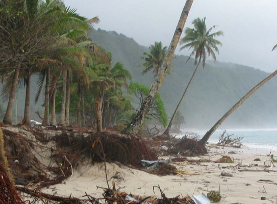
Paleotsunami clues
In this project, we reviewed all known paleotsunami information for the Auckland region. We used two databases, the New Zealand Historical Tsunami Database compiled by GNS and the New Zealand Paleotsunami Database compiled by NIWA, to create a well-rounded view of historic and pre-historic tsunami in the Auckland area.
We added to this body of knowledge by contributing new field observations from several locations. The details of the locations we surveyed can be found in this journal article(external link).
Tsunami Deposits Demonstration
A simple tsunami wave tank demonstration shows how a tsunami can create recognisable deposits in a coastal area.
Results and Application
Historic records showed that 30 relatively minor tsunamis had been observed in the region over the past 150 years. From our review of prehistoric surges from 18 sites, we concluded that just three of them bore convincing signs of inundation.
While there is little evidence of large tsunami, it doesn’t mean they didn’t occur. Also, the minor tsunamis in the historic and prehistoric past would likely have bigger impacts today given Auckland’s level of development.
The results from this research can be used to calibrate tsunami hazard modelling. We can also use of paleotsunami data is to better understand the earthquake behaviour of the Kermadec subduction zone.
-
Publications
This was the main output of the project:
Kate Clark & Regine Morgenstern (2021) The paleotsunami record of the Auckland region and implications for understanding tsunami hazards, New Zealand Journal of Geology and Geophysics, DOI: 10.1080/00288306.2021.1969956
Research programme details
Duration
2016 – 2020
Funding platform
Natural Hazards Commission Toka Tū Ake Biennial Fund
Status
Past
Programme leader
Kate Clark, GNS Science
Funder
The Natural Hazards Commission Toka Tū Ake