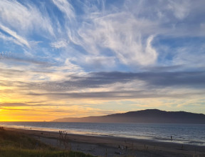
When westerly winds run hot and cold
Aotearoa New Zealand’s westerly winds are more important than you might realise.
They sweep over our land, setting the background conditions for our weather and climate. They connect us to both sub-tropical and sub-Antarctic regions.
The most important winds at mid-latitudes
North-westerlies bring warmer, more humid conditions from lower, sub-tropical latitudes. South-westerlies bring more cold, rainy days because most of the air is coming from cold, sub-Antarctic regions. These variations happen daily, seasonally and on longer, geological scales of millennia.
GNS scientists want to learn more about the variability of this system and how it affects rain and snowfall and storminess patterns. This has taken our research into lakes, the Southern Alps, Antarctica, modelling, wave climate and wind patterns going back to the Pliocene, and sediment cores from the Southern Ocean, Tasman Sea and Southwest Pacific.
The common thread
Finding out more about westerlies is like two sides of the same coin. On one side, no single research project will tell us everything we need to know. On the other side, westerlies are literally connected with our research from the Antarctic, up through the Southern Ocean, across New Zealand and out into the Tasman Sea and Southwest Pacific.
-
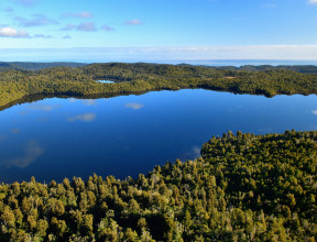
The Lake Ohau Climate History (LOCH) project
The Lake Ohau Climate History (LOCH) project drilled an exceptionally high-resolution 150m sediment core from Lake Ohau, close to the Southern Alps. This core has delivered a supermarket of geological data dating back 17,000 years to when the last ice age ended, giving us a long-term benchmark for the effects of climate change.
Sediment layers reflect the history of river inflows to the lake and how that is linked to the storminess and precipitation history of the South Island. It identifies glacial retreat. The sediments also trace another important climate signal – our westerly winds – because the lake sits at the northern boundary of these winds. Westerlies control a lot of our weather and, ultimately, our climate.
We’re want to know how that wind system has evolved through time, and moved or responded to large-scale global climate features such as El Niño. When combined with other climate records, the Ohau sediments help us assess the effect of warming on New Zealand’s climate processes.
-
Paleoclimate modelling
Westerlies are an important control on changes in rainfall across Aotearoa New Zealand.
They are part of our work around paleoclimate modelling. These models allow us to understand the atmospheric dynamics behind what we see in proxy records. And in turn, proxy records are needed to validate our models. If they can reproduce what we see in the past, we have more confidence in their ability to predict future climate.
We are most interested on what caused variability in extreme rainfall and drought over the last few thousand years , prior to human-caused greenhouse gas emissions, since understanding this natural variability can help us improve our models.
-
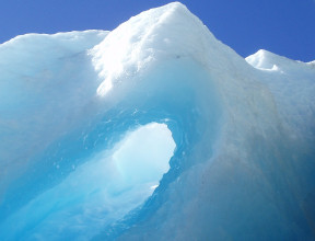
Linking glaciers and winds
Around 18,000 years ago, glaciers in the Southern Alps receded and it may have been because of the Southern Hemisphere westerly wind belt. These winds influence the behaviour of major ocean currents and determine the way water moves between the warm Pacific Ocean and the cold Southern Ocean.
Changes in these westerlies have far-reaching consequences for the global climate. During the last glaciation, the westerlies were farther north and weaker, making the world cooler. At the end of the last glaciation – 17,000 years ago – they shifted south and strengthened. This stirred up the ocean and generated more convection, moisture and warmer temperatures.
As the climate warmed, the ice-age glacier that filled Lake Pukaki receded, leaving rings along its side, like rings in a bathtub. We can estimate how cold the climate had to be to make the glacier that large, and work out when that happened by dating each moraine ridge.
-
The link with Antarctica
Anyone who’s lived in Canterbury will know about warm and dry, gusty winds. Cantabrians refer to them as “norwesters”, but their formal name is föhn – or Foehn. These same warm winds are in the Antarctic – and that’s potentially devastating.
Global warming plus the ozone hole over the Antarctic are sending westerly winds closer to the Antarctic and speeding them up. These westerlies drive warm, salty seawater under the West Antarctic Ice Sheet (WAIS). The result? The ice shelf thins and shrinks. Combine this with warmer air above and the WAIS is at huge risk of losing mass.
The most visible, recent example was the collapse of the Larsen B ice shelf in 2002.
-
On longer-time scales
Further away from New Zealand, the westerlies display variability as the Earth’s climate oscillates between glacial and warmer than present states.
Our scientists study this type of variability through a range of projects and tools, with studies of ice cores collected close to the coast of Antarctica or modelling of large-scale patterns using models of intermediate complexity, or use the Southern Ocean, Tasman Sea and Southwest Pacific to study their role as drivers in influencing oceanic fronts variability, or look into how New Zealand wave climate and wind patterns looked like for even older times, like the Pliocene (Georgia Grant).