Mapping aquifers from the air to secure water for the future
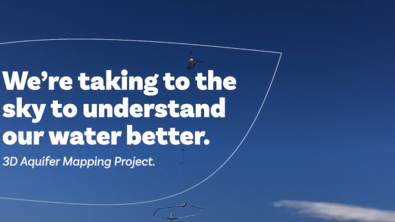
An ambitious project in Hawke’s Bay has seen experts take to the air to map water under the ground in Aotearoa New Zealand’s biggest ever aquifer mapping project.
GNS Science has partnered with Hawke’s Bay Regional Council on the multi-year initiative that will help protect the region’s underground freshwater resources for future generations.
The Hawke’s Bay 3D Aquifer Mapping project specifically aligns with two key research goals of GNS Science – to develop advanced groundwater maps in both 2D and 3D, with the goal of seamless characterisation from the local to the national scale; and to develop optimised numerical modelling decision-making tools that can be more easily applied by regional councils and rolled out nationally.
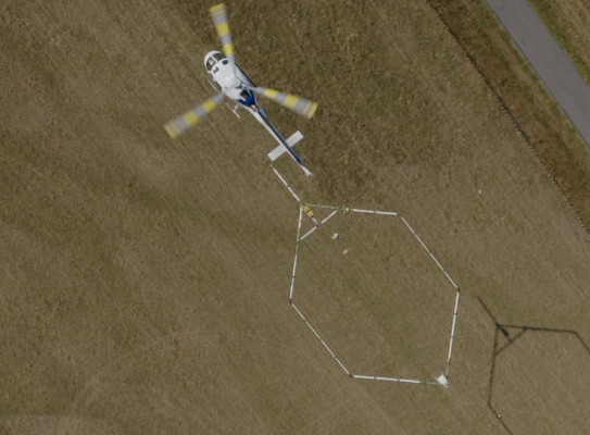
Central to the project is the Danish airborne electromagnetic survey technique known as SkyTEM, which can cover large areas of ground quickly and cost effectively to provide high levels of detail on the subsurface.
Project leader Zara Rawlinson of GNS Science’s Hydrogeology and Geophysics Team says that the high level of subsurface detail provided by the SkyTEM technology enables information gaps in aquifer mapping and modelling to be filled in a rapid and cost-efficient way not provided by other data collection methods.

The SkyTEM technology provides a 3D view of the subsurface to a depth of about 300m – a bit like getting a scan of the aquifers.
" It is sensitive to rock type, porosity, permeability, clay content, moisture content, and properties of water – all of which help in understanding aquifers and contribute to our mapping and characterisation of aquifers," she says.
In early 2020, a specially equipped helicopter using flight lines that were about 200m apart collected almost 8000km of data for the project in a few weeks. Areas covered were the Heretaunga Plains, the Ruataniwha Plains, and the Ōtāne and Poukawa Basins.
GNS Science worked closely with the Regional Council to plan the project and liaised with specialist contractors to ensure the surveys were fit for purpose and the data was of a high standard. We are currently working on the processing, modelling and hydrogeological interpretations of the data.
Benefits to Aotearoa New Zealand
Aotearoa New Zealand’s largest export-earning sectors – tourism and land-based industries – rely on freshwater, with irrigation from groundwater contributing about $2 billion to the economy annually.
Forty percent of New Zealanders rely on fresh groundwater for their drinking water, and yet up to 40 percent of our freshwater catchments face significant shortages and contamination. Remedying this involves significant costs and disruption.
Groundwater is also critical to sustain our aquatic ecosystems and cultural values such as mahinga kai, as 80 percent of our annual river flows come from groundwater.
We are making the processed data available to the Council in phases over the next two years, and much of it will be publicly available. In the next year, we will also work with the Council to drill several boreholes in the aquifers for scientific measurements that will be used to ground-truth the data and make the end result more robust
3D Aquifer Mapping Project using SkyTEM Technology transcript
this is a really exciting project for
the region because it really unlocks a
rich understanding of our groundwater
resources knowledge that we've never had
in the past critical to help inform our
future decision-making uses technology
that allows us to kind of look into our
groundwater and Aminah that we have been
out with it before so the helicopters
going to be flying over the hope
underneath it and through their hope
there's an electric current that current
generates an electromagnetic field and
the ground in the electromagnetic field
creates a secondary current which has
measured from the instruments and under
the helicopter as well their secondary
current depends upon the sediment and
them and the air cover materials so the
resistivity and the conductivity of the
aquifer materials determines the nature
of that secondary current so if we
measure there we give no Nicks of what's
going on in the air cover
so it's really exciting because we're
bringing that kind of cutting-edge
frontier science to Hawke's Bay to help
us better understand one of their most
critical precious resources to better
inform our decision-making allow smarter
more effectively so we would now whilst
at the same time protecting Wallace
talent for the region so it's really
it's really exciting in a real
progressive steam
sky team's gonna bring us a big basket
of knowledge that we've never had before
on the groundwater system at the moment
we're relying on records from drilling
so when people drill wells we keep a
record of what material safepoint
but that's very limited information that
just tells you what's going on and at
one point on the aquifer system and only
as deep as the well goes so SkyTeam will
give us detailed current coverage
horizontally and also tips that we just
everything before this has been the
combined effort of staff and inside the
organization a partnership with the
crown with CRI light genies so it's been
a really collaborative project that's
been a great partnership that's brought
that cutting-edge science to the region
which i think is really exciting so
Berkeley Hawks base a little bit out and
the provinces in terms of that stuff so
we've we've attracted that national and
international resourcing in in interest
to our region which I think the region
should be really proud of we end up with
this this information that puts us in a
really strong footing as a community to
make really sensible choices about how
we manage our water in the future
The final year of the project will include updating the Council’s groundwater modelling tools in the Heretaunga Plains with this information. The collected data and derived models will be a long-term asset for the Council to support their freshwater management objectives.
Science Manager at Hawke’s Bay Regional Council Dr Jeff Smith says the 3D Aquifer Mapping project is a major part of the Council’s critical water security programme. “It wouldn’t be happening without the impetus and support from GNS Science,” he says.
The SkyTEM technique is increasingly being used worldwide to address groundwater management issues. Other councils are expected to follow suit and use it to gain better images and models of the aquifers in their region to support sustainable freshwater management.
The Hawke’s Bay 3D Aquifer Mapping project is jointly funded by the Government’s Provincial Growth Fund, Hawke’s Bay Regional Council, and GNS Science’s Groundwater Research Programme (MBIE Strategic Science Investment Fund).
GNS Science’s research in groundwater aligns with a number of national and sectoral commitments, strategies and goals, including the National Policy Statement for Freshwater Management, the National Drinking Water Standards, and the Living Standards Framework.