GNS dam-cam films Crater Lake outburst
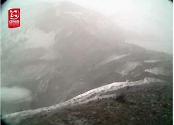
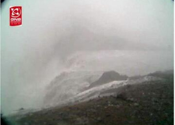
A camera installed by GNS Science near the summit of Ruapehu has captured the moment when the wall of tephra that had been holding back the Crater Lake failed, triggering the spectacular lahar.
The fixed digital still camera was installed overlooking the downstream side of the barrier in early January, and had been taking pictures at one minute intervals during daylight to monitor the development of erosion scarps and to attempt to capture unique pictures of the dam failing.
The gear worked perfectly, and the weather was just good enough to allow us to see the collapse of the dam and the Crater Lake pouring out through the breach.
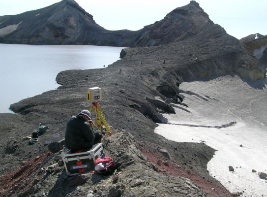
Other equipment at the crater operated by the Department of Conservation and GNS Science also gathered invaluable data on the sequence of dam failure.
“It’s a brilliant dataset”. Said Dr Chris Massey, a geotechnical engineer at GNS. “It will really help us constrain our understanding of how natural dams fail.”
A repeat laser scan of the remnants of the tephra dam and breach was carried out last Friday.
The $1M research programme is funded by a Marsden grant from the Royal Society of New Zealand, the Foundation for Research Science and Technology, and EQC.