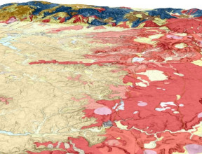
Geology of New Zealand
The land and continental shelf areas, together named "Zealandia", have had a long and varied geological history.
Our continent's surface has see-sawed between land and sea, thrusted up in powerful mountain-building phases, and then plunged into vast ocean troughs.
Aotearoa New Zealand’s geology
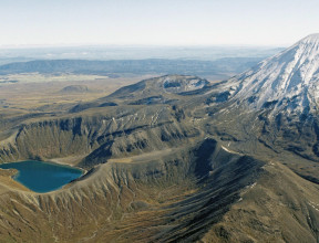
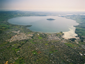
The New Zealand region lies in the southwest Pacific Ocean astride a distinct belt of volcanic and earthquake activity that surrounds the Pacific Ocean. This is the Pacific Mobile Belt, or "Ring of Fire", and the activity results from the structure of the Earth's crust. The crust is made up of a number of segments called plates, which move relative to one another in response to forces deep within the Earth. The plates may rub past one another, one may be forced down below another, or they may buckle at the edges as they meet head on. About 15 million years ago the uplift of our continent's crust began shaping the Southern Alps.
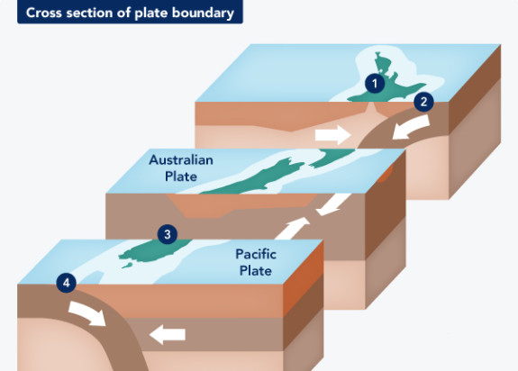
Our plate boundary
Wherever there is a plate boundary there is geological activity of a volcanic or tectonic nature. New Zealand straddles the boundary between the Pacific and Australian plates. To the north of New Zealand and beneath the eastern North Island, the thin, dense Pacific plate moves down beneath the thicker, lighter Australian plate in a process known as subduction. Within the South Island, the plate margin is marked by the Alpine Fault and here the plates rub past each other horizontally. South of New Zealand, the Australian plate is forced below the Pacific plate. Plate movement results in volcanic activity in the North Island and earthquakes that are felt throughout the country.
Our continent is still on the move
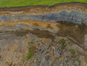
New Zealand is involved in a continuing cycle of geological events and the level of tectonic activity remains high. Offshore basins receiving sediment may, one day in the future, become land, while other areas onshore, being depressed, will be invaded by the sea. Our great mountains are being continually eroded - just look at the debris on their flanks and in the river valleys.
Each major earthquake has an effect on the land - for example, in 1855 the coastline of Wellington Harbour was uplifted 1.5 metres. Every volcanic eruption changes our surface, there is simply nothing permanent in geological time.
What causes vertical land movement?
Aotearoa has historically risen from the oceans, however due to the dynamic process of our plate boundary, some areas are actually now sinking.