Our geological origins
The present-day shape of New Zealand is shown on many maps, but millions of years ago the relative positions of land and sea were quite different.
Some hundreds of millions of years ago...
A super-continent (Gondwanaland), which included the present-day continents of South America, Africa, Australia, India, and Antarctica, existed in the southern hemisphere surrounded by sea. The New Zealand area was situated on the edge of Gondwanaland. Since that time, movements from within the Earth have caused the constituent continents to break away from one another and move to their present positions - a process which is still continuing. The original super-continent was not stationary; it too responded to forces from within the Earth so that it was in different positions with respect to the Earth's poles at different times. Thus at various times the fossil record and the rocks may show evidence of either cold, temperate, or tropical climate.
100 and 80 million years ago
New Zealand's fossil record in the older rocks show similarities with rocks of Australia and Antarctica of similar age. The relationship apparently ended between 100 and 80 million years ago when New Zealand broke away from Gondwanaland and started to move toward its present position, with the accompanying formation of the Tasman Sea. Since that time New Zealand has had its own geological history and developed a unique flora and fauna.
110-120 million years ago
The very oldest sedimentary rocks in New Zealand were deposited in basins lying offshore from Gondwanaland. Subsequently the sediments were disrupted by tectonic movements and pushed up to form land that eventually became parts of Australia, Antarctica and New Zealand. Later, an extensive series of depositional troughs developed off-shore, which collected sediment eroded from adjacent continents for nearly two hundred million years. Here the "greywacke" rocks that now make up the main ranges of New Zealand were formed. This era came to a close about 110-120 million years ago when tectonic plate movements uplifted the sediments to form new land.
About 15 million years ago
Erosion reduced much of Aotearoa's mountainous land to a low-lying, almost level plain. It was during this time that the split between Australia and New Zealand occurred. As the land of our continent sank, low-lying swampy areas developed. These areas are now the sites of major coalfields.
Eventually the sea started to cover the land, firstly depositing sediments in marginal basins, and later over most of the New Zealand area. Then, about 15 million years ago, the mainly quiet period ended, and New Zealand once again experienced tectonic activity, mountain building and widespread volcanic activity. Several basins developed, filled with sediment and were uplifted as land. In more recent geological times, the effects of rises and falls of sea level, due to alternating glaciations and warmer intervals, were superimposed on the tectonic events.
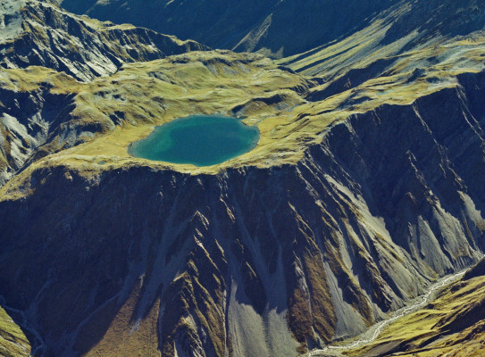
Nothing is permanent in geological time
It must be remembered that New Zealand is still involved in a continuing cycle of geological events and the level of tectonic activity remains high. Offshore basins receiving sediment may, one day in the future, become land, while other areas onshore, being depressed, will be invaded by the sea. Our great mountains are being continually eroded - just look at the debris on their flanks and in the river valleys. Each major earthquake has an effect on the land; in 1855 the coastline of Wellington Harbour was uplifted 1.5 metres.