
RiskScape
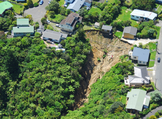
RiskScape is a software tool that enables users to assess risk to buildings, infrastructure and people from natural hazards such as volcanic eruptions, earthquakes, landslides, tsunami, and floods.
Overview
Developed in partnership with NIWA and Toka Tū Ake EQC, RiskScape 2.0 provides modern software for risk modelling underpinned by the latest scientific research.
The programme aims to
- provide natural hazard risk assessment professionals across sectors and disciplines with evidence to understand consequences, make risk-based decisions and implement cost-effective risk reduction solutions
- ensure ease of use for end users, in terms of data input and easy-to-interpret displays of modelling results
To achieve these objectives, we
- collaborate with colleagues from multiple organizations to create a tool that is multipurpose and serves a range of disciplines
- engage with stakeholders to ensure RiskScape is accessible and easy to use
- provide a free, open-source software platform for research purposes that integrates well with other platforms and tools
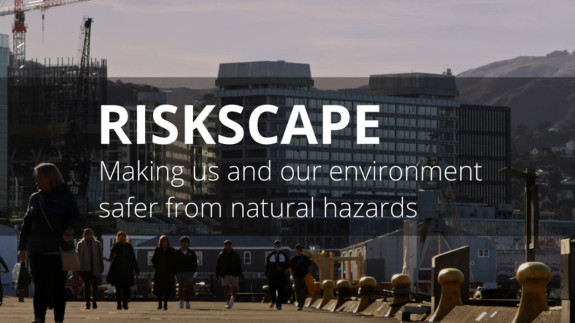
RiskScape – Making us and our environment safer from natural hazards transcript
RiskScape uses information about our hazards, our people, and our built environment to better
understand the risks from natural hazards.
RiskScape is trusted software designed and developed in New Zealand and uses New Zealand science to understand the impact of natural hazards on all people and property.
The software helps us understand the magnitude and severity of future natural hazard events, such as a large alpine fault earthquake or Central North Island volcanic eruption, so that our reinsurance is right size and so that we can anticipate the impacts and better respond to and recover from them.
Flood modeling is used in New Zealand by central government as well as local governments and organizations to help them understand the impacts of flooding and respond to the hazard.
New Zealand is at risk of many natural hazards. We need to better understand the risks associated with these hazards so that we can make more resilient buildings and make New Zealanders safer.
It's a great example of how our agencies work together to improve the resilience of natural hazards in New Zealand.
The project
Filling a need for risk modelling
Risk managers need to assess the impacts from natural hazard events to make informed decisions. They need to forecast the possible impacts on people, buildings and other infrastructure caused by volcanic eruptions, earthquakes, landslides and tsunami. These forecasts and projections under different types of natural hazard scenarios are key to designing mitigation and disaster management strategies as well as making planning decisions.
The need for an easy-to-use forecasting tool suitable for a range of stakeholders led to the creation of RiskScape, a national research programme examining the impacts of hazards on society, especially in Aotearoa New Zealand. The RiskScape modelling tool draws on decades of cutting-edge hazard research and is designed to support risk assessment from natural hazard events both locally and internationally.
RiskScape – risk modelling tool for NZ
RiskScape 2.0 presentation by Richard Woods, GNS Science
The development of RiskScape
The RiskScape research programme has been core-funded by NIWA and GNS since 2004. The first release of the RiskScape 1.0 software was in 2006. In 2017, it was decided that development of that software would stop – an external review found that the software, while modern at the time of its inception, was outdated and difficult to update.
In 2018, the RiskScape research programme embarked on developing new, open-source software that could serve end users both domestically and internationally. In 2019, Toka Tū Ake EQC provided funding to expedite development and make the model fully probabilistic to account for the inherent uncertainty associated with modelling natural hazards.
How the tool works
RiskScape 2.0 can model the impacts of natural hazard scenarios to understand the variability and uncertainty of damage expected by a particular event. There is no data hardcoded into the software, giving users the flexibility to provide data specific to their hazard and location of interest.
To calculate risk, RiskScape 2.0 requires the user to provide:
- geospatial data about the hazard (i.e. GIS layer)
- geospatial data about assets that stand to be damaged (e.g. buildings, infrastructure networks, and people)
- consequence functions that estimate loss based on the characteristics of the hazard and assets
The software uses that information to model potential damage outcomes for different scenarios. Outputs may include the probability of building damage, infrastructure damage, injuries to people, or fatalities. Depending on the data used and the goals of the user, outputs could also include the probability of damage to crops, the projected cost of different hazard scenarios, and the knock-on effects of cascading hazards, such as initial damage caused by an earthquake and additional damage caused by a subsequent tsunami.
Results can be displayed in a range of intuitive, visually appealing maps, graphs and tables, making it easy for risk modelers to communicate their results to a wide range of stakeholders and decisionmakers.
What RiskScape software has been used for
RiskScape 2.0 has been used locally and internationally by a variety of stakeholders. Locally, RiskScape is increasingly being used for central and local government agencies and infrastructure operators. For example, Toka Tū Ake EQC is using RiskScape to plan and prioritise its response to major earthquakes. Toka Tū Ake EQC is transitioning to RiskScape 2.0 as a replacement for its existing loss modelling tool due to RiskScape’s ability to model a wide range of natural perils.
Research programme details
Collaborators: GNS, NIWA
Duration
2004 – present
Funding platform
MBIE Strategic Science Investment Fund (SSIF) (both GNS and NIWA funding) with additional software development funding from Toka Tū Ake EQC.
Status
Current
Programme leaders
Nick Horspool (GNS)
Ryan Paulik (NIWA)
Funder
Funder: GNS, NIWA, and Toka Tū Ake EQC