Geological maps of resource-rich areas
There are many parts of New Zealand where we draw resources, such as minerals, aggregates and groundwater from our underlying rocks.
We are making new geological maps of these resource-rich areas to assist explorers and extractors of these resources.
Data from regional airborne geophysical surveys flown within the past decade across New Zealand are transforming geological knowledge, particularly in areas of dense vegetation, areas of poor outcrop, remote location and highly deformed rocks.
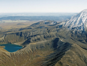
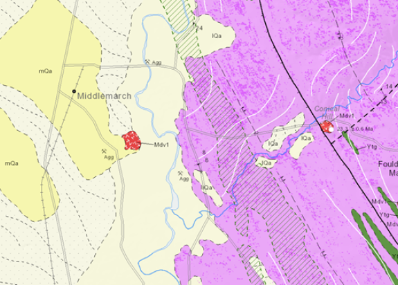
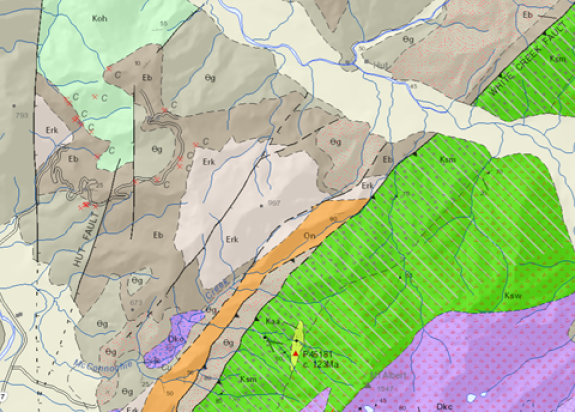
Geology of the Middlemarch area (GNSGM5)
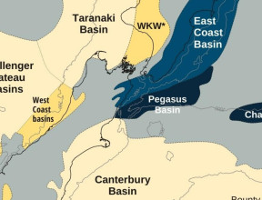
The Middlemarch area in East Otago has high prospectivity for orogenic gold deposits. It is adjacent to the world-class, actively mined Macraes gold
(± tungsten) deposit, contains two sites of historically important gold mining (Nenthorn and Barewood goldfields), and has gold (± tungsten ± antimony), groundwater, diatomite and aggregate resource potential.
The availability of regional airborne geophysics data significantly aided geological mapping. Processed geophysical datasets (magnetic, electromagnetic and gravity) and geophysical interpretations and models and are available along with other data as a GIS dataset.
The map(external link) is available free as a pdf from the GNS Shop and the dataset(external link) is available for purchase as feature classes in ESRI file geodatabase and shapefile GIS formats and freely consumable Web Map Services and Web Feature Services from GeoServer(external link) and ArcGIS Server(external link). GIS layerfiles that reference the web services are available for use in ArcGIS(external link) (ArcMap and ArcGIS Pro) and QGIS(external link). Metadata(external link) describing the GIS data is also available.
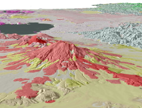
Geology of the Victoria Range area (GNSGM6)
Plutonic rocks of the Victoria Range segment of the Karamea Batholith are the focus of this map. The Victoria Range area occurs within the Western Province of the Austral Superprovince, apart from the southeastern corner of the map where Eastern Province metasedimentary rocks are juxtaposed by the Alpine fault. Country rocks to the Karamea Batholith in this area are low grade metasedimentary rocks of the Greenland Group (Buller Terrane), locally contact metamorphosed. Within the batholith, sillimanite garnet-grade metasedimentary rocks of the Victoria Paragneiss are likely metamorphosed Greenland Group. Isolated plutons intrude Takaka Terrane in the southeast of the map area.
Dense forest over two-thirds of the mapped area hindered accurate field mapping of pluton boundaries. Recently obtained aeromagnetic data were used to refine the map in several areas.
The map(external link) is available as a pdf free from the GNS Shop. The data are freely consumable as Web Map Services and Web Feature Services from GeoServer(external link) and ArcGIS Server(external link). GIS layerfiles that reference the web services are available for use in ArcGIS(external link) (ArcMap and ArcGIS Pro) and QGIS(external link). Metadata(external link) describing the GIS data is also available.
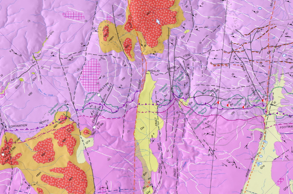
Geology of the Hyde-Macraes Shear Zone and Waihemo Fault Zone area (GNSGM9)
The Hyde-Macraes Shear Zone and Waihemo Fault Zone geological map and accompanying digital dataset show an interpretation of the geological and geophysical data held for the Hyde-Macraes Shear Zone and Waihemo Fault Zone area of northeastern Otago, depicted at 1:50 000.
The geological map focusses on the trans-crustal Waihemo Fault Zone, the economically significant Hyde-Macraes Shear Zone and the western edge of the Canterbury Basin. The inland geology is dominated by Rakaia Terrane rocks, while coastal and offshore areas are dominated by Zealandia Megasequence rocks. The geological map portrays the known or inferred geology close to the present land surface. Veneers of soil, loess or alluvial gravel are not shown so that the topmost significant geological unit can be depicted. Around the Macraes mine, the surface geology prior to mining operations commencing in 1990 is shown. Parts of some units have since been excavated away and/or obscured by mine tailings and pond water.
- PDF Map - Geology of the Hyde-Macraes Shear Zone and Waihemo Fault Zone area (GNS Shop)(external link)
- Services and Download - NZL GNS GM9 HMSZ geology (GNS Dataset Catalog)(external link)