Earthquakes
By understanding earthquakes and the hazards they cause, we can work to build a more earthquake-resilient society.
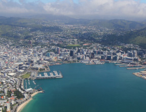
Land of the long complex plate boundary
Aotearoa New Zealand straddles the Pacific and Australian tectonic plates. These plates are colliding with huge force, causing one to slowly grind over, under or alongside the other. As the brittle crust gives way under the pressure, a fault ruptures and an earthquake is unleashed. Every year, GNS Science records over 20,000 earthquakes in New Zealand. About 100-150 of these quakes are large enough to be felt – the others we only know about because they are recorded by seismographs.
The team at GNS Science leads and contributes to a variety of research efforts to understand our earthquakes and the associated hazards and risks they pose to New Zealand. Our research ensures our communities are prepared and resilient.
Earthquakes in Aotearoa New Zealand – On average, we locate over 20,000 earthquakes a year in and around Aotearoa New Zealand. So why do we get so many earthquakes? Discover the cause, and what is happening beneath our feet. transcript
You may have wondered, why do we get so many earthquakes in New Zealand?
To explain, let's take a step back.
Earth's outermost layer, the crust, is made up of massive slabs of solid rock, ranging from a few hundred to thousands of kilometres across. These are known as tectonic plates, and there are seven major ones, and they're constantly moving, at slightly different speeds and in slightly different directions, continuously reshaping Earth's landscapes.
And it's at the boundaries between these plates that earthquake and
volcanic activity is concentrated.
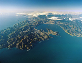
Aotearoa, New Zealand, is at the boundary between two of these major plates, the Australian Plate and the Pacific Plate. How the plates move against each other changes along this curving boundary.
In the North Island, the Pacific Plate is being pushed under the Australian Plate. This setting, with one plate going down beneath another, is called subduction.
At the southern end of the South Island, the opposite situation occurs, with the Australian Plate diving down beneath the Pacific Plate.
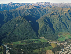
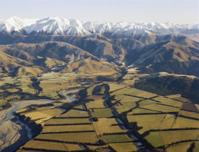
Through most of the South Island, the two plates grind past each other, creating the 600-kilometre-long main plate boundary fault. We call this the Alpine Fault, as it runs along the Southern Alps.
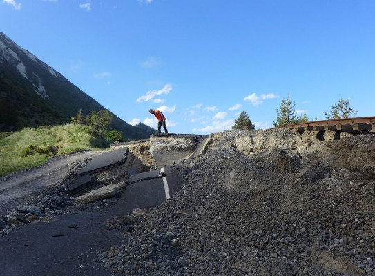
A fault is a fracture or a line of weakness in the crust, and it can be as short as a few metres or as long as a thousand kilometres. Much of the movement on
the Alpine Fault is sideways, but there's also some compression or pushing together and upward motion.
The upward movement is what causes the sudden change in the landscape between Westland and the high peaks of the Southern Alps, and the mountains continue to be driven upwards at a rate of about seven millimetres per year.
In the North Island, we have a subduction zone on the East Coast, and that can cause large earthquakes, such as those that have occurred in Japan or in Indonesia. It can also create smaller, but still major, earthquakes close to the coast, such as that in Napier in 1931.
Through the centre of the North Island, we have the volcanic region, where the land is being pulled apart. Earthquakes are generally smaller in
this region, but can often occur in swarms. Swarms can include hundreds of events and can continue for days, weeks or months, such as the
activity we saw in Taupō in 2022. Earthquake swarms in
these regions can indicate volcanic eruptions
and other volcanic activity.
But why does this mean we have earthquakes? While the plates are trying
to push against or past each other, often they're stuck, and stress is just building up. When the stress is big enough, the faults move suddenly and cause earthquakes.
And here in Aotearoa New Zealand, we have faults everywhere. There are the big plate boundary ones, like the Alpine Fault, but there are also many hundreds of smaller faults on the North and South Island and extending out into the oceans, and each of them can host earthquakes.
Every year, GNS Science records over 20,000 earthquakes in Aotearoa New Zealand. On average, about 100 to 150 of these earthquakes are big enough to be felt, though that can vary if we have a big sequence. The majority of the earthquakes, the smaller ones, we only know about because they're
recorded by our large network of instruments.
Living in an earthquake-prone country means you've always got to be prepared. And remember, if the earth starts shaking, drop, cover and hold.
Earthquake monitoring and response
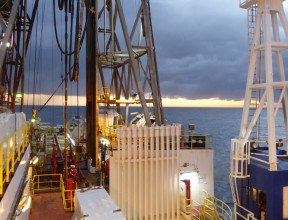
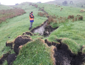
Nationwide, there are hundreds of seismographs and strong motion sensors monitoring thousands of small shakes and many large quakes per year. Continuous GPS is being used to monitor “slow” earthquakes, recording land movement down to a few millimetres. These data are acquired, collected, stored and made available for research and monitoring by the GeoNet programme.
GeoNet is a collaboration between GNS, the Natural Hazards Commission Toka Tū Ake and Toitū Te Whenua LINZ and includes the National Geohazards Monitoring Centre (NGMC), which contributes significantly to the analysis of seismic data and monitors seismic activity around the country. Earthquake monitoring feeds into applications such as emergency response and the rapid analysis of possible tsunami. Through a number of programmes, GNS works to develop and maintain scientific capability to rapidly assess and analyse earthquakes, ensure timely and accurate advice is provided to emergency management and stakeholders and inform the public about the event.
Earthquake readiness
One of the goals of natural hazard research is to help communities build resilience. We work to deliver earthquake research that supports the aspirations of communities to increase their resilience. Specifically, we contribute earthquake-specific knowledge and data to hazard and risk modelling so that communities can predict and respond to multi-hazard scenarios. We also partner with research groups and communities to inspire, educate and facilitate a deeper understanding of our hazard-prone nation.
Our research
We incorporate several fields of study in our research to best understand earthquakes in the context of our complex plate boundary. Our research involves models of earthquakes and their ground motions (seismology), earthquake geology, geodynamics and geodesy.
We contribute our expertise in these fields to a variety of projects, drawing on our wide range of disciplines. Recent projects and programmes we have led and supported include Resilience to Nature’s Challenges, Rapid Characterisation of Earthquakes and Tsunami (RCET), National Seismic Hazard Model (NSHM) and It’s Our Fault.